


Refine your search for walks in Eaux-Puiseaux
Eaux-Puiseaux walks


 From the church to the oak tree at Eaux-Puiseaux
 Visorando Member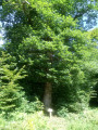
 4.55 mi
 +276 ft
 -272 ft
 2h 20
2h 20
 Easy
Easy
 Departure from Eaux-Puiseaux (Aube)
A lovely circular walk through the Forest of Othe, from the church at Eaux-Puiseaux to its hundred-year-old oak tree commemorating the village’s founding in 1849.
The Wolf Trail in Sommeval
 8.70 mi
+669 ft
-646 ft
4h 35
8.70 mi
+669 ft
-646 ft
4h 35
 Moderate
Departure from Sommeval (Aube)
Moderate
Departure from Sommeval (Aube)
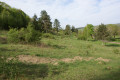
The Sentier du Loup trail circles Sommeval. This pretty little village stretches out in a valley which, like an amphitheatre, is surrounded on three sides by wooded hills. The trail allows visitors to discover one of the last dry grasslands in the Pays d'Othe.
The trail is well maintained and clearly marked, but it is not recommended during the hunting season, from November to February.
The Loup trail starting from Sommeval
 7.58 mi
+722 ft
-722 ft
4h 05
Moderate
Departure from Sommeval (Aube)
7.58 mi
+722 ft
-722 ft
4h 05
Moderate
Departure from Sommeval (Aube)
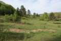
This variation of the Loup trail goes around Sommeval, a pretty little village nestled in a valley which, like an amphitheatre, is surrounded on three sides by wooded hills. The trail allows you to discover one of the last dry grasslands in the Pays d'Othe and to cross the forests of Javernant and Sommeval.
The trail is well maintained and clearly marked, but it is not recommended during the hunting season, from November to February.
The Wolf Trail via the Orchid Meadow and the Javernant Forest
 2.90 mi
+285 ft
-308 ft
1h 35
Easy
Departure from Sommeval (Aube)
2.90 mi
+285 ft
-308 ft
1h 35
Easy
Departure from Sommeval (Aube)
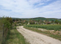
This variant of the Sentier du Loup trail allows you to explore the small village of Sommeval, the Pelouse aux Orchidées and to cross the Javernant communal forest.
From Sommeval to Javernant
 4.61 mi
+545 ft
-531 ft
2h 35
Easy
Departure from Sommeval (Aube)
4.61 mi
+545 ft
-531 ft
2h 35
Easy
Departure from Sommeval (Aube)
A short walk offering a beautiful view of the Crésantignes region and the forests of Jeugny and Aumont.
The Davrey Route
10.05 mi
+144 ft
-161 ft
4h 45
Moderate
Departure from Davrey (Aube)
A pleasant walk that follows the poplar-lined banks of the Landion, passing through copses and forests, forming a ring between the commune’s two lowland rivers, the Armance and the Landion.
From Bercenay to Vauchassis
 7.08 mi
+548 ft
-522 ft
3h 45
Moderate
Departure from Bercenay-en-Othe (Aube)
7.08 mi
+548 ft
-522 ft
3h 45
Moderate
Departure from Bercenay-en-Othe (Aube)
A short walk overlooking the villages of Bercenay and Vauchassis.
From the washhouse to the Sources de l’Ancre via the Bois de la Garenne in Bercenay
 5.67 mi
+305 ft
-302 ft
2h 50
Easy
Departure from Bercenay-en-Othe (Aube)
5.67 mi
+305 ft
-302 ft
2h 50
Easy
Departure from Bercenay-en-Othe (Aube)
From the wash house opposite the church, then via the Fond de la Garenne, up through the Bercenay-en-Othe Communal Forest, then down towards the Sources de l’Ancre and back along the River Ancre.
Jeugny to Saint-Phal circular route
 4.88 mi
+102 ft
-98 ft
2h 20
Easy
Departure from Jeugny (Aube)
4.88 mi
+102 ft
-98 ft
2h 20
Easy
Departure from Jeugny (Aube)
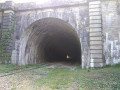
This route follows part of the L26 railway line, which has been disused since 1996, passing through the Fays-la-Chapelle tunnel. In 2018, an association called ASL26 was formed. Within three years, it had made the railway line between Jeugny and Auxon accessible to walkers.
The walk also takes in meadows and woodland.
Sentier des Trochées
5.65 mi
+623 ft
-623 ft
3h 10
Easy
Departure from Turny (Yonne)
A lovely walk in the hills above the village of Turny, with the start and finish at the highest point.
You’ll discover lovely panoramic views, the Tree of Liberty and the Chapel of La Bonne Mort.
Read the ‘Practical information’ and ‘During the walk’ sections to get even more out of this walk.
The Sentier des Moutons from Bouilly
 5.48 mi
+525 ft
-515 ft
3h 00
Easy
Departure from Bouilly (Aube)
5.48 mi
+525 ft
-515 ft
3h 00
Easy
Departure from Bouilly (Aube)
This trail follows one of the sheep tracks that allowed herds to move from the surrounding villages to the Essarts plateau when it was used as grazing land in the 19th century.
Since then, it has become a beautiful forest.
The Vauchassis Forest via the Belle Fayte ridge
 5.01 mi
+394 ft
-384 ft
2h 40
Easy
Departure from Vauchassis (Aube)
5.01 mi
+394 ft
-384 ft
2h 40
Easy
Departure from Vauchassis (Aube)
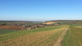
Walk in the forest east of Vauchassis and return via the Crête de la Belle Fayte
Ponds, drinking troughs and washhouses, valleys and forests in the Pays d’Othe
 8.51 mi
+669 ft
-676 ft
4h 30
Moderate
Departure from Villemoiron-en-Othe (Aube)
8.51 mi
+669 ft
-676 ft
4h 30
Moderate
Departure from Villemoiron-en-Othe (Aube)
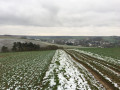
A walk through the valleys and forests to discover the remains of a time when shepherds led their flocks to drink from the pools above Villemoiron and Saint-Mards-en-Othe.
Montaigu from Souligny
 6.47 mi
+702 ft
-692 ft
3h 35
Moderate
Departure from Souligny (Aube)
6.47 mi
+702 ft
-692 ft
3h 35
Moderate
Departure from Souligny (Aube)
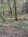
Walk through the Souligny Communal Forest, descend into the Val de Gloire along the Sentier des Moutons, then visit the Montaigu nature site, the remains of the Gallo-Roman oppidum and the ruins of the castle, with a panoramic view of the Champagne plain on the way back.The route follows sections of several well-signposted ‘Sentiers des Moutons’ trails (8 km, 12 km and 14 km in length).
Montaigu via Les Grandes Vallées
 4.31 mi
+463 ft
-472 ft
2h 25
Easy
Departure from Laines-aux-Bois (Aube)
4.31 mi
+463 ft
-472 ft
2h 25
Easy
Departure from Laines-aux-Bois (Aube)
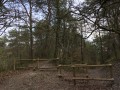
From the heights of Laines-aux-Bois, descend to the plain, visit the Fontaine site, the remains of the Gallo-Roman oppidum and the traces of the castle at the Montaigu nature site, then return via the Sentier des Moutons trail, ending with a walk through the charming hamlet of Les Grandes Vallées.
This route avoids the steepest paths.
Les Grandes Vallées – Heurtebise
 4.00 mi
+367 ft
-364 ft
2h 10
Easy
Departure from Laines-aux-Bois (Aube)
4.00 mi
+367 ft
-364 ft
2h 10
Easy
Departure from Laines-aux-Bois (Aube)
Circular route in the Grandes Vallées forest, Heurtebise and Fond de l’Homme Mort area.
Short circular in the Flogny-la-Chapelle communal forest
4.54 mi
+125 ft
-125 ft
2h 10
Easy
Departure from Flogny-la-Chapelle (Yonne)
The shaded forest atmosphere typical of the humid Champagne region can be enjoyed along this entire route, which is accessible on foot or by mountain bike. This route is strongly discouraged during the forest hunting season, from October to March, on Sundays and Wednesdays.
Mont Martin and the Laines Valley
 5.81 mi
+738 ft
-738 ft
3h 20
Moderate
Departure from Saint-Germain (Aube) (Aube)
5.81 mi
+738 ft
-738 ft
3h 20
Moderate
Departure from Saint-Germain (Aube) (Aube)
From the Chemin de la Grande Voie in the hamlet of Lépine (Saint-Germain), head towards Les Hauts des Forges and Mont Martin, then return along the Laines valley via theGR® de Pays ‘Plaines et Collines’ trail around Troyes.
Circular starting from Prusy
5.19 mi
+272 ft
-292 ft
2h 35
Easy
Departure from Prusy (Aube)
The route is fairly simple and allows you to walk along the paths around Prusy. It is mainly paths, but there are also a few sections on the road (essential for getting to the church). When you arrive at Saint-Edme Church, you can enjoy a pleasant view of the fields.
Prusy-Coussegrey circular
4.53 mi
+203 ft
-203 ft
2h 15
Easy
Departure from Prusy (Aube)
This circular route allows you to reach Coussegrey via the paths from Prusy. This route is fairly simple with a few climbs and stony paths. It is an easy route, but wear good, comfortable shoes to enjoy these beautiful trails.