Country:
 City:
City:


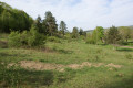
Park at Place du Jet d’Eau in Maraye-en-Othe.
(S/E) Walk down Rue de l’École, then turn left into Allée de la Promenade. Follow the white and yellow signposts. Continue to the end of the lane.
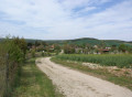
(1) Turn right onto Rue des Chenevières des Prés; after a few metres, take the right-hand fork, then turn right again towards the cultivated fields. Walk straight up to the power line.
(2) At the junction, turn left and continue along the path that skirts the hamlet of Champcharme Haut. Head downhill to the right to join the D111, then turn left onto it. Pass through the hamlet of Champcharme Bas. Carry on until you reach the junction with the D53.
(3) Turn right onto it and follow it for a few hundred metres until you reach a junction with a farm track at a right angle.
(4) Turn right onto this and head uphill along this wide track. Enter the Bois des Sudoins and you will very soon come to another junction.
(5) Turn right, then immediately left at a 90° angle. Continue along a straight path until you reach a new junction at thethird lane, marked by a large stone marker.
(6) Turn left onto this track and stay on it; after a slight dip to the left, pass a hunters’ hut, cross the forest road just before the climb begins, and join a forest path.
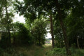
(7) Turn right onto this path, following the white and blue markings. Walk alongside plots 10 and then 9, then past some farmland. Turn sharply 90° to the left to stay on this path. Enter the woods and then exit them, cross the D23 road and then the Ruisseau de l’Ancre.
(8) Turn sharply right to follow the course of the Ancre stream, heading south. First take a farm track, then turn left to climb up to the power line. At the electricity pylon, rejoin the white and yellow markings. Turn right onto a wide path that runs alongside the gardens of the houses in the hamlet of La Perrière. Pass the riding centre.
(9) Turn right. Continue along Ruelle aux Vignes, cross the D 23, and climb up to the junction with the path leading to Les Eaux-Puiseaux. A signpost indicates the directions for Maraye-en-Othe and Les Eaux-Puiseaux.
(10) Continue straight ahead, towards Maraye-en-Othe. Head uphill through the woods, then descend to Fond de Vire-Loup; cross the crossroads and continue uphill in the same direction, heading west. On the plateau, reach the hamlet of Les Boulins via Rue Grapillat.
(11) At the D 72, turn left and pass through Les Boulins. Carry on until you reach the water tower.
(12) Take the path to the right of the water tower. Head down towards Maraye-en-Othe. Turn right onto Allée de la Promenade, then left onto Rue de l’École and continue to Place du Jet d’Eau (S/E).

 Visorando Member
 Easy
Easy