The Vauchassis Forest via La Halte

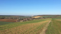
Walk through the Vauchassis Communal Forest to the west of Vauchassis, returning via the Gafichaux ridge and then the Beaumont valley.

Details

n°4707005
Creation:
Last update:
Last review:
  • Walking
    Activity: Walking
  • ↔
    Distance: 5.38 mi
  • ◔
    Average duration: 2h 40 
  • ▲
    Difficulty: Easy

  • ⚐
    Back to start: Yes
  • ↗
    Ascent: + 266 ft
  • ↘
    Descent: - 249 ft

  • ▲
    Highest point: 860 ft
  • ▼
    Lowest point: 607 ft

Photos

Description of the walk

Park on Rue de Beaumont, near the town hall.

(S/E) Walk past the town hall, then take Route de Bercenay and turn right at the first junction onto Rue de l’Église. Join theGR®2, theGRP® Tour du Pays d’Othe (marked in red and white).
Turn left into Rue Dumontier, then right into Rue du Verger. Continue in the same direction along the path until you reach the farm track.

(1) Turn left onto this farm track. The climb is steady. It is the only one on the entire walk.

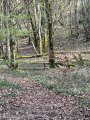
(2) When you reach the edge of the forest, take a look at the sign listing the region’s walking routes. Continue along theGR®2, which enters the forest and joins a forest track, then a forest road.

(3) After the hunting lodge, at the junction, take the small path on the left.

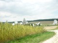
(4) After 500 m, you’ll reach the junction of theGR®2and thePR® Tour de Bercenay. ThePR® Tour de Bercenay is signposted in yellow and white. It circles the Space Telecommunications Centre.
Turn left.

(5) At the edge of the woods, turn left again and follow thePR® for 700 m as it runs alongside the forest.

(6) Leave thePR® when it turns right down towards Bercenay and continue along the Vauchassis Communal Forest (staying at the same level) until you reach the D53.

(7) Turn left until you reach the junction with the Route Forestière de la Grande Pièce and follow it to the right.

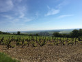
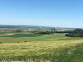
(8) After 1.5 km, turn left onto the forest track between plots 6 and 7. As you leave the forest, continue down the Gafichaux ridge on the left until you reach the Route de la Vallée de Beaumont.

(9) At the junction with the Route de Beaumont, turn left. Enter Vauchassis via Rue de Beaumont and head for the car park (S/E).

Waypoints

  1. S/E : mi 0 - alt. 614 ft - Small car park near the town hall
  2. 1 : mi 0.74 - alt. 610 ft - Junction with a farm track
  3. 2 : mi 1.22 - alt. 810 ft - Edge of the forest
  4. 3 : mi 1.73 - alt. 761 ft - Hunting lodge
  5. 4 : mi 2.16 - alt. 778 ft - Junction of the GRP and PR trails
  6. 5 : mi 2.27 - alt. 741 ft - PR on the edge of the forest
  7. 6 : mi 2.72 - alt. 764 ft - Junction of the PR and the footpath
  8. 7 : mi 3.15 - alt. 797 ft - Junction of the footpath and the D53
  9. 8 : mi 4.12 - alt. 860 ft - Junction of the forest road and the footpath
  10. 9 : mi 5.03 - alt. 643 ft - Junction of the footpath and the Beaumont road
  11. S/E : mi 5.38 - alt. 614 ft - Small car park near the town hall

Notes

You can park at La Halte (on the D53) and start this walk from there,

During the hunting season, from late October to late February, particularly on Saturdays and Sundays, the paths in the Vauchassis Communal Forest may be affected by hunting activities.

Worth a visit

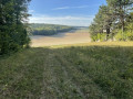
Picnic area at La Halte.

Excellent restaurant in Vauchassis.

Always be cautious and plan ahead when you're outdoors. Visorando and the author of this route cannot be held responsible for any accidents occurring on this route.

The GR® and PR® markings are the intellectual property of the Fédération Française de Randonnée Pédestre.

Reviews and comments

4.7 / 5
Based on 1 review

Reliability of the description
5 / 5
Ease of following the route
5 / 5
Route interest
4 / 5
User 7782349

Overall rating : 4.7 / 5

Date of your route : Oct 12, 2026
Reliability of the description : ★★★★★ Very good
Ease of following the route : ★★★★★ Very good
Route interest : ★★★★☆ Good
Very busy route : Yes

A lovely little walk, culminating in a beautiful view of the masts and satellite dishes at Bercenay (point 5).
Just a small point of confusion: the hunting lodge is no longer at point 3, but well before that, at the edge of the forest at the previous junction. At the hunting lodge, you should therefore turn right (basically, follow the route shown on the map).
The path is signposted throughout.

Mag & Arnaud

Machine-translated

Other walks in the area

For more walks, use our search engine .

The GPS track and description are the property of this route's author. Please do not copy them without permission.