Mont Martin and the Laines Valley

From the Chemin de la Grande Voie in the hamlet of Lépine (Saint-Germain), head towards Les Hauts des Forges and Mont Martin, then return along the Laines valley via theGR® de Pays ‘Plaines et Collines’ trail around Troyes.

Details

3245145
Creation:
Last update:
Last review:
  • Walking
    Activity: Walking
  • ↔
    Distance: 5.81 mi
  • ◔
    Average duration: 3h 20 
  • ▲
    Difficulty: Moderate

  • ⚐
    Back to start: Yes
  • ↗
    Ascent: + 738 ft
  • ↘
    Descent: - 738 ft

  • ▲
    Highest point: 853 ft
  • ▼
    Lowest point: 456 ft

Photos

Description of the walk

In Lépine, park at the side of the Chemin de la Grande Voie, by the last houses

(S/E) Head up the Chemin de la Grande Voie.

(1) After crossing the bridge over the motorway, take the path on the right that runs alongside the motorway. Turn left at the first path, which goes straight up and then down.

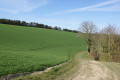
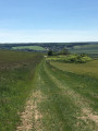
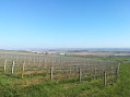
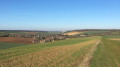
(2) At the junction with the tarmac road, there is a lovely view of Prugny. Take this tarmac road to the left. Walk past the petrol station and continue in the same direction, passing under a power line. Below, there is a view across the whole of the Troyes plain, Lépine and Laines-aux-Bois.

(3) At the bottom of the field, at the edge of the woodland, turn right. Walk alongside the woodland below for 800 m.

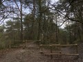
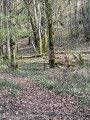
(4) Just after passing a path that climbs to the right, take the path that leads into the woodland on the left. Cross the woodland, then at the edge turn right to walk along Mont Martin.

(5) Turn left, then right, and head downhill towards the pumping station on the D83.

(6) Just before reaching the pumping station, take the path furthest to the left. Continue downhill. You’ll see the bell tower of Laines-aux-Bois.

(7) When you join theGRP® Plaines et Collines around Troyes, turn left. Follow the Laines Valley. After 500 m, theGRP® climbs steeply.

(8) Turn right, leaving theGRP®, and head down the white track, passing the Puits de la Chalonne.

(1) Follow the Chemin de la Grande Voie back to the starting point (S/E).

Waypoints

  1. S/E : mi 0 - alt. 456 ft - Chemin de la Grande Voie
  2. 1 : mi 0.41 - alt. 502 ft
  3. 2 : mi 1.53 - alt. 774 ft
  4. 3 : mi 2.1 - alt. 712 ft
  5. 4 : mi 2.67 - alt. 843 ft
  6. 5 : mi 3.09 - alt. 853 ft
  7. 6 : mi 3.46 - alt. 732 ft
  8. 7 : mi 4.2 - alt. 509 ft
  9. 8 : mi 4.97 - alt. 705 ft
  10. S/E : mi 5.81 - alt. 456 ft

Notes

In Lépine, park at the side of the Chemin de la Grande Voie, by the last houses.
It is possible to park beyond the bridge over the motorway as the road is passable.

Always be cautious and plan ahead when you're outdoors. Visorando and the author of this route cannot be held responsible for any accidents occurring on this route.

The GR® and PR® markings are the intellectual property of the Fédération Française de Randonnée Pédestre.

Reviews and comments

4.7 / 5
Based on 4 reviews

Reliability of the description
4.5 / 5
Ease of following the route
5 / 5
Route interest
4.5 / 5
Troyens
Troyens

Overall rating : 5 / 5

Date of your route : Jul 09, 2026
Reliability of the description : ★★★★★ Very good
Ease of following the route : ★★★★★ Very good
Route interest : ★★★★★ Very good
Very busy route : No

I completed the walk in 1 hour 53 minutes instead of the 3 hours 20 minutes stated; I’m not sure if the author could correct the estimated time.

As for the difficulty, it should be listed as ‘easy’ rather than ‘moderate’, as there were only two inclines.

According to the map and the gradient percentages provided by Visorando, you can see that there is a slope between points 1 and 2 which rises to 14 per cent over 600 metres. Then there is another climb to reach point 8, which rises to 17.5 per cent over 400 metres.

Machine-translated

Pat de l'Aube
Pat de l'Aube

Overall rating : 5 / 5

Date of your route : Dec 25, 2025
Reliability of the description : ★★★★★ Very good
Ease of following the route : ★★★★★ Very good
Route interest : ★★★★★ Very good
Very busy route : No

A lovely, easy little route with a few hills, sections through the woods and beautiful views over Troyes.

Machine-translated

François 10000
François 10000

Overall rating : 4.3 / 5

Date of your route : Aug 03, 2023
Reliability of the description : ★★★★☆ Good
Ease of following the route : ★★★★★ Very good
Route interest : ★★★★☆ Good
Very busy route : No

A lovely walk with a few climbs, offering beautiful views of the surrounding plains and villages.
Please note: there are one or two fallen trees blocking the path in the forest (but you can still get past with a bit of agility!).

Machine-translated

cococitron
cococitron

Overall rating : 4.3 / 5

Date of your route : Feb 23, 2021
Reliability of the description : ★★★★☆ Good
Ease of following the route : ★★★★★ Very good
Route interest : ★★★★☆ Good
Very busy route : No

A good walk with some steep climbs; lovely when the weather is sunny

Machine-translated

Other walks in the area

For more walks, use our search engine .

The GPS track and description are the property of this route's author. Please do not copy them without permission.