From the church to the oak tree at Eaux-Puiseaux

A lovely circular walk through the Forest of Othe, from the church at Eaux-Puiseaux to its hundred-year-old oak tree commemorating the village’s founding in 1849.

Details

n°13940710
Creation:
Last update:
Last review:
  • Walking
    Activity: Walking
  • ↔
    Distance: 4.55 mi
  • ◔
    Average duration: 2h 20 
  • ▲
    Difficulty: Easy

  • ⚐
    Back to start: Yes
  • ↗
    Ascent: + 276 ft
  • ↘
    Descent: - 272 ft

  • ▲
    Highest point: 922 ft
  • ▼
    Lowest point: 620 ft

Photos

Description of the walk

(S/E) From the car park at the Eaux-Puiseaux village hall, near the church, take Rue Largentier, which runs alongside the cemetery.

(1) After 300 metres, at the crossroads, turn left.
At the bottom of the slope, do not turn right but continue along the white path until you reach the four-way junction.

(2) Turn right, towards the forest. Follow the path uphill, marked in yellow and white. You’ll come to a hunting lodge on the right and the Vaupicot Centre on the left.

(3) Opposite the base, turn right onto the marked path until you reach the next right-angled junction.

(4) Opposite, all the markings are crossed out. Turn left and
follow the path as it curves to the right and carry on straight ahead until you reach the road, the D374.

(5) Ignore the path on the right – this will be the route back – go through the gate and cross the road to take the path opposite. There is another gate to go round.

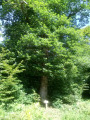
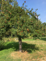
(6) About 150 metres on the left, you’ll come across the hundred-year-old oak tree, which was chosen in 1999 to commemorate the 150th anniversary of the village of Eaux-Puiseaux.
To return, retrace your steps to the D 374. Cross it and take the path opposite.

(5) After about 200 m, turn onto the first path on the left.

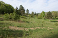
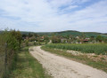
(7) At the end of the straight stretch, turn right, then left at the next junction. Carry on straight ahead until you reach the edge of the forest. Take in the scenery and head towards the church.

(1) Head back along Rue Largentier in the opposite direction to return to the car park (S/E).

Waypoints

  1. S/E : mi 0 - alt. 682 ft - Car park at the community hall near the church
  2. 1 : mi 0.22 - alt. 692 ft - Junction of the circular loop
  3. 2 : mi 0.55 - alt. 643 ft - Crossroads
  4. 3 : mi 1.76 - alt. 915 ft - Vaupicot base
  5. 4 : mi 2.22 - alt. 892 ft - Right-angled fork
  6. 5 : mi 2.63 - alt. 896 ft - Junction for the return route
  7. 6 : mi 2.82 - alt. 896 ft - The Eaux-Puiseaux Oak
  8. 7 : mi 3.18 - alt. 899 ft - Junction
  9. S/E : mi 4.55 - alt. 682 ft - Car park at the village hall near the church

Notes

  • Start from a free car park
  • Picnic area at waypoint (3).

Reviews and comments

4.3 / 5
Based on 2 reviews

Reliability of the description
4.5 / 5
Ease of following the route
4.5 / 5
Route interest
4 / 5
moitomi
moitomi

Overall rating : 4.7 / 5

Date of your route : Jun 02, 2023
Reliability of the description : ★★★★★ Very good
Ease of following the route : ★★★★★ Very good
Route interest : ★★★★☆ Good
Very busy route : Yes

Machine-translated

Evie10130
Evie10130

Indeed, work is currently under way on the section you have mentioned. This involves the construction of a forest track. The right-of-way is quite extensive, but the track itself will be much narrower, and the verges will be reforested. A pond will also be created.

I realise that, for the moment, it looks a bit of a mess. The work will be carried out this summer.

You can reach the hunting lodge by continuing on to the hamlet of Les Bordes instead of turning right at the crossroads (point 2).

At the end of the track (part of the GR), turn right and take the road leading towards the forest, which turns into a track. You’ll arrive at the hunting lodge and can then rejoin the route. This is the section marked with double dashes on the map.

Machine-translated

licaunais89
licaunais89
• Edited:

Overall rating : 4 / 5

Date of your route : Jun 12, 2022
Reliability of the description : ★★★★☆ Good
Ease of following the route : ★★★★☆ Good
Route interest : ★★★★☆ Good
Very busy route : No

We’ve just come back from this lovely walk, which could have been brilliant if the foresters weren’t in the process of wrecking everything
In fact, the path leading up to the hunters’ hut is completely destroyed for at least 600 metres before you reach the hut!!! It’s all torn up and impassable!!! This section lies between points 2 and 3

Machine-translated

Other walks in the area

For more walks, use our search engine .

The GPS track and description are the property of this route's author. Please do not copy them without permission.