The Wolf Trail via the Orchid Meadow and the Javernant Forest

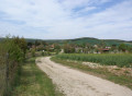
This variant of the Sentier du Loup trail allows you to explore the small village of Sommeval, the Pelouse aux Orchidées and to cross the Javernant communal forest.

Details

1994600
Creation:
Last update:
Last review:
  • Walking
    Activity: Walking
  • ↔
    Distance: 2.90 mi
  • ◔
    Average duration: 1h 35 
  • ▲
    Difficulty: Easy

  • ⚐
    Back to start: Yes
  • ↗
    Ascent: + 285 ft
  • ↘
    Descent: - 308 ft

  • ▲
    Highest point: 965 ft
  • ▼
    Lowest point: 630 ft
  • ⚐ Country: France
  • ⚐ City: Sommeval (10320)
  • ⚑
    Start/End: N 48.163943° / E 3.966246°
  • ❏
    IGN map(s): Ref. 2818SB
  • Hour-by-hour weather

Photos

Description of the walk

Start from the car park near the town hall.

(S/E) Continue along Rue de la Rencontre towards the village exit. Pass the Chemin de la Limodine on your right and, at the next junction, turn left into Rue de l’Avenir. Follow the white and yellow signposts.
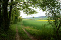
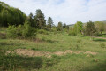
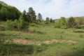
When you reach the information board, turn right onto the grassy path that climbs uphill. This path goes all the way round the Pelouse de l’Échelle. Cross the Pelouse aux Orchidées.

(1) An information board describes the conservation efforts for this dry grassland, which is exceptionally rich in biodiversity. At the end of the grassland, go through a small opening in the hedge to reach the path below. This path climbs steeply into the forest. At the first junction, continue straight on until you reach the corner of a copse on your left.

(2) At the Carrefour du Mulet, take thefirst forestpath leading down to the right (you’ll leave the 15km route here). 100 m further on, leave the track on your right and continue straight ahead

(3) At the corner of the fence, turn right. At the bottom, continue to the right, then left, and finally right at the entrance to Roiselée.

(4) Cross the D89 and take the Chemin de la Limodine opposite. Join the original route at the junction with Rue de la Rencontre, turn left and head for the town hall car park (S/E).

Waypoints

  1. S/E : mi 0 - alt. 689 ft - Town Hall
  2. 1 : mi 0.66 - alt. 797 ft - Pelouse de l’Échelle
  3. 2 : mi 1.21 - alt. 945 ft - Carrefour du Mulet
  4. 3 : mi 1.8 - alt. 702 ft - Corner of the fence
  5. 4 : mi 2.5 - alt. 643 ft - D89
  6. 5 : mi 2.51 - alt. 646 ft - Chemin de la Limodine
  7. S/E : mi 2.9 - alt. 689 ft - Town Hall

Notes

A well-maintained and clearly signposted path, though it is not recommended to walk it during the hunting season, from November to February.

The Pelouse de l’Échelle is home to certain species usually found in the south of France. Today, sheep grazing and occasional brush-clearing and mowing operations help to preserve this area, which is under threat of disappearing.

Reviews and comments

4.7 / 5
Based on 2 reviews

Reliability of the description
4.5 / 5
Ease of following the route
5 / 5
Route interest
4.5 / 5
lemarcheur65
lemarcheur65 ★

Hello User 24395873
Thank you for your comment.
Description updated.

Machine-translated

User 24395873

Overall rating : 4.7 / 5

Date of your route : Sep 16, 2026
Reliability of the description : ★★★★☆ Good
Ease of following the route : ★★★★★ Very good
Route interest : ★★★★★ Very good
Very busy route : No

A lovely spot for a short walk with children.

At marker (2), the sign says: At the Carrefour du Mulet, turn left onto the forest track that leads downhill (this is where you leave the 15km route).

We think it’s actually to the right

Machine-translated

SylvainO'
SylvainO'

Overall rating : 4.7 / 5

Date of your route : Feb 03, 2026
Reliability of the description : ★★★★★ Very good
Ease of following the route : ★★★★★ Very good
Route interest : ★★★★☆ Good
Very busy route : No

A lovely little hike; done in winter. The muddy terrain adds a bit of excitement to the outing, turning it into a "holiday on ice" experience. A nice little tour, without any major difficulties; we followed the GPS track.

Machine-translated

Other walks in the area

For more walks, use our search engine .

The GPS track and description are the property of this route's author. Please do not copy them without permission.