Ponds, drinking troughs and washhouses, valleys and forests in the Pays d’Othe

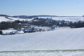
A walk through the valleys and forests to discover the remains of a time when shepherds led their flocks to drink from the pools above Villemoiron and Saint-Mards-en-Othe.

Details

4959044
Creation:
Last update:
Last review:
  • Walking
    Activity: Walking
  • ↔
    Distance: 8.51 mi
  • ◔
    Average duration: 4h 30 
  • ▲
    Difficulty: Moderate

  • ⚐
    Back to start: Yes
  • ↗
    Ascent: + 669 ft
  • ↘
    Descent: - 676 ft

  • ▲
    Highest point: 807 ft
  • ▼
    Lowest point: 495 ft

Photos

Description of the walk

Start from the car park at Villemoiron Town Hall, near the war memorial.

(S/E) Walk past the left-hand side of the church and head up the dirt track towards the Bois des Grémonts.
At the three-way junction, turn left and head into the woods.

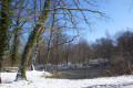
(1) At the junction, take the forest track on the right. This leads onto theGR®® de Pays Tour des Forêts d’Othe. Walk past the pond and continue along the track to the edge of the Villemoiron Forest.

(2) Turn left to walk along the edge of the woodland. Head uphill, then turn right onto the ridge path.

(3) At the corner of the park, at the junction, turn sharply right to leave the path. This path is not very obvious. Walk alongside a tree-lined hedge as you descend towards the hamlet of Surançon.

(4) Cross Rue du Lavoir (D21) and continue in the same direction along Chemin de la Source.

(5) At the three-way junction, take the path on the right, leavingthe GR®® de Pays to continue on theGRP®® de Saint-Jacques. Head up towards the forest, cross it, then descend towards Fond de Frayère. You’ll be looking down on Saint-Mards-en-Othe.

(6) At the junction with the Chemin de la Gare, turn left onto the grassy path, the Rue du Marché au blé.
At the Saint-Mards-en-Othe cemetery, turn right to walk down past the church and then along the Grande Rue.

(7) At the crossroads by the town hall, turn left into Rue de la Grenouille (D22). At L’Abreuvoir, veer right into Rue Richebourg.

(8) After about a hundred metres, just before the bridge over the Nosle, turn right onto the old towpath.

(9) At the war memorial, cross the Nosle and turn left into Rue de la Ferme.
At the Ferme de la Basse-Cour, continue along the path, keeping in the same direction.

(10) At the three-way junction, take the left-hand path, which climbs steeply towards the Bois de la Halte du Grand Marchais.

(11) At the fork, turn right and pass between the hunting lodge and the pond. Leave the woods, continuing in the same direction. Carry on downhill to the Fond des Vauroisses and then on to Villemoiron. Take Rue de la Frianderie, which runs alongside the River Nosle.

(12) Turn right onto Rue du Moulin.

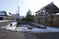
(13) Turn right again onto Ruelle du Moulin. At the wash house, at the junction with Grande Rue, turn left to reach the car park (S/E).

Waypoints

  1. S/E : mi 0 - alt. 515 ft - Car park at the town hall in Villemoiron-en-Othe
  2. 1 : mi 1.2 - alt. 771 ft - GR junction
  3. 2 : mi 1.69 - alt. 679 ft - Junction at the edge of the woods
  4. 3 : mi 2.2 - alt. 748 ft - Junction heading due south
  5. 4 : mi 2.6 - alt. 597 ft - Junction with the D121
  6. 5 : mi 2.86 - alt. 623 ft - Junction
  7. 6 : mi 4.32 - alt. 594 ft - Junction with the Chemin de la Gare
  8. 7 : mi 5.02 - alt. 564 ft - Junction by the town hall
  9. 8 : mi 5.15 - alt. 571 ft - End of the towpath - Nosle (rivière)
  10. 9 : mi 5.33 - alt. 561 ft - Crossroads by the war memorial
  11. 10 : mi 6.01 - alt. 574 ft - Three-Way Junction
  12. 11 : mi 6.63 - alt. 764 ft - Junction
  13. 12 : mi 8.29 - alt. 495 ft - Junction with Rue du Moulin
  14. 13 : mi 8.38 - alt. 502 ft - Ruelle du Moulin junction
  15. S/E : mi 8.51 - alt. 515 ft - Car park at Villemoiron-en-Othe Town Hall

Notes

This walk largely follows one of the many routes offered by the Association Randonnées en Pays d’Othe, but the starting point is Villemoiron-en-Othe.
For further information:
https://www.aube-champagne.com/fr/rando-...

Always be cautious and plan ahead when you're outdoors. Visorando and the author of this route cannot be held responsible for any accidents occurring on this route.

The GR® and PR® markings are the intellectual property of the Fédération Française de Randonnée Pédestre.

Reviews and comments

4.3 / 5
Based on 2 reviews

Reliability of the description
4.5 / 5
Ease of following the route
4.5 / 5
Route interest
4 / 5
moitomi
moitomi

Overall rating : 4.7 / 5

Date of your route : Sep 17, 2021
Reliability of the description : ★★★★★ Very good
Ease of following the route : ★★★★★ Very good
Route interest : ★★★★☆ Good
Very busy route : No

A varied route through woodland and farmland. Beautiful views over the valleys of the Pays d’Othe.

Machine-translated

noonkamikaz
noonkamikaz

Overall rating : 4 / 5

Date of your route : May 10, 2021
Reliability of the description : ★★★★☆ Good
Ease of following the route : ★★★★☆ Good
Route interest : ★★★★☆ Good
Very busy route : No

A nice route, but nothing out of the ordinary… a bit too much monoculture woodland for a while, and the stretch through Saint-Mard-en-Othe wasn’t particularly interesting… A dry washhouse…

Machine-translated

Other walks in the area

For more walks, use our search engine .

The GPS track and description are the property of this route's author. Please do not copy them without permission.