From the washhouse to the Sources de l’Ancre via the Bois de la Garenne in Bercenay

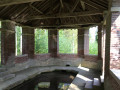
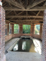
From the wash house opposite the church, then via the Fond de la Garenne, up through the Bercenay-en-Othe Communal Forest, then down towards the Sources de l’Ancre and back along the River Ancre.

Details

4749681
Creation:
Last update:
Last review:
  • Walking
    Activity: Walking
  • ↔
    Distance: 5.67 mi
  • ◔
    Average duration: 2h 50 
  • ▲
    Difficulty: Easy

  • ⚐
    Back to start: Yes
  • ↗
    Ascent: + 305 ft
  • ↘
    Descent: - 302 ft

  • ▲
    Highest point: 869 ft
  • ▼
    Lowest point: 574 ft

Photos

Description of the walk

Village hall car park, Rue de Maraye.

(S/E) With your back to the wash house, head left towards Maray-en-Othe, then turn left onto Rue du Prieuré. At the junction with Ruelle du Moulin and Ruelle du Commun, carry on straight ahead for about 150 m.

(1) At the junction, take the Fond de la Garenne path on the right.
Follow this path into the Bois de la Garenne and continue southwards.

(2) On reaching the edge of the Bois de la Garenne, turn right at a right angle, following the edge of the woodland. After this bend, head south again, ignoring any paths branching off to the right or left.
About 1.5 km further on, the path turns sharply left (towards the east) and quickly descends onto the D23.

(3) Cross the D23 carefully, moving about ten metres to the right, and continue eastwards. Walk past the Sources de l’Ancre and cross the stream.

(4) At the first junction, turn left. The return journey to Bercenay follows the footpaths and lanes, heading straight north until you reach the entrance to Concise via Rue des Terriers.

(5) Walk past the Concise wash house, follow Rue des Terriers and continue along Rue de Chamoy.

(6) At the junction with the D53, turn left to return to the wash house and head back to the car park (S/E).


Waypoints

  1. S/E : mi 0 - alt. 574 ft - Village hall car park
  2. 1 : mi 0.31 - alt. 591 ft - Junction with the Fond de la Garenne footpath
  3. 2 : mi 1.54 - alt. 817 ft - Edge of the Bois de la Garenne
  4. 3 : mi 3.13 - alt. 643 ft - Junction with the D23. Sources de l’Ancre
  5. 4 : mi 3.31 - alt. 653 ft - Junction
  6. 5 : mi 4.27 - alt. 610 ft - Concise Washhouse
  7. 6 : mi 5.57 - alt. 584 ft - Junction with the D53
  8. S/E : mi 5.67 - alt. 574 ft - Village hall car park

Notes

The car park for the Bercenay-en-Othe village hall is behind the wash house, opposite the church.

Worth a visit

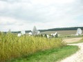
Space Telecommunications Centre

Reviews and comments

4.7 / 5
Based on 2 reviews

Reliability of the description
5 / 5
Ease of following the route
5 / 5
Route interest
4 / 5
Amande75
Amande75

Overall rating : 4.7 / 5

Date of your route : May 04, 2026
Reliability of the description : ★★★★★ Very good
Ease of following the route : ★★★★★ Very good
Route interest : ★★★★☆ Good
Very busy route : No

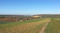
A pleasant walk through the woods and along fields, with some lovely views. The final stretch through the village (between 1.5 and 2 km) is a little less interesting, but as the road is quiet, it’s still a pleasant walk.

Machine-translated

SYLDEH
SYLDEH

Overall rating : 4.7 / 5

Date of your route : Mar 30, 2021
Reliability of the description : ★★★★★ Very good
Ease of following the route : ★★★★★ Very good
Route interest : ★★★★☆ Good
Very busy route : No

A lovely walk during lockdown! It’s a great addition to the existing walks in the area.
Lovely view.

Machine-translated

Other walks in the area

For more walks, use our search engine .

The GPS track and description are the property of this route's author. Please do not copy them without permission.