Refine your search for walks in Colroy-la-Grande
Colroy-la-Grande walks
 The Climont and the Voyemont from Saales
 Visorando Member
 11.83 mi
 +2,139 ft
 -2,133 ft
 7h 20
7h 20
 Moderate
 Departure from Saales (Bas-Rhin)
Climont rises to an altitude of 965 metres. The Julius Tower stands atop its summit, offering a 360-degree view of Alsace and the Black Forest. This walk takes you to the summit starting from Saales. Half of the walk is on flat ground. A further quarter is uphill, and another quarter is downhill. The climbs aren’t very long, but they are quite steep, technical and stony. Most of the walk takes place in the forest. The return route takes you past the Voyemont and the Roche des Fées, offering views of the Bruche Valley and the Bas-Rhin on one side, and the Vosges department on the other.
The Saâles ridges
 Tourist office6.67 mi
+1,063 ft
-1,063 ft
4h 00
Moderate
Departure from Saales (Bas-Rhin)
Tourist office6.67 mi
+1,063 ft
-1,063 ft
4h 00
Moderate
Departure from Saales (Bas-Rhin)
Set in the centre of a two-kilometre-long plateau, surrounded by mountains, the village of Saâles was built on the Via Salinaria at a convenient crossing point over the Vosges. The village has maintained its role as a market town throughout history. As early as 1743, it was granted the privilege of holding a fair and a market. In 1924, the rebuilt town hall housed the market halls on its ground floor.
Exploring Climont
 7.66 mi
+1,440 ft
-1,407 ft
4h 45
Moderate
Departure from Bourg-Bruche (Bas-Rhin)
7.66 mi
+1,440 ft
-1,407 ft
4h 45
Moderate
Departure from Bourg-Bruche (Bas-Rhin)
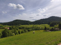
A lovely walk in the Bruche Valley, with the climb up to Climont offering magnificent scenery. The ascent between (2) and (3) follows a footpath and is a bit of a challenge but well worth the effort. The descent is more gradual and follows a forest track.
Le Climont and the source of the Bruche
6.74 mi
+1,250 ft
-1,247 ft
4h 10
Moderate
Departure from Bourg-Bruche (Bas-Rhin)
This walk winds through a haven of peace and tranquillity towards one of the legendary peaks of the Bruche Valley. Surrounded by green, wooded landscapes, Le Climont is the region's water tower. Three rivers originate in its vicinity: the Bruche, Giessen and Fave. This spot is marked by a stele created by sculptor Raymond Keller from a block of sandstone donated by the Champenay quarry.
The Bois de Belfays Wind Farm (long version)
 8.68 mi
+1,417 ft
-1,398 ft
5h 15
Moderate
Departure from Ban-de-Sapt (Vosges)
8.68 mi
+1,417 ft
-1,398 ft
5h 15
Moderate
Departure from Ban-de-Sapt (Vosges)
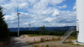
A walk offering a close-up view of the wind turbines at Bois de Belfays. In this longer version, you reach the wind farm via Pré Leroy (La Grande Fosse) and return via Pré Lannequin (Châtas).
Col D'Urbeis Pushchair Trail
2.93 mi
+167 ft
-167 ft
1h 30
 Easy
Departure from Lubine (Vosges)
Easy
Departure from Lubine (Vosges)
This walk is primarily intended for families with young children or pushchairs.
This circular is not difficult but offers truly magnificent scenery and atmosphere.
You can ask for more information at the Villé Tourist Office.
L'Alhan - Le Climont - The source of the Bruche
 9.68 mi
+2,037 ft
-2,031 ft
6h 15
9.68 mi
+2,037 ft
-2,031 ft
6h 15
 Difficult
Departure from Bourg-Bruche (Bas-Rhin)
Difficult
Departure from Bourg-Bruche (Bas-Rhin)
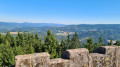
A beautiful hike with stunning views of all the surrounding valleys: the Bruche Valley, Donon, Saint-Dié-des-Vosges, Val de Villé, Sainte-Croix-aux-Mines, Haut-Koenigsbourg, etc.
It is quite difficult due to its length, elevation gain and rough terrain (narrow paths on the edge of the void or muddy forest paths).
The Hang clearing at the foot of Climont
6.95 mi
+860 ft
-876 ft
3h 55
Moderate
Departure from Bourg-Bruche (Bas-Rhin)
This walk winds through a haven of peace and tranquillity at the foot of one of the valley's legendary peaks: Climont (966 m). The Bruche river rises at an altitude of 660 m and then crosses a vast basin: the Hang clearing. This is where families of glassmakers settled in 1723. Le Hang continued to prosper thanks to the arrival of Mennonite farmers of Swiss origin. They found here a place conducive to their pastoral and community life.
 Le Climont on snowshoes
 7.04 mi
+1,391 ft
-1,385 ft
4 hrs
Easy
Departure from Urbeis (Bas-Rhin)
7.04 mi
+1,391 ft
-1,385 ft
4 hrs
Easy
Departure from Urbeis (Bas-Rhin)
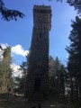
Snowshoeing towards Climont – 965m – (Vosges Mountains).
Le Climont pushchair trail
 3.44 mi
+249 ft
-249 ft
1h 50
Easy
Departure from Urbeis (Bas-Rhin)
3.44 mi
+249 ft
-249 ft
1h 50
Easy
Departure from Urbeis (Bas-Rhin)
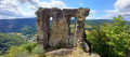
This walk is a round trip taking you to the ruins of Bilstein Castle.
Le Voyemont and the Roche des Fées viewpoint via the Hang shelter
 9.68 mi
+1,450 ft
-1,447 ft
5h 45
Moderate
Departure from Ranrupt (Bas-Rhin)
9.68 mi
+1,450 ft
-1,447 ft
5h 45
Moderate
Departure from Ranrupt (Bas-Rhin)
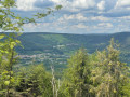
A mix of magnificent cow pastures and beautiful coniferous forests with stunning views. A preserved valley with a few farms and the odd holiday home, at the foot of one of the valley’s legendary peaks, the Climont (966 m). A haven of peace – picture-postcard perfect!The route is suitable for beginner hikers, though the climb to the Refuge du Hang and on to the Belvédère de la Roche des Fées may seem challenging for those less accustomed to hiking and requires a reasonable level of fitness.
The Fontenelle National Necropolis and the hamlets that fell for France
 3.85 mi
+341 ft
-367 ft
2h 05
Easy
Departure from Ban-de-Sapt (Vosges)
3.85 mi
+341 ft
-367 ft
2h 05
Easy
Departure from Ban-de-Sapt (Vosges)
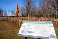
The Fontenelle National War Memorial is a major site commemorating the Vosges Front during the First World War. This route passes through hamlets that no longer exist, of which only a sign remains today to indicate their former existence.
From the Col de Sainte-Marie-aux-Mines to the Chaume de Lusse
8.51 mi
+1,526 ft
-1,526 ft
5h 15
Difficult
Departure from Wisembach (Vosges)
This circular hike links the Col de Sainte-Marie-aux-Mines to Chaume de Lusse, through typical Vosges forests of beech, fir, blueberry and high-altitude meadows. The forest paths and roads offer beautiful panoramic views of the Val d'Argent and Meurthe valleys. This is a fairly dynamic route that leads to Chaume de Lusse via a varied course, including sustained climbs (which is why we rate it as difficult), forest passages and open ridges. Part of the route runs between Alsace and Lorraine on paths and trails marked by the GR®531, the former border from 1871 to 1918, with boundary stones marked D (Deutschland), often hammered, and F, marking the historic border and named "Chemins de la Grande Guerre" (Paths of the Great War).
Col Sainte-Marie-aux-Mines / Paths of Memory
 6.72 mi
+1,325 ft
-1,329 ft
4h 15
Moderate
Departure from Wisembach (Vosges)
6.72 mi
+1,325 ft
-1,329 ft
4h 15
Moderate
Departure from Wisembach (Vosges)
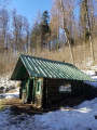
A beautiful historical hike near the Wisembach National Forest.A reminder of the facts:1871 - Alsace/Moselle are annexed by Germany, which modernises many areas.1914 - The heir to the Austrian throne is assassinated / Germany declares war on Russia, France and Belgium. Soldiers occupy villages and mountains.November 1918: the trenches are filled in, the blockhouses and other structures destroyed, but around a hundred remain visible in the heights of the Val d'Argent.
The shelter trail via the Côte d'Échery
 6.02 mi
+984 ft
-965 ft
3h 35
Moderate
Departure from Wisembach (Vosges)
6.02 mi
+984 ft
-965 ft
3h 35
Moderate
Departure from Wisembach (Vosges)
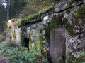
A short circular walk from the Col de Sainte-Marie-aux-Mines, offering the chance to explore the remains of theFirst World War (1914–1918), including the German army’s installations below the Tête du Violu front line.
Le Climont from the south side from the Col de Steige
 5.84 mi
+1,411 ft
-1,411 ft
3h 55
Difficult
Departure from Ranrupt (Bas-Rhin)
5.84 mi
+1,411 ft
-1,411 ft
3h 55
Difficult
Departure from Ranrupt (Bas-Rhin)
The Climont is a curious conical massif which you will approach from the south face. The climb is steep, but the view from the top of the Julius Tower, at an altitude of over 960m, is well worth the effort.
21/04/2025: Five years after its first publication, I revisited this route to check that the description still matches the terrain. I took the opportunity to clarify certain sections and add a few waypoints.
The descent is quite technical and difficult, and it is best to avoid it in wet weather, or else do the hike in the opposite direction. Enjoy the outing, everyone.
Tête du Violu
3.32 mi
+761 ft
-735 ft
2h 10
Easy
Departure from Wisembach (Vosges)
Ascent to the Tête du Violu from the Col de Sainte-Marie-aux-Mines via the Carrefour des Biches and the Labyrinth.
The Fontenelle site - The National Necropolis and Cote 627
 4.66 mi
+830 ft
-827 ft
2h 50
Easy
Departure from Ban-de-Sapt (Vosges)
4.66 mi
+830 ft
-827 ft
2h 50
Easy
Departure from Ban-de-Sapt (Vosges)
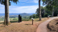
The walk takes you through the Fontenelle site and its surroundings, which were the scene of fighting during the First World War.
The Urbeis Heritage Trail: a story of time
2.65 mi
+702 ft
-682 ft
1h 50
Easy
Departure from Urbeis (Bas-Rhin)
This route will take you around Urbeis, leading you up to the higher ground and to the foot of the Théophile Mine.
The Urbeis Heritage Trail and Bilstein Castle
 8.59 mi
+1,398 ft
-1,385 ft
5h 10
Moderate
Departure from Urbeis (Bas-Rhin)
8.59 mi
+1,398 ft
-1,385 ft
5h 10
Moderate
Departure from Urbeis (Bas-Rhin)
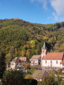
Circular starting from Urbeis in the Villé valley, following the heritage trail on the theme of the mining past, then passing by the ruins of Bilstein Castle, the village of Climont and the Col d'Urbeis.
Circular route around Saulxures
 6.71 mi
+755 ft
-764 ft
3h 45
Moderate
Departure from Saulxures (Bas-Rhin)
6.71 mi
+755 ft
-764 ft
3h 45
Moderate
Departure from Saulxures (Bas-Rhin)
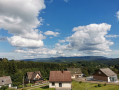
A pleasant walk around Saulxures, much of it in the shade. Beautiful views along the route.
From Haut-Ranrupt to Hauts-Bois
3.98 mi
+584 ft
-584 ft
2h 20
Easy
Departure from Ranrupt (Bas-Rhin)
Following the course of the Haut Bois stream, set off to explore the hills above the village of Ranrupt, where you’ll enjoy unobstructed views over the Climontaine valley. On your way, stop off at the Hauts-Bois farm inn to sample some local cuisine.
Farms and farmhouse inns around Ranrupt
7.42 mi
+1,316 ft
-1,286 ft
4h 35
Moderate
Departure from Ranrupt (Bas-Rhin)
Explore the trails above the village of Ranrupt and discover the hamlet of Fonrupt, a haven of tranquillity. Along the way, treat your taste buds to authentic local produce while enjoying splendid views of the Climontaine and Chiregoutte valleys.
Circular route between Ranrupt and Colroy-La-Roche
 8.89 mi
+1,535 ft
-1,545 ft
5h 25
Moderate
Departure from Ranrupt (Bas-Rhin)
8.89 mi
+1,535 ft
-1,545 ft
5h 25
Moderate
Departure from Ranrupt (Bas-Rhin)
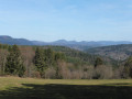
A circular walk starting from Ranrupt, taking us towards Stampoumont as far as Colroy-la-Roche, returning via Fonrupt.
A route alternating between open countryside and woodland, with two viewpoints overlooking the villages.
The first half is fairly gentle, the second half a little more challenging, with the Climont massif in view.
The summit of Climont from Steige
10.52 mi
+2,267 ft
-2,290 ft
6h 50
Difficult
Departure from Steige (Bas-Rhin)
Starting from Steige, this hike will take you to the summit of Climont to discover the Julius Tower and several magnificent viewpoints over the Villé Valley, as well as the Bruche Valley and the Vosges.
This hike is difficult and includes sections with very steep climbs and technical passages. You will need to be in good physical condition and carry a small backpack.
From Colroy-la-Roche to Stampoumont in a circular.
 5.51 mi
+712 ft
-705 ft
3h 10
Easy
Departure from Colroy-la-Roche (Bas-Rhin)
5.51 mi
+712 ft
-705 ft
3h 10
Easy
Departure from Colroy-la-Roche (Bas-Rhin)
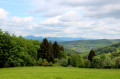
An easy walk to the hamlet of Stampoumont through a beautiful forest, then beautiful views of the pastures, the Donon and the Climont, not to mention the pretty chapel of Stampoumont with its minimalist stained glass windows. A calm and peaceful walk.
From Sainte-Marie-aux-Mines to the top of Violu
 9.17 mi
+2,172 ft
-2,169 ft
6h 05
Moderate
Departure from Sainte-Marie-aux-Mines (Haut-Rhin)
9.17 mi
+2,172 ft
-2,169 ft
6h 05
Moderate
Departure from Sainte-Marie-aux-Mines (Haut-Rhin)
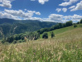
This is a beautiful hike through lovely forests and magnificent meadows, offering superb views of the valley and the surrounding mountains.
You will also discover a whole chapter of the history of Alsace-Moselle: the German occupation from 1870 to 1918, as well as the battles of theFirst World War that took place in the Vosges.
The hike presents no difficulty other than a few hundred metres with a 15% gradient after the Col de Sainte-Marie.
Nature, history and habitat around Ranrupt
 8.93 mi
+1,467 ft
-1,467 ft
5h 25
Moderate
Departure from Colroy-la-Roche (Bas-Rhin)
8.93 mi
+1,467 ft
-1,467 ft
5h 25
Moderate
Departure from Colroy-la-Roche (Bas-Rhin)
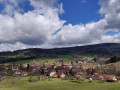
This circular loop, which runs mostly through the woods, offers a pleasant variety of points of interest. Villages and landscapes, nature and habitat, crafts, history and places of worship (ornate chapels, sandstone crosses) all contribute to the appeal of this still little-known region of Alsace.
Château de la Roche from Haut Ranrupt
5.87 mi
+1,102 ft
-1,093 ft
3h 40
Moderate
Departure from Ranrupt (Bas-Rhin)
A beautiful walk through the forest and meadows, taking you from a small village to the old castle of La Roche with a splendid view of the valley. The first hill you see is the Col de la Perheux. Behind this pass, you will see the Donon. Along the way, you will have several views of the Climont.
Échery, Le Petit Brézouard, Col des Bagenelles
14.05 mi
+3,648 ft
-3,652 ft
9h 35
Difficult
Departure from Sainte-Marie-aux-Mines (Haut-Rhin)
Exploring the old mines of the village of Échery and its Clock Tower. Climb to the summit of the Grand Brézouard and enjoy its 360° panorama of the Sainte-Marie-aux-Mines valley and the Vosges ridges.
La Chaume du Haïcot and Les Deux Brézouard from Échery
 10.20 mi
+2,904 ft
-2,897 ft
7h 15
Difficult
Departure from Sainte-Marie-aux-Mines (Haut-Rhin)
10.20 mi
+2,904 ft
-2,897 ft
7h 15
Difficult
Departure from Sainte-Marie-aux-Mines (Haut-Rhin)
One of the most beautiful slopes in the Vosges to climb one of the highest peaks in the Vosges, with, as a reward on a clear day, a view of the Bernese Jura and its trilogy of legendary peaks: the Eiger, the Mönch and the Jungfrau, i.e. the Ogre, the Monk and the Virgin. In autumn, when the mist sets in and the days grow shorter, early morning hikers will be impressed by the bellowing of the stags. This route is far from any noise pollution.
Around Sainte-Croix-aux-Mines
 7.58 mi
+1,253 ft
-1,237 ft
4h 35
Moderate
Departure from Sainte-Croix-aux-Mines (Haut-Rhin)
7.58 mi
+1,253 ft
-1,237 ft
4h 35
Moderate
Departure from Sainte-Croix-aux-Mines (Haut-Rhin)
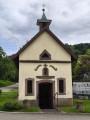
Thefirst part of the walk is mainly in the shade and not particularly difficult, apart from the fairly steep climb after Grand Rombach. Best done in hot weather to make the most of the shade. Please note that there is tarmac at the start and end of the walk.
Circular route in the hills above Sainte-Croix-aux-Mines
 9.13 mi
+1,752 ft
-1,742 ft
5h 45
Moderate
Departure from Sainte-Croix-aux-Mines (Haut-Rhin)
9.13 mi
+1,752 ft
-1,742 ft
5h 45
Moderate
Departure from Sainte-Croix-aux-Mines (Haut-Rhin)
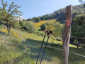
A lovely circular walk starting from Sainte-Croix-aux-Mines, alternating between open landscapes (offering views of the valley, the Taennchel massif and the Grand Brézouard) and beautiful forests; a route dotted with hamlets featuring old, isolated mountain farms.
The Flag Trail in Saint-Blaise-la-Roche
 4.53 mi
+594 ft
-620 ft
2h 35
Easy
Departure from Saint-Blaise-la-Roche (Bas-Rhin)
4.53 mi
+594 ft
-620 ft
2h 35
Easy
Departure from Saint-Blaise-la-Roche (Bas-Rhin)
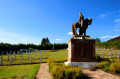
A commemorative walk retracing the Battle of Saint-Blaise-la-Roche during the First World War and the episode of the flag captured from the enemy. Numerous information boards line the route.
The banks of the Bruche from Saint-Blaise-la-Roche
10.83 mi
+1,155 ft
-1,171 ft
6h 00
Difficult
Departure from Saint-Blaise-la-Roche (Bas-Rhin)
Situated at the bottom of the valley, Saint-Blaise-la-Roche experienced significant population growth during the19th century with the establishment of weaving industries. The village is also situated on the first Strasbourg–Saâles–Saint-Dié-des-Vosges railway line, inaugurated in 1929 by Raymond Poincaré. Numerous engineering structures (including the Fouday viaduct further downstream) made it possible to create the first railway route through the Vosges.
Champenay sandstone
10.34 mi
+1,916 ft
-1,909 ft
6h 25
Moderate
Departure from Plaine (Bas-Rhin)
Champenay is known for its quartzite sandstone quarry. This is a red sandstone veined with white, known as ‘grès des Princes’ in reference to the former status of this territory, which was the Principality of Salm. At the highest point of the route, there are old France–Germany boundary markers dating from 1870–1918. Finally, the route passes through the refreshing Falle Valley and past the lake of the same name.
Circular route straddling Alsace and Lorraine, starting from Champenay
13.01 mi
+2,549 ft
-2,539 ft
8h 10
Difficult
Departure from Plaine (Bas-Rhin)
At the Col du Hantz, we cross into Lorraine; then, after a fairly long stretch along a quiet road, we follow a stream along an impressive medieval cobbled path, adorned with installations by ‘art student’ from the University of Nancy; a little further up, the tranquillity of a secluded peat bog is disturbed only by birdsong. The Chemin des Passeurs then takes us to La Haute-Loge and La Chatte Pendue. A journey for lovers of nature and history.
Around the smallest village in Alsace
4.61 mi
+787 ft
-764 ft
2h 50
Easy
Departure from Blancherupt (Bas-Rhin)
There is a proverb that says that everything small is cute. And it's true. With its 38 inhabitants, Blancherupt is the smallest municipality in Alsace and has a charm all of its own. In the 1990s, an award-winning advertising campaign described the commune as "In Blancherupt, there is nothing... nothing but the essentials", an invitation to discover this little corner of paradise without further delay.
The seigneury of Ban de la Roche
 4.91 mi
+850 ft
-840 ft
3h 00
Easy
Departure from Bellefosse (Bas-Rhin)
4.91 mi
+850 ft
-840 ft
3h 00
Easy
Departure from Bellefosse (Bas-Rhin)
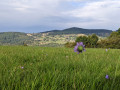
Bellefosse, known as ‘Béfoss’ in the local dialect, was part of the former seigneury of Ban de la Roche. This walk will take you up to the heights of Bellefosse to explore the ruins of La Roche Castle, known as ‘zum Stein’ or ‘Steinschloss’, then across the peaks, where you’ll discover the former seigneurial farmstead of Lachamp. Finally, you’ll have the chance to enjoy a meal at one of the two farmhouse inns: the Ban de la Roche or the Promont.