


Refine your search for walks in Chaliers
Chaliers walks
 The Valadour Footbridge in Chaliers
 Visorando Member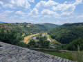
 6.19 mi
 +1,007 ft
 -981 ft
 3h 45
3h 45
 Moderate
 Departure from Loubaresse (Cantal) (Cantal)
Starting from Loubaresse, near an exit from the A75 motorway, this route follows the GR® de Pays circular Boucle de la Truyère and a variant that "turns" around the Truyère river to the village of Chaliers, which is well worth taking the time to explore. The route takes small local roads on both the left and right banks of this river with its wild gorges, crossing it twice via footbridges at Valadour and Terran.
The actual duration of the route is 4 hours and 40 minutes (GPS watch data), including a short stop in Chaliers.
Calvaire de Recoux and Roc del Burre, starting from Saint-Just
 6.73 mi
+1,115 ft
-1,115 ft
4h 05
Moderate
Departure from Saint-Just (Cantal) (Cantal)
6.73 mi
+1,115 ft
-1,115 ft
4h 05
Moderate
Departure from Saint-Just (Cantal) (Cantal)
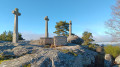
Setting off from the charming village of Saint-Just, numerous granite boulders are scattered here and there across the landscape. The most unusual is undoubtedly the Recoux Calvary, an imposing mass of granite topped by three majestic crosses, a testament to the skill of local stonemasons and to an era when men erected calvaries to the glory of God. On the way back, you cannot miss the Roc del Burre, better known as the Pierre Branlante. It’s up to you to find the right spot to make this 400-tonne boulder move with just one hand.
Walk in the Margeride Forest
2.70 mi
+489 ft
-505 ft
1h 40
 Easy
Departure from Cantal
Easy
Departure from Cantal
A short, gentle walk with views of the surrounding mountains and the Monts du Cantal. This walk follows a forest track through the woods. It is accessible on foot, by mountain bike and on snowshoes.
The Recoux Calvary and the Wobbly Rock at La Roche
 8.14 mi
+712 ft
-728 ft
4h 20
Moderate
Departure from Faverolles (Cantal) (Cantal)
8.14 mi
+712 ft
-728 ft
4h 20
Moderate
Departure from Faverolles (Cantal) (Cantal)
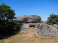
From Montchanson, with a rucksack on your back – in place of the schoolbag that children of yesteryear used to carry on their backs to get to school in one of the villages of the Arcomie Valley – let’s follow in their footsteps to discover the hamlets and local heritage. On the way, don’t forget to climb up to the Trois Croix du Bloc du Recoux for an exceptional view, before trying your hand at making the Pierre Branlante de la Roche wobble, north of Saint-Marc.
The balconies of the Truyère
 10.36 mi
+2,198 ft
-2,172 ft
6h 40
10.36 mi
+2,198 ft
-2,172 ft
6h 40
 Difficult
Departure from Blavignac (Lozère)
Difficult
Departure from Blavignac (Lozère)
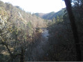
A superb hike, mostly through woods, to discover the wild and little-known Truyère gorges. Suitable for experienced walkers only due to the distance and elevation gain.
The geoscope and arboretum at the Lozère rest area
0.53 mi
+23 ft
-23 ft
0h 15
Easy
Departure from Les Monts-Verts (Lozère)
Take a break from the A75 for a pleasant and informative stop!
The hamlets of Saint-Privat-du-Fau
 7.25 mi
+1,076 ft
-1,086 ft
4h 15
Moderate
Departure from Saint-Privat-du-Fau (Lozère)
7.25 mi
+1,076 ft
-1,086 ft
4h 15
Moderate
Departure from Saint-Privat-du-Fau (Lozère)
Set off to discover the typical villages of the Margeride and its local heritage. This pleasant walk, offering superb views of the massif and the Cantal mountains, is also accessible by mountain bike.
Mont Mouchet from the Croix du Fau
 6.90 mi
+981 ft
-971 ft
4h 00
Moderate
Departure from Saint-Privat-du-Fau (Lozère)
6.90 mi
+981 ft
-971 ft
4h 00
Moderate
Departure from Saint-Privat-du-Fau (Lozère)
Discover the highest point of the Margeride and enjoy a 360° panorama of the Auvergne mountains. In good weather, you can also see the Alps and the Pyrenees.
The Grandval Dam via La Mourache
 5.76 mi
+1,168 ft
-1,184 ft
3h 40
Moderate
Departure from Fridefont (Cantal)
5.76 mi
+1,168 ft
-1,184 ft
3h 40
Moderate
Departure from Fridefont (Cantal)
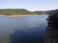
Over the centuries, the Truyère has carved out deep gorges which, with the rising water levels caused by the construction of the Grandval and Lanau dams, have given way to a natural landscape of surprising and contrasting beauty: islands and peninsulas, cirques with distant shores, mysterious meanders, narrow gorges opening onto vast expanses of water, a wooded valley… Following the PR la Mourache route, the walk offers magnificent views from the embankment supporting the Alleuze road.
Walking the route in the opposite direction offers more shade, but do keep an eye out for the signposting – which, to be honest, is rather sparse.
Upper town of Saint-Flour via the Montée des Chèvres
2.23 mi
+354 ft
-354 ft
1h 20
Easy
Departure from Saint-Flour (Cantal)
Passing through Auvergne? Take the opportunity to enjoy a pleasant break in Saint-Flour. From the banks of the Anver, climb up to discover the upper town via the Chemin des Chèvres and don't forget to stock up on cheese!
Short tour of the Planèze de Saint-Flour in three days
37.92 mi
+4,419 ft
-4,446 ft
3 days
Difficult
Departure from Saint-Flour (Cantal)
Starting from Saint-Flour, this tour of the northern part of the Planèze de Saint-Flour allows you to appreciate the diversity of the landscapes of this high basalt plateau in just three days of walking.
The stages in Paulhac and Valuéjols offer accommodation in stopover lodges.
The route follows part of a variant of the GR® de Pays de Saint-Flour and part of the GR®4.
Saint-Flour - Paulhac
15.30 mi
+1,460 ft
-745 ft
8h 20
Difficult
Departure from Saint-Flour (Cantal)
This is the first of three stages of the Saint-Flour Planèze tour. It is the longest stage, passing through several small villages typical of the Planèze with their bread ovens, which provide welcome shelter for a short break in rainy weather. The very quiet paths and small roads run alongside meadows grazed by numerous herds of cattle in season.
The Ramparts Trail and the old town of Saint-Flour
 2.05 mi
+197 ft
-213 ft
1h 05
Easy
Departure from Saint-Flour (Cantal)
2.05 mi
+197 ft
-213 ft
1h 05
Easy
Departure from Saint-Flour (Cantal)
A walk that allows you to explore the old town of Saint-Flour, perched on its volcanic rocky outcrop, which forms a natural rampart.
The wayside crosses around Malzieu
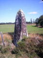 7.42 mi
+866 ft
-856 ft
4h 10
Moderate
Departure from Le Malzieu-Ville (Lozère)
7.42 mi
+866 ft
-856 ft
4h 10
Moderate
Departure from Le Malzieu-Ville (Lozère)
A walk dotted with wayside crosses, which once served to guide travellers but also served as a reminder to the local population of their duty of devotion to God. By the way, how many did you count?
Discovering the Barons of Apcher
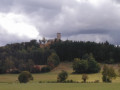 9.23 mi
+833 ft
-833 ft
5h 00
Moderate
Departure from Le Malzieu-Ville (Lozère)
9.23 mi
+833 ft
-833 ft
5h 00
Moderate
Departure from Le Malzieu-Ville (Lozère)
A walk through woods and meadows to explore the medieval site of Apcher.
Around Le Péchadu
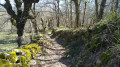 10.01 mi
+919 ft
-902 ft
5h 25
Moderate
Departure from Le Malzieu-Ville (Lozère)
10.01 mi
+919 ft
-902 ft
5h 25
Moderate
Departure from Le Malzieu-Ville (Lozère)
A walk alternating between forest sections and stretches across meadows. Best enjoyed on foot or by mountain bike, following the small, unspoilt paths.
The Porte des Fées at the start of the Malzieu
 4.68 mi
+525 ft
-522 ft
2h 35
Easy
Departure from Le Malzieu-Ville (Lozère)
4.68 mi
+525 ft
-522 ft
2h 35
Easy
Departure from Le Malzieu-Ville (Lozère)
A short walk leads to a majestic natural site and a perfect view of the Truyère Gorges. Be careful in rainy weather, however, as the area around the Porte des Fées can be slippery.
Circular route around Le Malzieu via Le Nozier
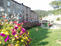 5.46 mi
+568 ft
-564 ft
3h 00
Easy
Departure from Le Malzieu-Ville (Lozère)
5.46 mi
+568 ft
-564 ft
3h 00
Easy
Departure from Le Malzieu-Ville (Lozère)
An easy nature walk at the foot of the Margeride.
Mauriono Circular Route
 4.74 mi
+492 ft
-492 ft
2h 35
Easy
Departure from Le Malzieu-Ville (Lozère)
4.74 mi
+492 ft
-492 ft
2h 35
Easy
Departure from Le Malzieu-Ville (Lozère)
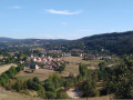
A walk through the fields on the hills above the village, offering lovely views of the Malzieu and the Truyère Valley.
Tour of the lake in Malzieu-Ville
 3.23 mi
+43 ft
-43 ft
1h 30
Easy
Departure from Le Malzieu-Ville (Lozère)
3.23 mi
+43 ft
-43 ft
1h 30
Easy
Departure from Le Malzieu-Ville (Lozère)
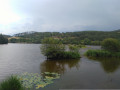
This is an easy family trail that allows you to discover the rich local flora and fauna. Only a stony section at the start and end of the lake may make this short hike difficult for those who are less mobile.
Las Combes
 AONB
AONB 2.56 mi
+479 ft
-459 ft
1h 35
Easy
Departure from Anterrieux (Cantal)
2.56 mi
+479 ft
-459 ft
1h 35
Easy
Departure from Anterrieux (Cantal)
A short route to explore the Gorges du Bès
From Valiette, this route descends past the dam before entering the gorges, offering superb views of the valley.
La Valette, starting from Prunières
 7.40 mi
+833 ft
-820 ft
4h 10
Moderate
Departure from Prunières (Lozère) (Lozère)
7.40 mi
+833 ft
-820 ft
4h 10
Moderate
Departure from Prunières (Lozère) (Lozère)
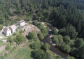
Head towards the hamlet of La Valette, situated 3 km from the village of Prunières in a peaceful spot on the banks of the Truyère. A castle once stood here, whose lords were vassals of the barony of Apcher – another village with a rich medieval history, where you can wander through the narrow streets and enjoy a magnificent panoramic view of the whole of the Margeride from the top of the castle keep.