Mauriono Circular Route

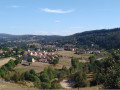
A walk through the fields on the hills above the village, offering lovely views of the Malzieu and the Truyère Valley.

Details

3945116
Creation:
Last update:
Last review:
  • Walking
    Activity: Walking
  • ↔
    Distance: 4.74 mi
  • ◔
    Average duration: 2h 35 
  • ▲
    Difficulty: Easy

  • ⚐
    Back to start: Yes
  • ↗
    Ascent: + 492 ft
  • ↘
    Descent: - 492 ft

  • ▲
    Highest point: 3,156 ft
  • ▼
    Lowest point: 2,812 ft

Photos

Description of the walk

Park at the fairground; free parking.

(S/E) With your back to the Salle des Fêtes, head left to reach Avenue de Saint-Chély.

(1) Turn right and walk round the town along the ramparts.

(2) Opposite the washhouse, take the footbridge over the Galastre. Turn right and follow the stream on your right until you reach the Estournels housing estate, then keep left to continue towards the hamlet of Fontoubette, where the road leads onto a grassy path which joins a wider track further on.

(3) Continue to your right, passing the two farm buildings. Stay on the main track, ignoring the two successive paths on the right, and join the D47.

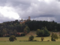
(4) Carefully follow the county road to the left for about 30 metres, then take the grassy path on the right which joins the road leading to the village of Verdezun. Walk through the village towards the mobile phone mast situated on the hilltop.

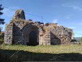
(5) Near the ruins of the old Romanesque church, take a small path on the right signposted ‘le Malzieu’ and ‘retour parking via ferrata’. Go through the gate and head down the grassy path on your left. When you reach the Maison du Cagnardou, carry on straight ahead until you reach the Route de Saint-Léger (D47).

(6) Turn right to reach the village of Le Malzieu.

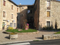
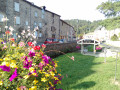
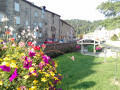
(7) Cross the bridge then turn right. At the corner by the Daudet butcher’s, take the cobbled path between the two houses. Walk past the state school and the church, following the low wall to reach Avenue de Saint-Chély, then follow it to the left.

(1) Turn right to return to the fairground and the starting car park (S/E).

Waypoints

  1. S/E : mi 0 - alt. 2,822 ft - Foirail
  2. 1 : mi 0.05 - alt. 2,825 ft - Junction of the circular loop
  3. 2 : mi 0.27 - alt. 2,828 ft - Footbridge
  4. 3 : mi 1.08 - alt. 3,022 ft - Wide track, on the right
  5. 4 : mi 2.86 - alt. 2,904 ft - D47 road
  6. 5 : mi 3.69 - alt. 3,054 ft - Fountain and ruins of the Romanesque church
  7. 6 : mi 4.12 - alt. 2,858 ft - D47 road
  8. 7 : mi 4.5 - alt. 2,825 ft - Dance Bridge
  9. S/E : mi 4.74 - alt. 2,822 ft - Foirail

Worth a visit

(5) Gate of the old Romanesque church.

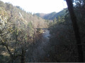
Lovely view of the Truyère Gorges with the climbing routes and the via ferrata below.

Reviews and comments

4.6 / 5
Based on 3 reviews

Reliability of the description
5 / 5
Ease of following the route
5 / 5
Route interest
3.7 / 5
User 670003

Overall rating : 4.7 / 5

Date of your route : Aug 31, 2026
Reliability of the description : ★★★★★ Very good
Ease of following the route : ★★★★★ Very good
Route interest : ★★★★☆ Good
Very busy route : Yes

A circular route. Good description of the route.

Machine-translated

sergio0342
sergio0342

Overall rating : 4.7 / 5

Date of your route : Jul 08, 2024
Reliability of the description : ★★★★★ Very good
Ease of following the route : ★★★★★ Very good
Route interest : ★★★★☆ Good
Very busy route : No

A lovely walk to enjoy with the family, even with young children; the only downside is that over 50 per cent of the route is on tarmac.

Machine-translated

viricel jacques
viricel jacques

Overall rating : 4.3 / 5

Date of your route : Jun 06, 2022
Reliability of the description : ★★★★★ Very good
Ease of following the route : ★★★★★ Very good
Route interest : ★★★☆☆ Average
Very busy route : No

A discovery walk around the local area; the main attraction is the panoramic view (from the mobile phone masts) of the Truyère Gorges. It would be worth mentioning this in point 4, along with a lovely spot for a picnic.

Machine-translated

Other walks in the area

For more walks, use our search engine .

The GPS track and description are the property of this route's author. Please do not copy them without permission.