Calvaire de Recoux and Roc del Burre, starting from Saint-Just

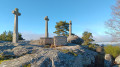
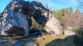
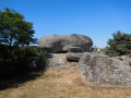
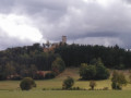
Setting off from the charming village of Saint-Just, numerous granite boulders are scattered here and there across the landscape. The most unusual is undoubtedly the Recoux Calvary, an imposing mass of granite topped by three majestic crosses, a testament to the skill of local stonemasons and to an era when men erected calvaries to the glory of God. On the way back, you cannot miss the Roc del Burre, better known as the Pierre Branlante. It’s up to you to find the right spot to make this 400-tonne boulder move with just one hand.

Details

67782584
Creation:
Last update:
Last review:
  • Walking
    Activity: Walking
  • ↔
    Distance: 6.73 mi
  • ◔
    Average duration: 4h 05 
  • ▲
    Difficulty: Moderate

  • ⚐
    Back to start: Yes
  • ↗
    Ascent: + 1,115 ft
  • ↘
    Descent: - 1,115 ft

  • ▲
    Highest point: 3,661 ft
  • ▼
    Lowest point: 2,986 ft

Photos

Description of the walk

The walk starts from the car park at the village entrance, near the municipal campsite

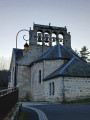
(S/E) With your back to the car park, start the walk on the right, along Rue des Pradelles. Turn left at the junction and, opposite the restaurant, take the street on the right towards the church. Walk round the church and continue left along Rue des Tailleurs de Pierre.

(1) Once past the last house, at the junction, take the track on the left which joins the small tarmac road (D448). Carry on straight ahead for about 350 m.

(2) Leave the road and take the track on your left. Cross the stream, which you will then follow amongst the large granite boulders scattered here and there across the landscape. You will reach the hamlet of La Fage.

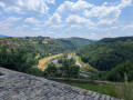
(3) At the entrance to the hamlet, take the first road on the right. Continue straight on between the houses, some of which are quite remarkable. The tarmac soon gives way to a wide, downhill track. Follow it to the junction with the D248: all along the way, you’ll be treated to unobstructed views of the Plomb du Cantal massif.

(4) Turn right and continue along this tarmac section to the next junction. From there, if you look carefully, you can make out the three crosses of the Recoux Calvary emerging from the forest. Follow the road to the right towards Saint-Just for a few dozen metres, then take the wide track on the left. As the Calvary is not signposted, you should follow this track until you reach the water tower situated by the roadside on your right.

(5) Just before this, take the path on your right which climbs through the pine forest. Once past an imposing pile of granite boulders, you’ll come across the remarkable Calvary and its orientation board. Turn back.

(5) Return to the track on the right until you reach the T-junction.

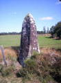
(6) Continue to the right until you reach the next crossroads. At the granite cross, follow the path on your left through the pastures. When you reach the peatland area of Sagne Nègre, leave the path on your left and continue straight on, ignoring the tracks on either side. Join the D348.

(7) Head left towards the hamlet of La Bessière. At the entrance to the hamlet, before the large farmhouse, take the first road on the right. 100 metres further on, between two buildings, take the grassy path on the right. Cross the small stream and then the gate blocking the way. The faintly visible path then crosses a pasture and runs alongside a small copse until it reaches the next gate, which you will pass through again to reach Nalhac and then the D348.

(8) Continue to the right, then at the junction by a granite cross, turn left towards La Roche. Walk through the hamlet to reach La Pierre Branlante or Roc del Burre: a picnic area is available.

(9) Turn back towards the granite cross and turn left onto the small, grassy path leading uphill. Ignore the tracks on either side and head for the village of Saint-Marc.

(10) Continue left along the small tarmac road to the next hamlet.

(11) At the entrance to Le Monteil, at the junction, turn left. Walk through the hamlet, then at the crossroads, take the road on the right, which leads onto a wide track further on. Continue to the next junction, where you should leave the track on the left and carry on straight ahead towards Saint-Just.

(1) At the end of the track, reach the village by following the road on the left. Turn right at the church and return to the car park (S/E).

Waypoints

  1. S/E : mi 0 - alt. 2,986 ft - Municipal campsite car park
  2. 1 : mi 0.25 - alt. 3,130 ft - Junction of the circular loop
  3. 2 : mi 0.48 - alt. 3,291 ft - Path on the left
  4. 3 : mi 1.43 - alt. 3,589 ft - La Fage
  5. 4 : mi 1.91 - alt. 3,609 ft - Junction with the D248
  6. 5 : mi 2.55 - alt. 3,642 ft - Water tower
  7. 6 : mi 2.84 - alt. 3,422 ft - T-junction
  8. 7 : mi 3.85 - alt. 3,422 ft - La Bessière
  9. 8 : mi 4.52 - alt. 3,310 ft - Junction with the D348
  10. 9 : mi 4.81 - alt. 3,310 ft - Roc del Burre
  11. 10 : mi 5.24 - alt. 3,409 ft - Saint-Marc
  12. 11 : mi 5.84 - alt. 3,399 ft - Le Monteil
  13. S/E : mi 6.73 - alt. 2,986 ft - Municipal campsite car park

Worth a visit

Saint-Just and its surroundings were once renowned for their stonemasons. Raw material abounds in this area, as evidenced by the large granite boulders scattered throughout the countryside.

(S/E) In the church square, you pass a superb Gothic cross, carved from Volvic stone (not granite), dating from the late 15th or early 16th century. On the eastern side, you can see the Crucifixion, whilst on the western side is the Coronation of the Virgin.

(5) The Recoux Calvary stands at an altitude of 1,075 metres. Erected to the glory of God, the cup-shaped hollows carved into it remain a mystery. The site is also renowned as a natural bouldering spot.

(8) The ‘wobbly rock’ at La Roche, also known as Roc del Burre, is a geological curiosity weighing over 400 tonnes. A few presses of the hand on the side of the rock are said to set it in motion. It’s up to you to find the key spot.
There are other boulders featuring cup marks at this site. Whether an illustration of geological history or simply a legend, one of these boulders is said to resemble a sacrificial table with a small hollow for the head.

Picnics are permitted on site.

Reviews and comments

4.6 / 5
Based on 3 reviews

Reliability of the description
4.7 / 5
Ease of following the route
4.7 / 5
Route interest
4.3 / 5
RandoCBZ
RandoCBZ

Overall rating : 4 / 5

Date of your route : Apr 06, 2026
Reliability of the description : ★★★★☆ Good
Ease of following the route : ★★★★☆ Good
Route interest : ★★★★☆ Good
Very busy route : Yes

A superb hike with magnificent views of the Cantal mountains.
The Cantal is truly magnificent

Machine-translated

Poronponpon
Poronponpon

Overall rating : 4.7 / 5

Date of your route : Sep 08, 2025
Reliability of the description : ★★★★★ Very good
Ease of following the route : ★★★★★ Very good
Route interest : ★★★★☆ Good
Very busy route : No

Easy route.
Don't miss the Calvaire de Recoux.
It's a magical and rejuvenating place.
Roc del Burre is the ideal spot for a picnic.
Beautiful hike
Pedro

Machine-translated

jocelyne48
jocelyne48

Overall rating : 5 / 5

Date of your route : Feb 17, 2025
Reliability of the description : ★★★★★ Very good
Ease of following the route : ★★★★★ Very good
Route interest : ★★★★★ Very good
Very busy route : No

A lovely route with beautiful scenery, where granite boulders are a prominent feature. No particular difficulties apart from the hill at the start.
The estimated time of 4 hours 5 minutes is very, very generous. We completed it in under 3 hours, whilst taking the time to enjoy the scenery.
Thank you for this lovely route

Machine-translated

Other walks in the area

For more walks, use our search engine .

The GPS track and description are the property of this route's author. Please do not copy them without permission.