Circular route around Le Malzieu via Le Nozier

An easy nature walk at the foot of the Margeride.

Details

4230689
Creation:
Last update:
Last review:
  • Walking
    Activity: Walking
  • ↔
    Distance: 5.46 mi
  • ◔
    Average duration: 3h 00 
  • ▲
    Difficulty: Easy

  • ⚐
    Back to start: Yes
  • ↗
    Ascent: + 568 ft
  • ↘
    Descent: - 564 ft

  • ▲
    Highest point: 3,235 ft
  • ▼
    Lowest point: 2,818 ft

Photos

Description of the walk

Starting point: Place du Poirail. Free parking.

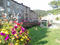
(S/E) With your back to the Salle des Fêtes, head left to reach Avenue de Saint-Chély. Opposite the Porte des Drogols, turn right and walk round the town along the ramparts.

(1) Opposite the wash house, take the footbridge over the Galastre. Turn right and follow the stream on your right-hand side as far as the Estournels housing estate, then keep left to continue towards the hamlet of Fontoubette, where the road leads onto a grassy path which joins a wider track further on.

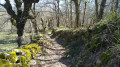
(2) Continue to the right, passing the two farm buildings. Turn right at the second track that leads into the woods.

(3) 100 m before reaching the D989, turn right onto a small path that joins the departmental road. Cross it with care. Walk down a few metres, then turn left towards the hamlet of Le Nozier.

(4) At the end of the village, turn right. Go round the back of the “Le Pré de l’Hiver” guesthouse to cross the small stone bridge over the Ravin de la Coste. Continue along a grassy path which leads into a meadow; simply cross this, keeping to the right of the barbed wire fence (make sure you close the gate properly behind you as there may be livestock). You will then rejoin the path leading to the hamlet of La Salcette after crossing the Galastre via the small wooden bridge.

(5) Join the road on your right heading towards Malzieu.

(6) After the Croix de Togne, turn left onto a track that climbs through the woods and leads to Le Villard. Cross the village and take the D48 on the right.

(7) At the last house, turn left onto a wide track which leads to Malzieu via the Chemin du Pigeonnier. Walk past the cemetery on your left, then continue right onto Avenue Jacques de Feligonde.

(8) Opposite the Tour de Bodon (home to the Tourist Office), turn left onto Rue du Barry, which takes you back to Place du Foirail (S/E)

Waypoints

  1. S/E : mi 0 - alt. 2,822 ft - Place du Foirail near the - Truyère (rivière)
  2. 1 : mi 0.25 - alt. 2,828 ft - Footbridge
  3. 2 : mi 1.06 - alt. 3,022 ft - Junction with wide track
  4. 3 : mi 2.28 - alt. 3,225 ft - Path on the right before the D989
  5. 4 : mi 2.59 - alt. 3,127 ft - The hamlet of Le Nozier
  6. 5 : mi 2.98 - alt. 3,025 ft - The hamlet of La Salcette
  7. 6 : mi 3.4 - alt. 2,995 ft - Fork in the woods
  8. 7 : mi 4.12 - alt. 3,084 ft - Wide track on the outskirts of Le Villard
  9. 8 : mi 5.36 - alt. 2,838 ft - Bodon Tower
  10. S/E : mi 5.46 - alt. 2,822 ft - Place du Foirail

Worth a visit

Reviews and comments

4.2 / 5
Based on 3 reviews

Reliability of the description
4.3 / 5
Ease of following the route
4 / 5
Route interest
4.3 / 5
gerardjacques.gerard@gmail.com

Overall rating : 4 / 5

Date of your route : Jun 24, 2024
Reliability of the description : ★★★★☆ Good
Ease of following the route : ★★★☆☆ Average
Route interest : ★★★★★ Very good
Very busy route : No

Poor signposting in the final third of the route.

Machine-translated

odnar81
odnar81

Overall rating : 3.7 / 5

Date of your route : Aug 01, 2022
Reliability of the description : ★★★★☆ Good
Ease of following the route : ★★★★☆ Good
Route interest : ★★★☆☆ Average
Very busy route : No

An open-air route with little shade. Best avoided in hot weather

Machine-translated

MymiCas67
MymiCas67

Overall rating : 5 / 5

Date of your route : Aug 26, 2021
Reliability of the description : ★★★★★ Very good
Ease of following the route : ★★★★★ Very good
Route interest : ★★★★★ Very good
Very busy route : No

A lovely walk around Malzieu

Machine-translated

Other walks in the area

For more walks, use our search engine .

The GPS track and description are the property of this route's author. Please do not copy them without permission.