Around Le Péchadu

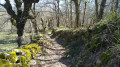
A walk alternating between forest sections and stretches across meadows. Best enjoyed on foot or by mountain bike, following the small, unspoilt paths.

Details

4305226
Creation:
Last update:
Last review:
  • Walking
    Activity: Walking
  • ↔
    Distance: 10.01 mi
  • ◔
    Average duration: 5h 25 
  • ▲
    Difficulty: Moderate

  • ⚐
    Back to start: Yes
  • ↗
    Ascent: + 919 ft
  • ↘
    Descent: - 902 ft

  • ▲
    Highest point: 3,445 ft
  • ▼
    Lowest point: 2,812 ft

Photos

Description of the walk

Start at Place du Foirail.

(S/E) Opposite the war memorial, turn right and take the footbridge over the Béal to reach the Chemin de la Sablière (locally known as the ‘chemin des jardins’), then the Route de Saint-Chély, which you’ll follow on the left.

(1) Cross the bridge over the Truyère, then take the Sentier des Espagnols on the right (GR®4), which is a fairly steep climb. Cross the road carefully and continue along the path furthest to the right, which leads up through the woods parallel to the D4.

(2) At the crossroads, follow the horse-riding signs to the left, then turn left again onto the road. Cross the D989 carefully and take the wide path opposite, near the orientation table.

(3) When you reach a wide junction, turn right twice. The path continues south-west through the pastures before entering the forest.

(4) Continue along the wide track on the left. At the junction marked by orienteering marker no. 73, turn right. The path through the woodland (yellowPR® signposting) leads safely back to the road.

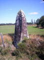
(5) Cross the road using the wooden footbridge. Head towards the granite cross at Bébulon and continue straight ahead along a new track, keeping to the right at the next junction.

(6) At the Chaumazelle junction, turn left. 20 m before the road, turn left again. Follow the narrow path lined with old low walls, which runs below the village and skirts the medieval site to the left.

(7) At the orienteering marker, continue to the right then to the left. A wider track on your right will take you to the road at elevation 1034.

(8) Cross carefully and take the path opposite, which leads to the hamlet of Aubuisson. Pass between the two houses and continue along the grassy path furthest to the left.

(9) Opposite the shed, turn left into the woods. Stay on the main track, ignoring the small paths on either side, then continue straight on along a wide track that climbs up to the entrance to the village of Prunières.

(10) Turn right towards the village. Walk through the village, keeping the Second World War memorial on your right, then the fountain and the Saint-Caprais lodge on your left. Once past the last house, continue along a wide track. Ignore the two successive paths on the right and, further on, take the path leading downhill to the left at elevation 981. Cross the Pisseratte stream.

(11) At the orienteering marker, a few metres before the road, turn right towards Molières. Walk past the hamlet on your left.

(12) Just before the quarry, take the path on the right that leads into the forest. At the next junction, turn left and carry on straight ahead, ignoring the paths on either side. Pass under the treetop adventure course and reach the road.

(13) Turn right onto the road. Walk past the holiday village on your left and carry on towards La Chazette.

(14) At the bend, turn left at the hornbeam hedge onto a small path leading to the municipal campsite, then follow the road past the football pitch and tennis courts to the fairground (S/E).

Waypoints

  1. S/E : mi 0 - alt. 2,822 ft - Place du Foirail
  2. 1 : mi 0.33 - alt. 2,812 ft - Notre-Dame Bridge - Truyère (rivière)
  3. 2 : mi 0.75 - alt. 3,114 ft - Croix Rozière
  4. 3 : mi 1.7 - alt. 3,251 ft - Crossroads – Elevation 990
  5. 4 : mi 2.31 - alt. 3,258 ft - Trail junction
  6. 5 : mi 3.02 - alt. 3,278 ft - Cross the road
  7. 6 : mi 3.78 - alt. 3,389 ft - Crossroads at Chaumazelle
  8. 7 : mi 4.18 - alt. 3,392 ft - Orienteering marker no. 77
  9. 8 : mi 4.8 - alt. 3,396 ft - Cross the road
  10. 9 : mi 5.3 - alt. 3,399 ft - Cabanon
  11. 10 : mi 6.75 - alt. 3,297 ft - Road junction
  12. 11 : mi 8.13 - alt. 3,117 ft - Orienteering marker
  13. 12 : mi 8.52 - alt. 3,074 ft - Quarry – Junction
  14. 13 : mi 9.17 - alt. 2,956 ft - Road junction
  15. 14 : mi 9.37 - alt. 2,887 ft - Turn left
  16. S/E : mi 10.01 - alt. 2,822 ft - Place du Foirail

Always be cautious and plan ahead when you're outdoors. Visorando and the author of this route cannot be held responsible for any accidents occurring on this route.

The GR® and PR® markings are the intellectual property of the Fédération Française de Randonnée Pédestre.

Reviews and comments

4.2 / 5
Based on 4 reviews

Reliability of the description
4.3 / 5
Ease of following the route
4.3 / 5
Route interest
4 / 5
Patrone G.
Patrone G.

Overall rating : 4 / 5

Date of your route : Aug 21, 2025
Reliability of the description : ★★★★☆ Good
Ease of following the route : ★★★★☆ Good
Route interest : ★★★★☆ Good
Very busy route : No

An interesting route with varied landscapes, the medieval site of Apcher is worth a detour, and the view of the surrounding area is worth lingering over.

Machine-translated

bab
bab

Indeed, this local footpath, which was previously impassable, was reopened this winter of 2023 and now provides direct access to the Bébulon cross, thus avoiding the traffic.
Thank you for your message

Machine-translated

Michelle34
Michelle34

Overall rating : 4 / 5

Date of your route : Aug 22, 2024
Reliability of the description : ★★★★☆ Good
Ease of following the route : ★★★★☆ Good
Route interest : ★★★★☆ Good
Very busy route : No

A lovely, shaded walk.
1/ A variation on the route: at 4.4 km, heading towards Les Faysses, you can leave the wide path on the left and follow the yellow markings on the right (dotted lines = a municipal boundary on the IGN map).
2/ Take the time to visit Apcher and wander around the medieval site at the foot of the tower. You can rejoin the route by taking a small, sloping path at the far end of the site.

Machine-translated

Arpette
Arpette

Overall rating : 4 / 5

Date of your route : Jul 30, 2022
Reliability of the description : ★★★★☆ Good
Ease of following the route : ★★★★☆ Good
Route interest : ★★★★☆ Good
Very busy route : No

A lovely walk, even though the route is easily confusing without a GPS

Machine-translated

bab
bab

Thank you for your comment, and I’m sorry to have misled you. I mapped out this route from memory directly using the IGN map, as it’s a route I do regularly. Some paths appear on the IGN map even though they have disappeared over time, whilst conversely, other tracks that are clearly visible on the ground are not shown on the map. At point 9, you did indeed need to turn left as detailed in the description; the path is perfectly passable. I made the mistake of relying on the route shown on the map. The correction has been made.

Machine-translated

VincentR34
VincentR34

Overall rating : 4.7 / 5

Date of your route : Mar 24, 2021
Reliability of the description : ★★★★★ Very good
Ease of following the route : ★★★★★ Very good
Route interest : ★★★★☆ Good
Very busy route : No

A lovely walk in the Margeride mountains, completed in March 2021.
- Stunning views at Apcher (a restored village).
- After the hamlet of Aubuisson, the path is blocked and impassable, forcing you to walk along the edge of a private plot of land as far as point 9. We think it’s better to turn left at point 8 (before Aubuisson) to reach point 10 at the entrance to Prunieres.

Machine-translated

Other walks in the area

For more walks, use our search engine .

The GPS track and description are the property of this route's author. Please do not copy them without permission.