Country:

 City:


Set off from the tourist information office located in the Tour de Bodon next to the town hall.
(S) From the tourist office, turn right onto Avenue de Saint-Chély. Walk past the town hall on your right – housed in the former monastery of the White Penitents – then past the hospice chapel. Continue along this avenue until you reach the edge of the village and the Notre-Dame bridge, which you will cross.
(1) Immediately after the bridge, take the Sentier des Espagnols on the right (GR®4), which is a fairly steep climb.
Cross the D4 with care and take the path furthest to the right, which leads up through the woods parallel to the road.
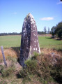
(2) At the Croix Rosière crossroads (the granite cross, which is not very visible, is set back slightly on the right), turn left and head towards the village of Ortizet.
(3) Then follow the road to the left until you reach the junction. Cross the D989 with care and take the wide track opposite. Pass the car park on your left – stopping briefly at the orientation table – and continue along the wide, uphill path on your right, which runs alongside the coniferous forest. This will take you to a junction of tracks.
(4) Turn right, then left at the Y-junction, and head towards the hamlet of Molières, ignoring the track that climbs up to the left. At the first house, turn right downhill towards the road. Turn right again.
(5) After a few metres, veer left (equestrian signposting). Follow the path lined with low walls to the junction, then continue to the left. Cross the Ruisseau de Pisseratte and carry on to the next crossroads (elevation 981).
(6) Turn right uphill onto a wide track. Ignore the successive paths on the left and head for the village of Prunières. Walk through the village along the main street. Once you reach the square, walk past theSecond World War memorial on your left, and continue straight ahead along the road for about 500 m.
(7) Before the shed by the roadside, take the track on the right, then turn left at the junction. The narrow path crosses the pastures. Follow it, ignoring the two successive tracks on the left.
(8) At the junction marked by wooden boundary marker No. 77, turn left twice uphill, then right to reach the medieval site of Apcher.
(9) Take some time to explore the magnificent medieval site and its 13th-century keep, then continue on your way by turning left between the houses, then right and left again. At the cross, carry on to the right, then pass the house on your right and take the grassy path marked by a wooden fence. At the end of this path, head straight ahead to reach the crossroads.
(10) Turn right (speed bump). Walk alongside the memorial garden on your left, then turn left immediately onto a small path that climbs towards the Truc de la Chapelle and leads onto a wide track; follow this to the right, before turning left at the next crossroads. Stay on this main track until you reach the road.
(11) Turn left for a few metres before taking a path on the right towards a large farm building.
(12) At the next junction, keep right as you head uphill. Cross the little Ruisseau de Chandaison stream, then, as you approach the A75, go through the tunnel underneath it, and continue uphill to the cemeteries, keeping to their left.
(13) Head back down via the Chemin du Réadet to the old cemeteries of the town of Saint-Chély d’Apcher. Follow the road that runs between the two sites and head up Avenue du Cimetière on the right.
(14) Before reaching the junction, turn left onto the grassy path known as the Chemin du Souvenir. Join Rue Beauséjour and continue to the right towards the keep.
(15) Leave Place du Foirail on your right and head back down Rue du Clocher to a crossroads in the town centre. Carry on straight ahead for a few metres, then take the narrow lane on the right, at the corner of an old building. At the next junction, keep left.
Pass the Evangelical Church hall on your left, then take the stairs leading to the Espace du Péchaud. Walk alongside this green space towards the municipal swimming pool and then its car park, until you reach a large junction which you’ll cross towards the Gédimat shop.
(16) To the left of this shop, the road passes under a bridge (traffic lights). Cross over and take the steps on the right, which climb quite steeply towards the Montmartre neighbourhood. Continue straight on between the houses, follow the Chemin de la Colline and, at the end of the track, carry on to the right between the pastures.
(17) At the next junction, keep to the right (GRP®) then turn right again opposite the picnic area. The track winds pleasantly through woodland until it reaches the road. Then turn left, following theGRP® signposts. At the end of the road, take the track on the left to reach the Moulin de la Griffette.
(18) Walk along the right-hand side of the D989 for about 300 m, taking care, until you reach the granite cross. Continue along the path to the hamlet of Aloziers. At the village square, turn right (GRP®) and leave the hamlet.
(19) At the end of the descent, leave the road and take a track that runs alongside a wooded area on the left (GRP® signposted). This track soon gives way to a narrow path that crosses pastures. Follow it, keeping the barbed wire on your left.
(20) At the end of the track, keep to the right, go through the gate by the small stream and head back up towards the hamlet of La Croze. Walk along the right-hand side of the old restored buildings, then turn left at the cross. Stay on this road until you reach the village of Termes, the end of thissecond stage (E).
 Visorando Member
 Moderate
 Easy