Montchauvet – Notre-Dame de Beaulieu circular loop

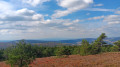
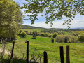
The Margeride is a little-known mountain range home to remarkable landscapes of moorland, meadows and high-altitude forests. Along this route, you’ll first discover the Brassalières mountain pastures, the starting point of this walk, then the panoramic view from the summit of Montchauvet and finally Notre-Dame de Beaulieu, an iconic site situated in the Tombatou Stream valley.

Details

n°109296656
Creation:
Last update:
Last review:
–
  • Walking
    Activity: Walking
  • ↔
    Distance: 6.01 mi
  • ◔
    Average duration: 3h 55 
  • ▲
    Difficulty: Moderate

  • ⚐
    Back to start: Yes
  • ↗
    Ascent: + 1,325 ft
  • ↘
    Descent: - 1,339 ft

  • ▲
    Highest point: 5,043 ft
  • ▼
    Lowest point: 4,154 ft

Photos

Description of the walk

To start this walk, head for the Brassalières estate, situated 10 km from Malzieu-Ville, via the D48. Pass the farm of the same name and, 800 m further on, you’ll reach a crossroads to the left of the road. There are several parking options.

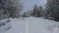
(S/E) Take the path furthest to the right, running parallel to the D48 through the heart of the forest. After 1.5 km, ignore the track leading downhill on the left and continue a little further up a steep incline until you reach the departmental road.

(1) Walk along this road on the left, following the forest track. Carry on to the second junction.

(2) Turn left onto the wide track which leads, climbing steadily, to another junction.

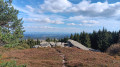
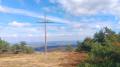
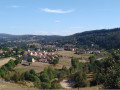
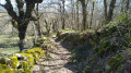
(3) Turn left and walk for about 500 m. Then leave the track and head uphill to the right. The climb is short but steep for the first few tens of metres. The “Sommet du Montchauvet” signpost will guide you across the moorland to the summit cross at an altitude of 1,485 metres. Along the way, you’ll enjoy lovely views of the Monts du Forez, the Margeride and the Cantal.

(4) Continue downhill through the woods to a crossroads.

(5) Follow the path furthest to the left to join the GRP® Tour de la Margeride: marked with yellow and red signs.

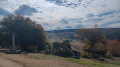
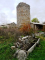
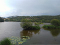
(6) Take the wide track on the left, heading towards the ruins of the Church of Notre-Dame de Beaulieu. It’s a lovely spot to stop for a break or perhaps have a picnic.

(7) Then begin the steady climb.

(8) Cross the stream and continue to the starting point (S/E).

Waypoints

  1. S/E : mi 0 - alt. 4,623 ft - Crossroads
  2. 1 : mi 1.06 - alt. 4,688 ft - County road
  3. 2 : mi 1.43 - alt. 4,688 ft - Path on the left-hand side
  4. 3 : mi 2.04 - alt. 4,613 ft - Junction
  5. 4 : mi 2.83 - alt. 5,043 ft - Summit cross at - Montchauvet (1485 m)
  6. 5 : mi 4.02 - alt. 4,403 ft - Crossroads
  7. 6 : mi 4.69 - alt. 4,436 ft - GRP® junction
  8. 7 : mi 4.92 - alt. 4,180 ft - Notre-Dame de Beaulieu (Paulhac-en-Margeride)
  9. 8 : mi 5.25 - alt. 4,308 ft - Tombatou (ruisseau) - Affluent de la Desges
  10. S/E : mi 6.01 - alt. 4,636 ft - Crossroads

Notes

The route is largely shaded, making it very pleasant in hot weather.

Water point at Notre-Dame de Beaulieu (7) then along the Tombatou Stream.

Worth a visit

Panoramic view from the summit of Montchauvet (4).

Ruins of Notre-Dame de Beaulieu (7).

Other walks in the area

For more walks, use our search engine .

The GPS track and description are the property of this route's author. Please do not copy them without permission.