Country:

 City:


Set off from the car park of the village hall, situated next to the Hôtel Le Verdy at the entrance to the village of Termes.
(S) With your back to the village hall, follow the road to the left towards the village centre. At the first junction (granite cross), turn left and join the D989, 400 m further down.
(1) Cross the road carefully and take the path opposite which runs past the Pont du Renard on the right, then climbs through woods and pastures to the hamlet of Fromagère.
(2) Walk past the houses on the left until you reach the cross, then keep to the left. The road then climbs towards Aussets.
(3) As you approach the imposing building, turn right at the junction onto a track, then leave this after a few metres to take a narrow path lined with low walls. Continue on, ignoring the paths on either side, until you reach the village of Fournels.
(4) At the entrance to the village, turn left onto the main road and head towards the central square, keeping to the right-hand side of it. At the junction, continue to the right, leaving the church below you, and head for the roundabout at the end of the street.
(5) Carefully follow the departmental road to the left. Walk past the campsite on your left, then the hotel complex, and continue to the edge of the village. At the next junction, carry on straight ahead towards Saint-Juéry for about 600 metres.
(6) Then leave this busy road and turn off towards Le Mazel. Once past the first houses, keep to the left until you reach the cross and the fountain. Carry on straight ahead along theGRP®-marked path until you reach the road.
(7) Take this road on the right until you reach the small roadside chapel at the entrance to the village of Saint-Juéry. Turn right onto the small downhill road leading to the centre of the village, giving you the chance to stop and admire the village’s architectural heritage. Continue to the left, following the small stream known as ‘le Rouanel’, then, once past the car park, take the road opposite heading towards Le Chambon. After a few metres, before the shed, turn left onto a path – which is barely visible at first – that winds through pastures overlooking the river.
(8) Once past the old granite cross on your left in the meadow, keep right at the junction and join the road, following it to the left. Pass the houses of Boutans Haut and continue on to Volpilières.
(9) At the next crossroads, carry on straight ahead. The quiet road leads to the hamlet of Chauchaillette; cross through it to reach the D12.
(10) Cross over and take the track straight ahead, which climbs steeply up through the pastures. Pass the water tower and join the road, following it to the right whilst leaving the quarry on your left.
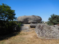
(11) Follow this road to the next junction, then turn left and head for the hamlet of Le Cheylaret. As you pass, look out for the rock of the same name on your right. It is from the top of this vast basalt mound that the view over the Bès and the Aubrac plateau is at its most beautiful.
(12) Once past the farm buildings on either side, you’ll reach the village square. An information board on the right, just past the cross, provides details about the local architectural heritage and the daily lives of the inhabitants in days gone by. You can also take this opportunity to fill your water bottles at the fountain before continuing along the road towards La Valentine.
(13) At the bend, leave the road and take the path on the left-hand side (markedPR® yellow). This will take you back to the road a little further on. Then continue to the left. The road, which has very little traffic, leads to the hamlet of Le Fau. At the cross, leave thePR® trail and carry on straight ahead. Continue in this direction, ignoring the road below on the right, and head towards Brion.
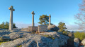
(14) At the junction, on the outskirts of the village, walk up a few metres to the left to take the small grassy path on the right. This leads round the back of the church and into the village centre. As you pass, take a look at the wayside cross on its rocky outcrop to the right at the top of the path. A horizontal heart is engraved on it, indicating to pilgrims the route to take to reach Conques.
(15) From the square, follow the road to the right between the two lodges, then keep to the left. At the cross, take the path that runs alongside the house at a place called Les Bouteillers. The old path descends through the pastures towards La Blachère.
(16) At the crossroads, cut across the track and continue straight ahead. Cross the Ruisseau des Gafettes and carry on to the end of the path.
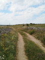
(17) Then step over the fence of the meadow on the left and walk alongside it, following the drovers' road on your right, which is overgrown with brambles. At the end of this field, step over the fence again and cross the other field, also following the barbed-wire fence on your right. At the far end, you’ll come to a wide track leading to the village of Grandvals, the finish point of thisthird stage (E).
 AONB
 Easy
 Visorando Member
 Moderate