


Refine your search for walks in Bretenière
Bretenière walks


 The Burgundy Canal at Bretenière
 Visorando Member
 4.67 mi
 +26 ft
 -26 ft
 2h 10
 Easy
 Departure from Bretenière (Côte-d'Or)
A bridge linking the north and the south: the 242-km-long Burgundy Canal connects Migennes on the Yonne to Saint-Jean-de-Losne on the Saône. The idea of crossing the Burgundian hills by water dates back to 1490, but work was not commissioned until 1774 by Louis XVI. It was not until 1833 that the canal was fully opened to navigation. It has 189 locks.
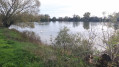
The banks of the Oscara from Fauverney
 6.87 mi
+26 ft
-26 ft
3h 10
 Moderate
Departure from Fauverney (Côte-d'Or)
This walk takes place partly along the Ouche river (Oscara in Latin). It has its source in Lusigny-sur-Ouche. This commune is the guardian of the sources of the Ouche. The village is particularly charming with its stone houses.
From one Saulon to another
 5.85 mi
+151 ft
-148 ft
2h 50
Easy
Departure from Saulon-la-Rue (Côte-d'Or)
Winter hike with limited risk of mud and hunting, but to be avoided in case of flooding due to the Sans Fond river.
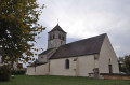
This hike will allow you to see the castle of Saulon-la-Rue, the church of Saulon-la-Chapelle with its two turrets, and to walk along part of the river "La Sans Fond" with the mill of Saulon-la-Chapelle.
Due to private property issues, a change to the route is currently being considered.
Circular along the banks of the Ouche starting from Neuilly-lès-Dijon
 6.81 mi
+33 ft
-43 ft
3h 10
Easy
Departure from Neuilly-lès-Dijon (Côte-d'Or)
The Ouche has been redeveloped, making it a great place for a walk in spring or autumn. You can collect walnuts in season. A very pleasant bucolic setting where you can watch the birds. Picnics are possible by the pond.Note:La Gaule de Neuilly is organising its Enduro Carpes from 23 to 25 May (2025) at theNeuilly-Crimoloispond.
Longecourt Castle and Burgundy Canal
 5.83 mi
+30 ft
-30 ft
2h 40
Easy
Departure from Longecourt-en-Plaine (Côte-d'Or)
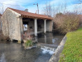
A circular route through the Domaniale d'Izeure forest and along the Burgundy Canal with three locks, which may be in operation when you visit. In Longecourt, you can see the castle, the wash house and the church.
Between Thorey-en-Plaine and Longecourt-en-Plaine
4.30 mi
+30 ft
-30 ft
2h 00
Easy
Departure from Longecourt-en-Plaine (Côte-d'Or)
A short family walk between woods and the Burgundy Canal.
Walk along the banks of the Ouche from Longvic
 7.19 mi
+39 ft
-36 ft
3h 20
Moderate
Departure from Longvic (Côte-d'Or)
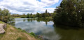
Étang Royal, a little corner of paradise.
Walkers, joggers and other nature lovers appreciate this site for its calm, beauty and balance.
An easy walk to enjoy the green charm of the ponds and banks of the Ouche.
Marais Trail in Magny-sur-Tille
3.07 mi
+13 ft
-13 ft
1h 25
Easy
Departure from Magny-sur-Tille (Côte-d'Or)
An easy, well-signposted family walk around the ponds of Magny-sur-Tille
From Domois to Cîteaux Abbey
 12.14 mi
+33 ft
-131 ft
5h 35
Moderate
Departure from Perrigny-lès-Dijon (Côte-d'Or)
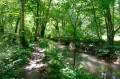
This very pleasant walk will take you to Cîteaux Abbey, following the Cent Fonts river, which will serve as your guide. There are a few picnic areas along this lovely walk.
The national forest and the banks of the Cent Fonts in Izeure
 11.58 mi
+46 ft
-46 ft
5h 20
Moderate
Departure from Izeure (Côte-d'Or)
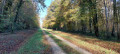
As a resident of Izeure, I had to suggest a hike starting from my town, and now I have. This beautiful walk can be done with the family, is not difficult and has many picnic spots along the Cent Fonts (and not without bottom).
Moderator's warning on 07/04/2021: Caution! Private property issue in (12). See reviews.
The plain, the Norges and the Longeault-Pluvault pond from Genlis
6.51 mi
+26 ft
-26 ft
3h 00
Easy
Departure from Genlis (Côte-d'Or)
An easy walk along the banks of the River Norges, crossing the plain south of Genlis and passing by the Longeault-Pluvault pond. The route has little shade and is mostly on stony paths.
Circular route through the plains on the outskirts of Dijon
11.73 mi
+79 ft
-79 ft
5h 30
Moderate
Departure from Quetigny (Côte-d'Or)
A circular route with no technical difficulty starting from Quétigny, taking you to the outskirts of the residential areas of Saint-Apollinaire, Varois and Chaignot, Couternon, and Chevigny-Saint-Sauveur. A very pleasant route in fine weather when the path runs alongside the Vieille Tille and then the Norges between Couternon and Chevigny.
Circular walk along the Sans Fond starting from Corcelles-lès-Cîteaux
 5.84 mi
+115 ft
-125 ft
2h 45
Easy
Departure from Corcelles-lès-Cîteaux (Côte-d'Or)
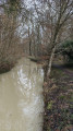
A short circular loop around the River Sans Fond, which winds through fields and the Izeure State Forest. The Sansfondis 16.3 km long, rising at Perrigny-les-Dijon at an altitude of 230 m and flowing into the Vouge at the Abbey of Cîteaux within the municipality of Saint-Nicolas-lès-Cîteaux at an altitude of 193 m.
A variation on the Corcelles-lès-Cîteaux circular route running alongside the Sansfond
 5.83 mi
+72 ft
-72 ft
2h 45
Easy
Departure from Corcelles-lès-Cîteaux (Côte-d'Or)
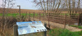
A circular walk around the River Sansfond, this walk takes place in the Izeure National Forest and across fields; it is not technically demanding and the terrain is fairly flat. This alternative route follows the Sansfond for longer towards Noiron-sous-Gevrey, now that a footbridge allows you to cross the river safely to reach Corcelles-lès-Cîteaux. Alovely walk, ideal for everyone.
Boucle de Tart-le-haut - Tart l'Abbaye et Tart-le-bas
6.64 mi
+135 ft
-135 ft
3h 10
Moderate
Departure from Tart-le-Haut (Côte-d'Or)
Randonnée au départ de Tart le haut en passant par plaines et bois afin de rejoindre les communes avoisinantes.
Around Saint-Apollinaire
5.46 mi
+151 ft
-151 ft
2h 40
Easy
Departure from Saint-Apollinaire (Côte-d'Or) (Côte-d'Or)
I suggest you take a tour of Saint-Apollinaire along the dirt tracks, passing by the Fort de la Redoute, the town’s various housing estates and the Bois Guillaume business park.
Les Six Filles
 4.86 mi
+79 ft
-79 ft
2h 20
Easy
Departure from Cessey-sur-Tille (Côte-d'Or)
A short, easy walk offering the chance to see a remarkable tree, ‘Les Six Filles’, and to pay tribute to the Maquis des Lochères.
Chenôve vineyard
 2.85 mi
+194 ft
-194 ft
1h 30
Easy
Departure from Chenôve (Côte-d'Or)
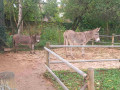
A short walk well suited to families with children, through the vineyards, then through woodland, and ending in a park with a children’s play area and animals.
In search of the Owl of Dijon
5.11 mi
+52 ft
-59 ft
2h 25
Easy
Departure from Dijon (Côte-d'Or)
Some towns have a ‘symbolic’ animal: the lion in Belfort, an imposing statue; the frog in Salamanca, much harder to find… In Dijon, it’s an owl, which I suggest you try to find on this city centre walk. Here’s a clue: the bird is carved onto an ancient monument. The legend goes: place your left hand on the owl and your right hand on your heart, make a wish, and it will come true. But first, you’ve got to find the animal…
In the heart of the Dijon vineyards
 Association / Club / Walk leader
 11.94 mi
+1,263 ft
-1,263 ft
6h 35
 Difficult
Departure from Chenôve (Côte-d'Or)
This day-long hike allows you to discover the vineyards that will eventually make up the Dijon appellation. You will regularly enjoy beautiful views of the plain or Dijon, but also more mysterious passages in the undergrowth and at the bottom of the valley. It is a varied route rich in heritage, on terrain that can be very different at times.
Around Couternon
 5.84 mi
+39 ft
-39 ft
2h 45
Easy
Departure from Couternon (Côte-d'Or)
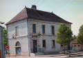
A leisurely walk around Courternon. This route will take you round the village and allow you to discover it in a different light.
The route is in open countryside with little shade. Make sure you bring suitable gear if the sun is strong.
In search of greenery in Dijon
 4.53 mi
+262 ft
-240 ft
2h 20
Easy
Departure from Dijon (Côte-d'Or)
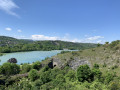
I suggest a short walk that will take you through some of Dijon's parks, passing by a beautiful viewpoint overlooking Lac Kir.
Dijon, from the Valois to Art Nouveau
 4.92 mi
+30 ft
-20 ft
2h 15
Easy
Departure from Dijon (Côte-d'Or)
Dijon is a remarkable city, shaped by its history. Since its Gallo-Roman origins (3rd century), three major periods have shaped this city: the Middle Ages, with its churches; then the Valois, Grand Dukes of Burgundy; and the Renaissance, reflected in the splendour of the parliamentarians’ mansions; and Art Nouveau, with its inventive decorations. The aim of this discovery walk is to take you through these different periods.
Batier circular route
 10.27 mi
+948 ft
-961 ft
5h 35
Moderate
Departure from Dijon (Côte-d'Or)
A short section of the Parcours Batier, allowing you to return to the starting point. This route, created in 1965 by Félix Batier, president of the CAF, is a challenging cycle route running from Dijon to Nuits-Saint-Georges; it is 52 km long and has an elevation gain of 1,998 m, said to be equivalent to that of Mont Blanc.
Around the Combe à la Serpent, off the beaten track
5.43 mi
+682 ft
-656 ft
3h 05
Easy
Departure from Dijon (Côte-d'Or)
A short route offering unique views of the Combe à la Serpent, following little-used paths. Minimal elevation gain. Don’t always follow the markings (red and yellow); the route sometimes follows them and sometimes veers off.
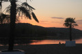
Lac Chanoine Kir loop - French alpine club (CAF) route and variants
 7.18 mi
+840 ft
-853 ft
4h 00
Moderate
Departure from Talant (Côte-d'Or)
Lac Chanoine Kir loop through the heights of Talant, Plombières-lès-Dijon and Fontaine d'Ouche.A route between town and nature, with beautiful views over the lake.