


Refine your search for walks in Bourg-Lastic
Bourg-Lastic walks
 The ‘Electric Dordogne’ in Saint-Sauves-d’Auvergne
 Visorando Member
 9.08 mi
 +1,204 ft
 -1,224 ft
 5h 15
5h 15
 Moderate
 Departure from Saint-Sauves-d'Auvergne (Puy-de-Dôme)
A circular route starting from Saint-Sauves-d’Auvergne, with two round trips added to the route: the first along the fast-flowing Dordogne, just past the first dam on its course, just downstream from La Bourboule; the second to climb to the summit of the Petit Puy de Châteauneuf, for a beautiful viewpoint. A Sully lime tree and a 12th-century carved archway in the village of Saint-Sauves round off this outing.
The Trois Tourtes du Sioulet from Herment
6.24 mi
+604 ft
-597 ft
3h 25
Moderate
Departure from Herment (Puy-de-Dôme)
A pleasant walk north of Herment, exploring the Sioulet Valley and the druidic site of Les Trois Tourtes. The varied route through a hedgerow-lined countryside combines meadows and woodland sections, making for a very natural and peaceful route.
Confolent-Port-Dieu – La Bournerie
11.17 mi
+2,182 ft
-2,549 ft
7h 00
 Difficult
Departure from Confolent-Port-Dieu (Corrèze)
Difficult
Departure from Confolent-Port-Dieu (Corrèze)
The route starts in the village of Confolent-Port-Dieu, where the River Dordogne enters the Corrèze.A lovely start to the walk: you’ll follow the reservoir of the Bort-les-Orgues dam along a route that’s already full of stunning views.
The Dordogne lake at Prieuré Port-Dieu
0.57 mi
+121 ft
-112 ft
0h 20
 Easy
Departure from Confolent-Port-Dieu (Corrèze)
Easy
Departure from Confolent-Port-Dieu (Corrèze)
A short walk to discover a beautiful site upstream from the Bort-les-Orgues dam.
Banne d'Ordanche and Borne des Quatre Seigneurs from Pré Cohadon
8.59 mi
+1,952 ft
-1,923 ft
5h 40
Moderate
Departure from Murat-le-Quaire (Puy-de-Dôme)
Starting from the Murat-le-Quaire leisure area, the route climbs directly to the Banne d'Ordanche, then passes by the Borne des Quatre Seigneurs before returning through the forest. Superb views.
Visit Murat-le-Quaire
0.85 mi
+102 ft
-102 ft
0h 30
Easy
Departure from Murat-le-Quaire (Puy-de-Dôme)
A walk to discover this village in the Dordogne valley, located in the hills above La Bourboule.
Circular route between La Bourboule and Saint-Sauves-d’Auvergne
 Association / Club / Walk leader10.36 mi
+1,398 ft
-1,378 ft
6h 00
Moderate
Departure from La Bourboule (Puy-de-Dôme)
Association / Club / Walk leader10.36 mi
+1,398 ft
-1,378 ft
6h 00
Moderate
Departure from La Bourboule (Puy-de-Dôme)
Starting from the tourist office in La Bourboule – a charming town with superb spa architecture, including the Grands Thermes with its oriental-style domes – this circular walk will take you through the landscapes of the upper Dordogne valley, passing through Saint-Sauves-d’Auvergne, a village designated a ‘Classée Commune Touristique’ in 2016.
La Banne d'Ordanche from La Bourboule
9.01 mi
+2,411 ft
-2,395 ft
6h 15
Difficult
Departure from La Bourboule (Puy-de-Dôme)
Rising to an altitude of 1,515 metres above the village of Murat-le-Quaire, the Banne d’Ordanche is a volcanic peak offering a 360° view that is truly breathtaking. This hike begins with an ascent, starting with gentle zigzags before finishing with steps leading to the summit of the Banne.
The thermal Dordogne at La Bourboule
3.62 mi
+528 ft
-541 ft
2h 05
Easy
Departure from La Bourboule (Puy-de-Dôme)
A circular walk to discover the small spa town, taking in a number of viewpoints on either side of the Dordogne River.
Vendeix, the stream, the rock and the hamlets
6.36 mi
+1,742 ft
-1,759 ft
4h 25
Moderate
Departure from La Bourboule (Puy-de-Dôme)
A circular route on the south side of La Bourboule, following the Vendeix, a tributary of the Dordogne which you follow during the first part of the hike, which is also the name of a small basalt spur, the Roche de Vendeix, and two hamlets. After passing by the Rocher de l'Aigle, which offers a breathtaking view of La Bourboule, the hike ends with a visit to some of the must-see sights of this small spa town.
La Banne d'Ordanche from Le Pessy or Le Pré Cohadon
 6.82 mi
+1,883 ft
-1,883 ft
4h 45
Moderate
Departure from Murat-le-Quaire (Puy-de-Dôme)
6.82 mi
+1,883 ft
-1,883 ft
4h 45
Moderate
Departure from Murat-le-Quaire (Puy-de-Dôme)
A pleasant circular walk, starting from the hamlet of Le Pessy (Murat-le-Quaire, above the spa town of La Bourboule). The route passes through magnificent beech forests before reaching the summer pastures and high-altitude meadows of the Banne d’Ordanche. This volcanic peak, rising to 1,512 m, offers exceptional views: from the Cantal mountains to the Corrèze plateaus, all the way to the Dôme mountains.
La Bourboule - Le Mont Dore route
 25.64 mi
+7,228 ft
-6,680 ft
3 days
Moderate
Departure from La Bourboule (Puy-de-Dôme)
25.64 mi
+7,228 ft
-6,680 ft
3 days
Moderate
Departure from La Bourboule (Puy-de-Dôme)
A three-day hike starting from La Bourboule, taking you to several peaks in Auvergne (Capucin, Puy de Cliergue, Puy de la Tour Carrée, Le Sancy), the Chaudefour Valley, the Grande Cascade waterfall, etc., ending in the town of Le Mont Dore.
La Bourboule - Mont Dore Resort
9.63 mi
+3,022 ft
-1,614 ft
7h 05
Difficult
Departure from La Bourboule (Puy-de-Dôme)
We will set off from the Étoile du Sancy in La Bourboule and head to the ECIR Chalet in the resort of Mont Dore, passing through Capucin, Puys de Cliergue, La Tour Carrée and Val de Courre.
Pregnoux Circular in La Bourboule
 3.51 mi
+440 ft
-449 ft
2h 00
Easy
Departure from La Bourboule (Puy-de-Dôme)
3.51 mi
+440 ft
-449 ft
2h 00
Easy
Departure from La Bourboule (Puy-de-Dôme)
This route takes you along the River Dordogne before heading up to the rural village of Le Pregnoux, situated on the hills above the spa town, then back to La Bourboule via Parc Fenestre, alongside the River Vendeix.
Le Puy Gros from La Bourboule
8.71 mi
+2,339 ft
-2,333 ft
6h 05
Difficult
Departure from La Bourboule (Puy-de-Dôme)
A hike that begins with a lovely climb through lush semi-alpine vegetation, rich in colour and country scents. Le Puy Gros, the remnant of an ancient volcanic dome, offers a unique panorama over the Upper Dordogne valley and the spa towns of Mont-Dore and La Bourboule.
 Saint-Sauves-d’Auvergne from La Bourboule
11.28 mi
+1,555 ft
-1,581 ft
2 hrs
Moderate
Departure from La Bourboule (Puy-de-Dôme)
A route that follows the Dordogne river to Saint-Sauves-d’Auvergne along a wooded path, then a gentle climb up to the ridges with beautiful, sweeping views, before reaching Lac du Pré Cohadon. The walk then takes you through the village of Murat-le-Quaire before returning to La Bourboule, which, when viewed from above, reveals its superb architecture, including the Grands Thermes with their oriental-style domes and the stately mansions.
La Banne d'Ordanche and Puy Loup via the Borne des Quatres Seigneurs
 3.68 mi
+778 ft
-768 ft
2h 20
Easy
Departure from Murat-le-Quaire (Puy-de-Dôme)
3.68 mi
+778 ft
-768 ft
2h 20
Easy
Departure from Murat-le-Quaire (Puy-de-Dôme)
An unmissable viewpoint over the surrounding mountains, the Banne d'Ordanche, with its orientation table, allows you to locate yourself in relation to the Monts Dore and the surrounding massifs. Don't forget to take a detour through the summer pastures to the Borne des Quatre Seigneurs and then on to Puy Loup with its renovated circular shelter.
Circular Banne d'Ordanche from the Refuge de la Banne
 2.89 mi
+584 ft
-610 ft
1h 50
Easy
Departure from Murat-le-Quaire (Puy-de-Dôme)
2.89 mi
+584 ft
-610 ft
1h 50
Easy
Departure from Murat-le-Quaire (Puy-de-Dôme)
A pleasant and accessible circular route starting from the Refuge de la Banne, allowing you to reach the 1,512 m altitude of the Banne d'Ordanche. The summit offers a remarkable panorama, from the Cantal massif to the plateaus of Corrèze and the Dômes mountains.The return journey is via the western slope, passing by one of the sites of the Horizons summer art exhibition.
It is possible to do only the round trip from the refuge to the summit (see variations).
Discover the thermal springs of the Dordogne
3.47 mi
+709 ft
-709 ft
2h 15
Easy
Departure from La Bourboule (Puy-de-Dôme)
Starting from La Bourboule, this hike follows the spring trail along the banks of the Dordogne. Halfway through, you can either retrace your steps or go via Rigolet Bas as described below.
This hike allows you to discover thermal springs such as the Félix Spring and the Croizat Spring.
Stream, waterfall and mountain pastures of La Graille
2.27 mi
+492 ft
-482 ft
1h 30
Easy
Departure from Perpezat (Puy-de-Dôme)
Short hike in the Ruisseau de la Graille valley, with a passage over the top of a waterfall, then a return via the mountain pastures, home to cows.
Gour des Chevaux Waterfall
0.18 mi
+46 ft
-46 ft
0h 05
Easy
Departure from La Tour-d'Auvergne (Puy-de-Dôme)
Very pretty waterfall on the Burande stream, just south of La Tour-d'Auvergne. Another beautiful waterfall nearby, see the "Things to see" section.
The Lacustrine Dordogne at Monestier-Port-Dieu
3.19 mi
+574 ft
-597 ft
2h 00
Easy
Departure from Monestier-Port-Dieu (Corrèze)
A short circular route, mostly through the woods, with two return trips: the first to reach the banks of the Dordogne, which here is a lake just upstream from the Bort-les-Orgues dam, and the second to discover the Site de la Vie, a pretty viewpoint with an orientation table.
Discover the small built heritage around Chastreix
 3.58 mi
+364 ft
-367 ft
2h 00
Easy
Departure from Chastreix (Puy-de-Dôme)
3.58 mi
+364 ft
-367 ft
2h 00
Easy
Departure from Chastreix (Puy-de-Dôme)
A route to discover an exceptional heritage: a Gallic bridge, a shepherd's hut, then you will enter the legend of the Devil's Step. (Information boards are installed with information!) You will also discover a waterfall and, along the way, old drinking troughs that evoke the history of agriculture in the past.
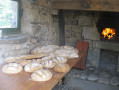
The bread oven and the Auvergne cross at Chastreix
 2.20 mi
+476 ft
-492 ft
1h 25
Easy
Departure from Chastreix (Puy-de-Dôme)
2.20 mi
+476 ft
-492 ft
1h 25
Easy
Departure from Chastreix (Puy-de-Dôme)
A small mountain village, Chastreix and its 12th-century Saint-Bonnet church, listed as a historic monument.
The association Chemins et patrimoine aux pays des Toupis works to promote the local heritage and hiking trails.
Gagne Valley
9.98 mi
+1,270 ft
-1,270 ft
5h 40
Moderate
Departure from Chastreix (Puy-de-Dôme)
La Gagne is a pretty river that rises from the confluence of three streams of the same name, upstream from Chastreix. This circular route crosses them several times. Added to this route is a first return trip to the Cascade des Essarts, then a second to the Montagne du Mont, at the foot of the Sancy.
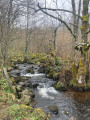
Essarts Waterfall
 2.82 mi
+361 ft
-354 ft
1h 35
Easy
Departure from Chastreix (Puy-de-Dôme)
2.82 mi
+361 ft
-354 ft
1h 35
Easy
Departure from Chastreix (Puy-de-Dôme)
A pleasant, peaceful and easy route to discover a waterfall, with a picnic area and, on the way back, a view of a deer farm.
Around the ponds near Flayat
 4.27 mi
+171 ft
-194 ft
2h 05
Easy
Departure from Flayat (Creuse)
4.27 mi
+171 ft
-194 ft
2h 05
Easy
Departure from Flayat (Creuse)
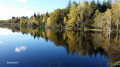
During this walk, you will discover some of the many ponds in the commune of Flayat.
You are in a mushroom-rich area and the landscape is spectacular in autumn when the trees are ablaze with colour and reflected in the ponds.
The Puy de Sancy from the west via Chastreix
 9.52 mi
+2,474 ft
-2,434 ft
6h 30
Moderate
Departure from Chastreix (Puy-de-Dôme)
9.52 mi
+2,474 ft
-2,434 ft
6h 30
Moderate
Departure from Chastreix (Puy-de-Dôme)
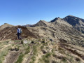
The western slope of Puy de Sancy, in the heart of the Chastreix-Sancy Nature Reserve (dogs not allowed).
A natural heritage site of great quality where many natural environments are well preserved. The exceptional flora and remarkable fauna thrive on an exceptional geology. The landscapes are magnificent.
The Puy de Sancy and the Cirque de la Fontaine Salée from Mont
 Tourism professional11.82 mi
+2,792 ft
-2,762 ft
7h 50
Difficult
Departure from Chastreix (Puy-de-Dôme)
Tourism professional11.82 mi
+2,792 ft
-2,762 ft
7h 50
Difficult
Departure from Chastreix (Puy-de-Dôme)
A very varied route, with ridges, forest, a spring and, above all, exceptional views! A wild route with people at the summit of Puy de Sancy but no one else anywhere else.Dogs are not allowed on this hike (even on a lead), located in the Chastreix-Sancy Nature Reserve (they are only allowed on a lead on the GR®30).
The Essarts Waterfall and the Bois de la Masse from Mont
 6.20 mi
+781 ft
-781 ft
3h 30
Moderate
Departure from Chastreix (Puy-de-Dôme)
6.20 mi
+781 ft
-781 ft
3h 30
Moderate
Departure from Chastreix (Puy-de-Dôme)
A very pleasant loop, shaded for much of the way, which allows you to discover the Essarts waterfall, the magnificent Bois de la Masse forest in the Chastreix-Sancy Nature Reserve, and beautiful views of the southern slopes of the Sancy.
The Cirque de la Fontaine Salée
 4.90 mi
+489 ft
-486 ft
2h 40
Easy
Departure from Chastreix (Puy-de-Dôme)
4.90 mi
+489 ft
-486 ft
2h 40
Easy
Departure from Chastreix (Puy-de-Dôme)
A trail with informative signs (August 2024) allowing you to discover the Fontaine Salée glacial valley, with views of the south face of Puy de Sancy and Cézallier.
The Roc de Courlande across the summer pastures
 6.60 mi
+1,716 ft
-1,742 ft
4h 30
Moderate
Departure from Chastreix (Puy-de-Dôme)
6.60 mi
+1,716 ft
-1,742 ft
4h 30
Moderate
Departure from Chastreix (Puy-de-Dôme)
This circular route takes you to the Roc de Courlande, on the edge of the Chastreix-Sancy Nature Reserve. A sharp peak topped by a cross, offering a unique panoramic view of Chastreix, the Cantal mountains and even the Limousin mountains. Best done at the end of the day to enjoy the colours of the setting sun!
The Cirque de la Fontaine Salée as seen from the hamlet of Les Bories, drystone shelters
6.90 mi
+866 ft
-853 ft
3h 55
Moderate
Departure from Chastreix (Puy-de-Dôme)
A pleasant and varied walk in terms of scenery, partly in the shade and with magnificent views all along the way over the southern slopes of the Sancy Massif and the Cantal Massif further to the south. Minimal elevation gain. Best undertaken on a clear day.
Chareire - Mont-Dore Station
 8.61 mi
+2,526 ft
-2,129 ft
6h 10
Moderate
Departure from Picherande (Puy-de-Dôme)
8.61 mi
+2,526 ft
-2,129 ft
6h 10
Moderate
Departure from Picherande (Puy-de-Dôme)
From Chareire, you will begin the ascent of Puy de Sancy (alt. 1,883 m), the highest point of the Massif Central, passing via the Col du Couhay and the Cabane, before descending towards the Mont-Dore resort via the Val de Courre.
Vallées de la Fontaine Salée, de la Trentaine and de Chareire
9.62 mi
+1,722 ft
-1,703 ft
5h 55
Moderate
Departure from Picherande (Puy-de-Dôme)
On the southern flank of Puy de Sancy, the route climbs up the Fontaine Salée watershed and continues to ascend, passing through mountain pastures criss-crossed by streams at the foot of the Gros and Paillaret peaks, before descending into the Ruisseau de Chareire valley. Superb views to the south and west.
La Fontaine Salée
 12.68 mi
+1,982 ft
-1,965 ft
7h 35
Difficult
Departure from Picherande (Puy-de-Dôme)
12.68 mi
+1,982 ft
-1,965 ft
7h 35
Difficult
Departure from Picherande (Puy-de-Dôme)
A day's walk from Picherande allows you to discover the impressive glacial cove of Fontaine Salée, whose pastoral activity is now protected by a nature reserve.
Lac Chauvet from Picherande
9.56 mi
+968 ft
-981 ft
5h 15
Moderate
Departure from Picherande (Puy-de-Dôme)
A beautiful hike in the heights of Cézallier. The route follows a stream, crosses footbridges, beech woods and pastures to discover the Cascade de la Barthe waterfall and Lac Chauvet lake. Note that there is a picnic area at (8).