Country:

 City:
City:


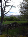
Park at the “P’tit café – Terre d’Horizon” in Les Bories.
(S/E) Take the well-marked cattle track to the east, which winds its way through the trees and emerges from the woodland about 500 metres further on.
(1) At the electricity pylon, follow the path to the left. Cross a footbridge before reaching the ruins of the old village of Chastreix, which was abandoned due to repeated outbreaks of the plague. At the junction, take the upper path on the right and walk for about 250 metres to reach another junction.
(2) Take the path that climbs to the right and continues due east through a magnificent forest, rising slightly, until you reach a wide forest track.
(3) Cross it and take the path opposite, which climbs steeply through the broom until you reach another junction. Turn left onto the path that runs alongside a steep slope until you reach a stream at the foot of the Roc de Courlande, near a small car park.
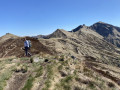
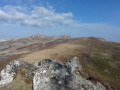
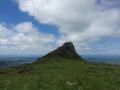
(4) Turn right onto the path, which becomes increasingly steep and rugged, leading to the summit of the Roc de Courlande.
(5) After taking in the views, head back down to the car park via the same route.
(4) At the car park, a small path leads down opposite through the broom to join the road. Follow it to the left to reach another car park at a hairpin bend.
(6) Take the path that climbs to the right, in the bend, towards a house. You’ll reach a woodland; take the path that descends to the left and initially runs along the edge of the woodland. Then, cross an area of summer pastures (where there are cows), passing through barbed-wire fences, before descending back to the road at the hamlet of Baffaud. Turn right.
(7) Cross the road carefully and, shortly afterwards, take the path leading down to the left between two houses. Further on, ignore a path on the right and continue straight on until you reach the crossroads in the hamlet of La Vessaire.
(8) Follow the road to the left to join another road, which you follow to the right until you reach another junction.
(9) Turn left onto the road that climbs up to the hamlet of Le Mont, which you pass through by continuing straight on until the first right-hand bend.
(10) Take a path on the left which climbs gradually to the car park of the “P’tit café – Terre d’Horizon” (S/E).
 Tourism professional
 Difficult
  Visorando Member
 Easy
Easy