


sucreroux23

 Visorando Member
 Premium user
 - Gender: man
Sign up:
Published route(s)
 Mont-Dore Station - Col de la Croix Morand
 9.16 mi
 +3,163 ft
 -2,812 ft
 7h 00
7h 00
 Moderate
 Departure from Mont-Dore (Puy-de-Dôme)
You will pass through the ridges, the Puy des Crebasses (alt. 1,762 m), the Roc de Cuzeau (alt. 1,737 m) and the Puy de l'Angle (alt. 1,740 m), with an optional detour via the Grande Cascade, all with views of the resort and the magnificent Chaudefour Valley.
Circular route around the Chaudefour Valley and Puy de Sancy
 39.28 mi
+9,514 ft
-9,534 ft
4 days
Moderate
Departure from Mont-Dore (Puy-de-Dôme)
39.28 mi
+9,514 ft
-9,534 ft
4 days
Moderate
Departure from Mont-Dore (Puy-de-Dôme)
A 4-day hike staying in stopover lodges, so you can sleep in the warmth every night
The route takes you along the GR®4 and GR®30 trails through the Chastreix-Sancy National Nature Reserve and the Chaudefour Valley Nature Reserve, where you’ll discover the highest peaks of the Massif Central and magnificent waterfalls, with a short break to relax at Lac Chambon.
Col de la Croix Morand - Courbanges
 9.75 mi
+1,230 ft
-2,051 ft
5h 35
Moderate
Departure from Chambon-sur-Lac (Puy-de-Dôme)
9.75 mi
+1,230 ft
-2,051 ft
5h 35
Moderate
Departure from Chambon-sur-Lac (Puy-de-Dôme)
You’ll pass close to farms, with lovely countryside scenery, then you’ll go through Chambon-sur-Lac and, of course, its lake, and you’ll take the Chemin des Quayres as you head deep into a thick forest.
Courbanges - Chareire
 11.77 mi
+2,595 ft
-2,543 ft
7h 40
Moderate
Departure from Saint-Victor-la-Rivière (Puy-de-Dôme)
11.77 mi
+2,595 ft
-2,543 ft
7h 40
Moderate
Departure from Saint-Victor-la-Rivière (Puy-de-Dôme)
You will pass close to waterfalls at Cheix, Pérouse and Biche, and stop for a quick drink at the Sainte-Anne spring before beginning the ascent of the Puy de Champgourdeix (alt. 1,566 m) and the Perdrix (alt. 1,824 m), with views over the resort of Super Besse.
Chareire - Mont-Dore Station
8.61 mi
+2,526 ft
-2,129 ft
6h 10
Moderate
Departure from Picherande (Puy-de-Dôme)
From Chareire, you will begin the ascent of Puy de Sancy (alt. 1,883 m), the highest point of the Massif Central, passing via the Col du Couhay and the Cabane, before descending towards the Mont-Dore resort via the Val de Courre.
Circular walk around the Pointe de la Sambuy in Albertville
29.29 mi
+10,397 ft
-10,443 ft
4 days
 Difficult
Departure from Albertville (Savoie)
Difficult
Departure from Albertville (Savoie)
A 4-day hiking tour with wild camping, starting and finishing at Albertville railway station
The route takes you through the Bauges Game and Wildlife Reserve, where you’ll discover the highest points of the Bauges Massif: the Pointe de Chaurionde (alt. 2,173 m) and the Col de l’Alpettaz (alt. 1,580 m), passing through the forests of Tamié, Saint-Ruph and Les Héris.
From the Baraque de l'Abbaye to the Chalet de l'Alpettaz
 9.20 mi
+3,583 ft
-2,201 ft
7h 20
Difficult
Departure from Seythenex (Haute-Savoie)
9.20 mi
+3,583 ft
-2,201 ft
7h 20
Difficult
Departure from Seythenex (Haute-Savoie)
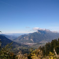
This hike takes you to the heart of the Faverges-Seythenex valley, following the Lac d'Annecy with the Torrent de Saint-Ruph, which is the lake's main source of water, ending with a view of Albertville and Mont Blanc at the Col de l'Alpettaz (alt. 1,580 m).
From Pessade to Orcival
5.69 mi
+367 ft
-1,345 ft
2h 55
Moderate
Departure from Saulzet-le-Froid (Puy-de-Dôme)
Starting from Pessade, the route follows theGR®®441andGR®®30, taking you past Lac de Servière, a lake of volcanic origin, and ending in Orcival with its magnificent Romanesque basilica built between 1146 and 1178.
Circular route through the heart of the Chaîne des Puys
 35.90 mi
+4,902 ft
-4,898 ft
4 days
Moderate
Departure from Saulzet-le-Froid (Puy-de-Dôme)
35.90 mi
+4,902 ft
-4,898 ft
4 days
Moderate
Departure from Saulzet-le-Froid (Puy-de-Dôme)
A four-day hike (or three – see the practical information) staying in stopover lodges, so you can sleep in the warmth every night.
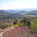
The route will take you along the GR®30 and GR®441 trails into the heart of the Chaîne des Puys, between the Puy de Sancy and the Puy de Dôme, to explore the volcanoes and lakes of Auvergne as well as the Romanesque basilica of Notre-Dame d’Orcival.
From Orcival to Laschamps
 9.78 mi
+1,371 ft
-988 ft
5h 40
Moderate
Departure from Orcival (Puy-de-Dôme)
9.78 mi
+1,371 ft
-988 ft
5h 40
Moderate
Departure from Orcival (Puy-de-Dôme)
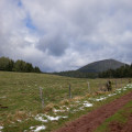
Starting from Orcival, with its Romanesque basilica built in 1178, the route takes you along the GR®4-30 and the circular Dômes route to bring you close to the Puys de Pourcharet and Mercoeur, before reaching Laschamps, with views of the Puy de Dôme.
From Laschamps to La Cassière
9.27 mi
+1,463 ft
-1,732 ft
5h 30
Moderate
Departure from Saint-Genès-Champanelle (Puy-de-Dôme)
Starting from Laschamps near Puy de Dôme, the route takes you to the village of Beaune le Chaud, then onto theGR®®4andGR®®30to climb the Puy de Lassolas and Puy de la Vache with magnificent panoramic views, before reaching La Cassière and its lake.
Please note: Access to the summits of Puys de la Vache and Lassolas will be closed for works between spring 2026 and early 2028.
Please note: the Montlosier car park will be closed for works between August 2025 and 2027.
From Lac de Blanchemer to the Chalet de Rouge Mousse
 7.13 mi
+1,880 ft
-2,054 ft
4h 55
Moderate
Departure from La Bresse (Vosges)
7.13 mi
+1,880 ft
-2,054 ft
4h 55
Moderate
Departure from La Bresse (Vosges)
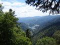
Starting from Lac de Blanchemer, the route follows theGR®531, taking you via the Rainkopf (alt. 1,305 m), before descending towards the Tourbière de Machais, the Col de Bramont and the Étang de Sèchemer to reach the Chalet de Rouge Mousse.
Circular Vosges, Hohneck, Lakes
22.45 mi
+5,240 ft
-5,223 ft
3 days
Moderate
Departure from La Bresse (Vosges)
A 3-day hiking and bivouacking trip, starting and finishing at Lac de Blanchemer
The route takes you through the Ballons des Vosges Regional Nature Park to explore the park’s third-highest peak, the Hohneck (alt. 1,363 m), as well as the Rainkopf (alt. 1,305 m), passing through the dense Bresse forest and past Lac des Corbeaux.
From the Chalet de Rouge Mousse to the Cabane des Champis
 6.55 mi
+1,732 ft
-968 ft
4h 30
Moderate
Departure from La Bresse (Vosges)
6.55 mi
+1,732 ft
-968 ft
4h 30
Moderate
Departure from La Bresse (Vosges)
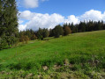
Starting from the Chalet de Rouge Mousse, the route takes you to Lac des Corbeaux, then via the GR®533 to La Roche Beauty (viewpoint), and on to Mont Moyenmont (alt. 969 m) to reach La Chaume des Champis and its hut.
From the Cabane des Champis to Lac de Blanchemer
 8.77 mi
+1,627 ft
-2,201 ft
5h 25
Moderate
Departure from La Bresse (Vosges)
8.77 mi
+1,627 ft
-2,201 ft
5h 25
Moderate
Departure from La Bresse (Vosges)
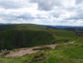
Starting from Les Champis, the route passes through the Marécage Rouge Feigne, the Col de Thiaville (alt. 1,112 m), the Hohneck (alt. 1,363 m) and the Col du Wormspel (alt. 1,277 m) before descending towards Lac de Blanchemer.
From the Refuge du Saut to the Refuge de l'Orgère via the Col du Soufre
 10.24 mi
+3,576 ft
-4,196 ft
7h 50
Difficult
Departure from Les Allues (Savoie)
10.24 mi
+3,576 ft
-4,196 ft
7h 50
Difficult
Departure from Les Allues (Savoie)
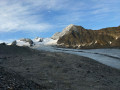
From the Refuge du Saut to the Refuge Porte de l'Orgère, the route passes close to the Gébroulaz Glacier via the Col du Soufre (2,817 m) before descending towards Lac Blanc and, via theGR®55, the Col de Chavière (2,796 m) and the Tête Noire rocks.
From the Refuge de l'Orgère to the Refuge du Fond d'Aussois via the Grand Roc
 7.42 mi
+4,787 ft
-3,412 ft
7 hrs
7.42 mi
+4,787 ft
-3,412 ft
7 hrs
 Very difficult
Departure from Villarodin-Bourget (Savoie)
Very difficult
Departure from Villarodin-Bourget (Savoie)
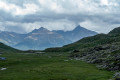
Starting from the Refuge Porte de l'Orgère, the route passes through the Valon de l'Orgère to reach the Col de la Masse (2,952 m) with the option of climbing the Grand Roc (3,316 m), then follows the valleys to reach the Refuge du Fond d'Aussois.
Tour of the five passes of the Vanoise
 27.00 mi
+13,077 ft
-13,051 ft
3 days
Very difficult
Departure from Villarodin-Bourget (Savoie)
27.00 mi
+13,077 ft
-13,051 ft
3 days
Very difficult
Departure from Villarodin-Bourget (Savoie)
A 3-day hike with camping or staying in mountain huts.
The route takes you into the Vanoise National Park, close to the Gébroulaz Glacier and Lac Blanc, with the option of climbing the Grand Roc (3,316 m) and the Pointe de l'Observatoire (3,015 m).
There are many other panoramic views to discover across the five passes: Col de la Masse (2,952 m), Col d’Aussois (2,914 m), Col Rouge (2,730 m), Col du Soufre (2,817 m) and Col de Chavière (2,796 m).
From the Fond d'Aussois Refuge to the Saut Refuge via the Pointe de l'Observatoire
 9.33 mi
+4,724 ft
-5,443 ft
8 hrs
Very difficult
Departure from Aussois (Savoie)
9.33 mi
+4,724 ft
-5,443 ft
8 hrs
Very difficult
Departure from Aussois (Savoie)
From the Refuge du Fond d'Aussois to the Refuge du Saut, the route passes via the Col d'Aussois (2,914 m) with the option to climb the Pointe de l'Observatoire (3,015 m) before descending into the valley via the Ritort farm, then the Col Rouge (2,730 m).
Ravin des Serres - Vallonpierre refuge
 10.03 mi
+5,138 ft
-5,220 ft
9h 05
Difficult
Departure from L'Argentière-la-Bessée (Hautes-Alpes)
10.03 mi
+5,138 ft
-5,220 ft
9h 05
Difficult
Departure from L'Argentière-la-Bessée (Hautes-Alpes)
The hike begins with the ascent of the Pas de la Cavale, which rises to an altitude of 2,735 metres. After this climb, you will reach the Pré de la Chaumette refuge. From there, another climb will take you along the imposing Sirac, passing through the Vallette, Gouiran and Vallonpierre passes. The route ends at the Vallonpierre refuge.
Le Lauvet - Lac Labarre
 11.84 mi
+4,869 ft
-3,711 ft
9h 40
Difficult
Departure from Valjouffrey (Isère)
11.84 mi
+4,869 ft
-3,711 ft
9h 40
Difficult
Departure from Valjouffrey (Isère)
From Le Lauvet, descend to La Chapelle-en-Valjouffrey. Then take the Sentier du Facteur trail, cross the Haute Vallée du Béranger nature reserve in Valsenestre, and finish on the GR®54B trail to Lac Labarre.
Wild crossing of the Écrins
 73.32 mi
+28,494 ft
-29,314 ft
7 days
Very difficult
Departure from L'Argentière-la-Bessée (Hautes-Alpes)
73.32 mi
+28,494 ft
-29,314 ft
7 days
Very difficult
Departure from L'Argentière-la-Bessée (Hautes-Alpes)
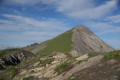
This 7-day trek is for hikers who are used to camping in tents.Although there are a few refuges along the route, the stages are designed for those who wish to sleep in the heart of nature.The circuit crosses the Écrins massif and offers total immersion in the alpine landscape, where you can encounter local flora and fauna.Ideal for walkers who are used to the mountains, it is a complete adventure that will challenge you with its significant elevation changes and occasional technical or unmarked sections.
Lakes of Sebeyras - Le Lauvet
 11.28 mi
+5,371 ft
-6,191 ft
9h 50
Very difficult
Departure from La Chapelle-en-Valgaudemar (Hautes-Alpes)
11.28 mi
+5,371 ft
-6,191 ft
9h 50
Very difficult
Departure from La Chapelle-en-Valgaudemar (Hautes-Alpes)
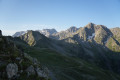
From the Sebeyras Lakes, the route will first take you to the Col de Pétarel. From there, you will descend towards Saint-Maurice-en-Valgodemar. You will then follow the old transhumance paths to reach the Six Cabanes, then climb the Col de Menoux to Lauvet.
Lac Labarre - Lac du Vallon
 6.06 mi
+3,192 ft
-2,828 ft
5h 35
Difficult
Departure from Valjouffrey (Isère)
6.06 mi
+3,192 ft
-2,828 ft
5h 35
Difficult
Departure from Valjouffrey (Isère)
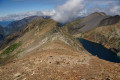
From Lac Labarre, the route follows part of the GR®54B. You will cross the Col de la Romeïou, the Cabane de la Selle, then the Col du Paletas. From there, a wild hike along the ridges, passing by the Neyrard at an altitude of 2,796 m, will take you to Lac du Vallon.
Argentière station - Ravin des Serres
 11.12 mi
+4,564 ft
-223 ft
9h 05
Difficult
Departure from L'Argentière-la-Bessée (Hautes-Alpes)
11.12 mi
+4,564 ft
-223 ft
9h 05
Difficult
Departure from L'Argentière-la-Bessée (Hautes-Alpes)
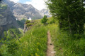
For this first stage, you will begin your journey at the Argentière-les-Écrins train station. The hike follows the GR®54A, taking you through the Fournel valley and the Deslioures biological reserve. You will finally arrive at a plateau that is ideal for camping.
Please note: landslide in July 2025
Vallonpierre refuge - Sebeyras lakes
 14.23 mi
+4,291 ft
-4,255 ft
10h 15
Very difficult
Departure from La Chapelle-en-Valgaudemar (Hautes-Alpes)
14.23 mi
+4,291 ft
-4,255 ft
10h 15
Very difficult
Departure from La Chapelle-en-Valgaudemar (Hautes-Alpes)
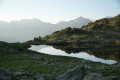
From the Vallonpierre refuge, the hike takes you to the Rif du Sap chapel, then to the charming village of La Chapelle-en-Valgaudémar, where you can stop for refreshments at a local grocery store. The route then crosses the Valgaudémar National Forest before reaching the magnificent lakes of Pétarel and Sebeyras.
Lac du Vallon - Le Bourg-d'Oisans
 8.76 mi
+1,070 ft
-6,886 ft
5h 00
Difficult
Departure from Chantelouve (Isère)
8.76 mi
+1,070 ft
-6,886 ft
5h 00
Difficult
Departure from Chantelouve (Isère)
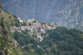
The last stage begins at the large Vallon Lake. You will then cross the Col du Rochail, which rises to an altitude of 2,756 metres. After this climb, your path will take you to the Refuge des Sources, then to Villard-Notre-Dame, a village offering a superb view of Bourg-d'Oisans, your final destination.
Circular route in the Valgaudemar
 29.74 mi
+15,112 ft
-15,098 ft
5 days
Difficult
Departure from Villar-Loubière (Hautes-Alpes)
29.74 mi
+15,112 ft
-15,098 ft
5 days
Difficult
Departure from Villar-Loubière (Hautes-Alpes)
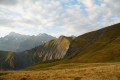
This 5-day trek is aimed at hikers wishing to camp in tents. The route crosses the Valgaudémar valley and passes through the village of La Chapelle-en-Valgaudémar, where you can stock up on supplies at the local grocery shop.
The route crosses the Écrins Massif and offers an optional ascent of Pic Turbat (3,028 m) for the most determined, whilst also providing accessible routes with mostly signposted sections.
Ideal for walkers in good physical condition, it offers a complete adventure combining forests, lakes and high peaks, with varied elevation changes and a few short off-trail sections requiring particular attention to navigation.
Villar Loubière – Sebeyras Lakes
 5.63 mi
+4,511 ft
-354 ft
6h 30
Difficult
Departure from Villar-Loubière (Hautes-Alpes)
5.63 mi
+4,511 ft
-354 ft
6h 30
Difficult
Departure from Villar-Loubière (Hautes-Alpes)
This first stage takes you along the GRP® Tour du Vieux Chaillol trail, linking Villar-Loubière to the Sebeyras Lakes. The route passes by the Pétarel Lakes, with a gradual climb through the Valgaudémar State Forest.
Sebeyras Lakes – Les Prés de Lauplat
7.56 mi
+3,369 ft
-3,970 ft
6h 25
Difficult
Departure from La Chapelle-en-Valgaudemar (Hautes-Alpes)
This stage takes you from the Sebeyras Lakes to the Lauplat Meadows via the Col de Pétarel and the Col de la Béranne. The route then descends towards the hamlet of Navette and the Buchardet Waterfall, before a long climb along a more rugged path.
Les Prés de Lauplat – Les Naizets
 6.38 mi
+2,762 ft
-3,547 ft
5h 20
Moderate
Departure from La Chapelle-en-Valgaudemar (Hautes-Alpes)
6.38 mi
+2,762 ft
-3,547 ft
5h 20
Moderate
Departure from La Chapelle-en-Valgaudemar (Hautes-Alpes)
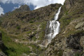
This stage takes you from the Prés de Lauplat to the Naizets bivouac, passing through the village of La Chapelle-en-Valgaudémar. The route follows the Oulles du Diable before climbing via the GR®54, passing the Combefroide Waterfall to reach a grassy plateau.
Les Naizets – Lac du Lautier (via Pic Turbat)
 4.81 mi
+4,209 ft
-2,582 ft
5h 55
Very difficult
Departure from La Chapelle-en-Valgaudemar (Hautes-Alpes)
4.81 mi
+4,209 ft
-2,582 ft
5h 55
Very difficult
Departure from La Chapelle-en-Valgaudemar (Hautes-Alpes)
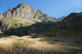
This stage takes you from Les Naizets to Lac du Lautier via the Col de Colombes. The route offers an optional detour to climb Pic Turbat before descending to the campsite by the lake.
Lautier Lake – Villar Loubière
 5.36 mi
+259 ft
-4,646 ft
2h 40
Moderate
Departure from Villar-Loubière (Hautes-Alpes)
5.36 mi
+259 ft
-4,646 ft
2h 40
Moderate
Departure from Villar-Loubière (Hautes-Alpes)
This stage takes you from Lac du Lautier to the Villar-Loubière car park, descending the valley along the GR®54. The descent passes through the Bois de Champat and goes past the Lautier Torrent Waterfall before reaching the village.