Country:

 City:
City:


(S) From Les Prés de Lauplat, head west and rejoin the path from the previous stage: Lacs de Sebeyras – Les Prés de Lauplat.
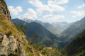
Begin a long descent (~760 m down) via switchbacks over sandy ground, then through tall grass.
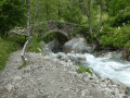
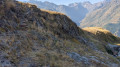
(1) Cross an old, narrow stream channel (see photo); there are no particular difficulties, but take care in wet weather.
Continue towards the Torrent de Tempier, which lies in the hollow of the valley.
(2) Once you reach the stream, turn left onto a wider path leading towards the hamlet of Navette.
(3) Walk past a chapel and the ruins of the hamlet to reach a fountain. Once at the fountain, continue to the right (north) towards the Pont des Oules, along a forest track unsuitable for vehicles.
(4) At the next junction, carry on straight ahead, staying on the right bank of the stream along a footpath.
(5) At the Pont des Oules du Diable, head towards La Chapelle-en-Valgaudémar (signposted ‘La Chapelle’) via the GRP® du Tour du Vieux Chaillol (yellow and red markings). Please note: as the old GRP® route is closed (due to a rockslide), you will need to take a short detour.
Cross the Pont des Oules, then take a path on the right, following the left bank of the Oules. You’ll come to a footbridge. Cross the Oulles torrent and climb a few metres.
(6) Continue to the left to rejoin the GRP® Tour du Vieux Chaillol.
(7) After the final hairpin bends through the woods, leave the GRP® and take the GR®54 to the left (red and white markings). Further down, you’ll reach the village of La Chapelle-en-Valgaudémar; head down the narrow lane. There’s a fountain on the right: turn right here towards the main road, the D480.
(8) Leave the village, heading towards Le Casset, and continue along the D480 for a further 600 m. After a bridge and a right-hand bend, rejoin the GR®54 path on your left, near a small car park with a commemorative stele.
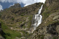
(9) Take the GR®54 path and head uphill towards the Refuge de l’Olan. Continue climbing to the finish via numerous hairpin bends (~780 m elevation gain). Cross the first bridge (Torrent de Combefroide waterfall),
(10) At the next junction, keep right on the GR®54.
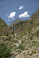
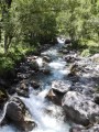
(11) At the second bridge you come to, cross it and immediately leave the GR®. Continue off-trail along the left bank of the stream (see photo), and further on (100 m) you’ll reach a grassy plateau jutting out from the slope where you can camp (E).
 Visorando Member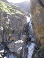
 Easy
Easy 
 Very difficult
 Difficult