Circular route around the Chaudefour Valley and Puy de Sancy

A 4-day hike staying in stopover lodges, so you can sleep in the warmth every night

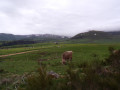
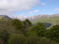
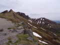
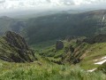
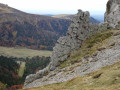
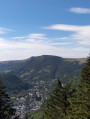
The route takes you along the GR®4 and GR®30 trails through the Chastreix-Sancy National Nature Reserve and the Chaudefour Valley Nature Reserve, where you’ll discover the highest peaks of the Massif Central and magnificent waterfalls, with a short break to relax at Lac Chambon.

Details

1055479
Creation:
Last update:
Last review:
  • Walking
    Activity: Walking
  • ↔
    Distance: 39.28 mi
  • ◔
    Average duration: 4 days 
  • ▲
    Difficulty: Moderate

  • ⚐
    Back to start: Yes
  • ↗
    Ascent: + 9,514 ft
  • ↘
    Descent: - 9,534 ft

  • ▲
    Highest point: 6,158 ft
  • ▼
    Lowest point: 2,805 ft

Photos

Stages of the route

This route needs several days, find the details below:

  1. S
  2. 2
  3. 3
  4. E

Notes

Please note: This route passes through the Chastreix-Sancy and Chaudefour Valley nature reserves. Dogs are not permitted, even on a lead, except on the markedGR® 30 trails.
Mountain biking, foraging and camping are prohibited. Please stay on the marked paths.
Full details at: Chastreix-Sancy Nature Reserve and Chaudefour Valley Nature Reserve

Some additional information about the circular loop:

Difficulty: Moderate with some fairly steep climbs; walking poles are strongly recommended.

There may be snow in May and gusts of wind on the numerous ridges and passes along the route; I advise you to bring warm and/or windproof clothing.

Please note: at the start of the second stage (Col de la Croix Morand – Courbanges):
to avoid walking alongside a main road, you can take a shortcut – a pleasant, scenic 500m off-trail section – but waterproof footwear is advised, as the ground can be a bit marshy during wet spells.

Water sources: there are plenty; on the third day, you’ll find the Source Sainte-Anne, among others, and several waterfalls nearby (bring a water filter or purification tablets in these cases); otherwise, you can fill your water bottles in the evening at the refuge.

This route passes through multiple protected areas, which may be subject to special regulations:

Always be cautious and plan ahead when you're outdoors. Visorando and the author of this route cannot be held responsible for any accidents occurring on this route.

The GR® and PR® markings are the intellectual property of the Fédération Française de Randonnée Pédestre.

Reviews and comments

4.9 / 5
Based on 3 reviews

Reliability of the description
5 / 5
Ease of following the route
5 / 5
Route interest
4.7 / 5
bernard Gallois
bernard Gallois

Overall rating : 5 / 5

Date of your route : Aug 06, 2023
Reliability of the description : ★★★★★ Very good
Ease of following the route : ★★★★★ Very good
Route interest : ★★★★★ Very good
Very busy route : Yes

Having set off with the tent, it was difficult to find a place to camp.

Machine-translated

karkad
karkad

Overall rating : 4.7 / 5

Date of your route : Aug 29, 2022
Reliability of the description : ★★★★★ Very good
Ease of following the route : ★★★★★ Very good
Route interest : ★★★★☆ Good
Very busy route : No

A lovely circular route completed on 26 August. Note: paid parking at the start costs €4 for under 4 hours, otherwise €6, and €17 for over 12 hours!!! Quite a few people at the start and around Sancy, but very few once you start climbing towards the ridges. Magnificent scenery; the Fontaine Sainte-Anne is well worth a visit (drinking sparkling water). Spotted a slow worm and wild horses – blueberries, yum! I’ll be going back as this route doesn’t really allow you to explore the valley or its waterfalls.

Machine-translated

pupu94
pupu94

Overall rating : 5 / 5

Date of your route : Jul 26, 2022
Reliability of the description : ★★★★★ Very good
Ease of following the route : ★★★★★ Very good
Route interest : ★★★★★ Very good
Very busy route : No

A lovely 4-day hike with stunning, varied scenery! Thanks to the author for this wonderful route.
Completed on 14/07/2022, camping:
-Day 1: at the top of the Puits de la Tache / make sure you take water with you at the start as there is none along the way.
-Day 2: we chose to continue past Courbanges to camp below the reserve house, by a stream.
-Day 3: camped at the exit of La Morangie on the outskirts of La Trentaine.
-Day 4: set off at 6am to be at the top of the Puits de Sancy by 8.30am, almost alone, with only the local trail runners out for their Sunday training and before the first tourists arrived.
Poles are essential due to the elevation changes, the terrain which is sometimes slippery and stony, and even in completely dry weather, as was the case for us.

Machine-translated

sucreroux23
sucreroux23
• Edited:

Thank you for choosing this hike – we look forward to sharing it with you!

Machine-translated

Other walks in the area

For more walks, use our search engine .

The GPS track and description are the property of this route's author. Please do not copy them without permission.