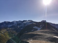
Fond d’Aussois Mountain Hut – Valette Mountain Hut

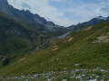
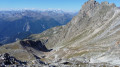
Starting from the Refuge du Fond d’Aussois, the route passes via the Col d’Aussois (2,914 m), follows the western slopes of the Vanoise Glaciers and crosses their torrents to reach the Refuge de la Valette.

This walk is part of a multi-day hike: Boucle Vanoise à Modane

Details

n°15332398
Creation:
Last update:
Last review:
  • Walking
    Activity: Walking
  • ↔
    Distance: 9.64 mi
  • ◔
    Average duration: 8h 25 
  • ▲
    Difficulty: Difficult

  • ⚐
    Back to start: No
  • ↗
    Ascent: + 4,547 ft
  • ↘
    Descent: - 3,698 ft

  • ▲
    Highest point: 9,567 ft
  • ▼
    Lowest point: 6,844 ft
  • ⚐ Country: France
  • ⚐
    Areas: Alps, Vanoise
  • ⚐ City: Aussois (73500)
  • ⚑
    Start: N 45.27661° / E 6.702528°
  • ⚑
    End: N 45.353303° / E 6.724096°
  • ❏
    IGN map(s): Ref. 3534OT, 3534OTR
  • Hour-by-hour weather

Photos

Description of the walk

(S) Starting from the Refuge du Fond d’Aussois, head down to a small bridge to cross the Ruisseau de Saint-Benoit. At the next junction, turn left (north-west), following the yellow markings to the Col d’Aussois. You’ll reach a more rocky area.

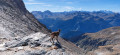
(1) Continue the ascent to the right, following the cairns. Pass the wayside cross on a ledge, then reach the Col d’Aussois.
Please note: the climb up to the Col d’Aussois is steep and, depending on the season, there may be snowfields.

(2) Continue straight ahead to begin the descent to the Ruisseau de Rosoire.
Cross the stream, then head left to reach the ruins of the Chalet de Rosoire.

(3) Turn right towards Pointe Ariande, following a gentle ascent that runs along the mountainside. After passing beneath Pointe Ariande, begin a winding descent to reach the Torrent du Glacier du Génépy.

(4) Cross it via a bridge, then stay on the path to the left.
Then, at the next fork, continue along the original path until you reach the Ruisseau des Ferrandes

(5) Cross this too, passing through the ruins of the Chalet Clou, near a pond.
Continue along the path to reach the streams of Nants.

(6) Take care when crossing these torrents: there are no bridges, so as a precaution you’ll need to leave the path to find the best places to cross.
Then head towards the Chalet des Nants.

(7) Turn right onto the path, which climbs quite steeply in hairpin bends, then continues along a ledge. You’ll reach the junction with the path leading to the refuge.

(8) Turn right onto this path and continue climbing for a few metres to reach the Refuge de la Valette (E), today’s destination.

Waypoints

  1. S : mi 0 - alt. 7,694 ft - Refuge du Fond d'Aussois
  2. 1 : mi 0.88 - alt. 8,320 ft - Gravel track
  3. 2 : mi 1.78 - alt. 9,567 ft - Col d'Aussois
  4. 3 : mi 3.41 - alt. 7,343 ft - Ruins near the Roisoire Chalet
  5. 4 : mi 5.74 - alt. 7,628 ft - Génépy Glacier torrent
  6. 5 : mi 7.4 - alt. 7,211 ft - Ruins of the Chalet Clou
  7. 6 : mi 8.34 - alt. 7,172 ft - Torrents des streams
  8. 7 : mi 8.49 - alt. 7,195 ft - Chalet des Nants
  9. 8 : mi 9.41 - alt. 8,392 ft - Refuge junction
  10. E : mi 9.64 - alt. 8,517 ft - Refuge de la Valette

Notes

Note: The Fond d’Aussois mountain hut is also referred to as the Refuge de Fond d’Aussois.

Please note: this route passes through the Vanoise National Park
To preserve the park’s natural heritage, you must follow a few rules.
- Do not bring dogs, even on a lead,
- Do not pick or collect flowers, fruit, insects or minerals,
- Take all your rubbish away with you,
- Do not disturb the peace and quiet of the area or the wildlife with noise, shouting or sound-producing devices,
- Do not camp or pitch a tent except near certain mountain huts,
- Do not light fires,
- Stay on the paths and avoid cutting across the switchbacks on the descent,
- Do not go paragliding or practise other aerial sports,
- Do not go mountain biking,
- Do not drive motorised vehicles,
- Fish in authorised lakes and watercourses in accordance with the regulations.
Further information at: www.vanoise-parcnational.fr

Accommodation:
(S) You can spend the night at the Refuge du Fond d’Aussois; camping is permitted near the refuge
Bookings and prices at: Refuge Fond d’Aussois
(E) You can spend the night at the Refuge de la Valette; camping is permitted near the refuge
Bookings and prices at: Refuge de la Valette

Water:
(S) At the Refuge du Fond d’Aussois, you can top up your water supplies at a drinking water fountain.
(4) At the Torrent du Glacier du Génépy (filtering recommended)
(6) At the Torrents des Nants (filtering recommended)
(E) At the Refuge de la Valette, you can refill your water bottles at a drinking fountain.

Route difficulty (technical information):
IBP: 167 (hike) (HKG)
Percentage ascent: 17.37%
Percentage descent: 18.12%
Technical details available here

Reviews and comments

5 / 5
Based on 1 review

Reliability of the description
5 / 5
Ease of following the route
5 / 5
Route interest
5 / 5
jeanluc.salvignol
jeanluc.salvignol

Overall rating : 5 / 5

Date of your route : Oct 06, 2025
Reliability of the description : ★★★★★ Very good
Ease of following the route : ★★★★★ Very good
Route interest : ★★★★★ Very good
Very busy route : No

a beautiful hike offering magnificent views of the glaciers, or what remains of them... Enjoy!

consider climbing to the top of the observatory, which offers magnificent views after a 15-minute climb (you can leave your bags in the scree before the climb).

Machine-translated

Other walks in the area

For more walks, use our search engine .

The GPS track and description are the property of this route's author. Please do not copy them without permission.