Country:

 City:
City:


Start from the car park west of Villar-Loubière on the D985a, before the tunnel when coming from Villar-Loubière.
(S) From the car park (there are other car parks available further along the road towards Villar-Loubière), join a footpath and cross the footbridge over the dam. At the next junction, take the GRP® ‘Tour du Vieux Chaillol’ route to the left (marked in yellow and red) towards the Villar-Loubière campsite.
(1) At the Eaux Douces municipal campsite, leave the GRP® and take the path on the right towards the Pérarel Lakes (yellow markings). Stay on the most clearly marked path, which winds its way uphill.
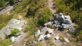
(2) After leaving the forest, shortly after a second scree slope, you’ll come to an unmarked fork (see photo). Take the path on the left and continue across the scree slope (north-east). At the next fork, join and follow the GRP® Tour du Vieux Chaillol to the right towards the Lacs de Pérarel.
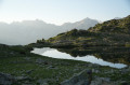
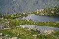
(3) Walk alongside the lakes and continue the climb towards the Col de Pétarel to reach the crossroads below the Lacs de Sebeyras.
(4) Please note: this section is off-trail. It takes between 5 and 10 minutes; whilst there are no particular difficulties to report, a good sense of direction is essential (a GPS app is recommended).
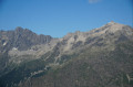
As you approach a rocky outcrop in a scree slope (see photo), leave the marked GRP® trail and turn left; a few cairns may help guide you. Keep heading south-east until you reach your destination. Go round the few large boulders on the left (see photo) and then wind your way to the left of a scree slope. When you come to a rocky outcrop ahead of you, go round it on the left, close to the large boulders. Then climb a few metres up to the right, near a fissure (see photo).
When you reach a grassy clearing (see photo), head left and cross the small stream flowing through the fissure from above.
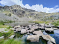
Head right to climb a small hill; beyond it lies the Lower Lake of Sebeyras, where you can camp (E).
 Visorando Member
 Very difficult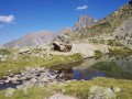
 Moderate