Country:

 City:
City:


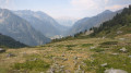
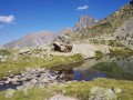
(S) From Lac du Lautier, join the GR®54 (red and white markings) heading towards its outlet tothe west, and head towards the Refuge des Souffles.
Then begin a long descent (~1,300 m of elevation loss to the bottom of the valley).
(1) At the next junction, just before the Col des Clochettes, leave the GR®54 and take the path on the left towards the village of Villar Loubière.
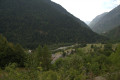
(2) As the path begins to enter the coniferous forest, at the fork continue along the path on the left, still heading towards Villar Loubière. The conifers give way to deciduous trees.
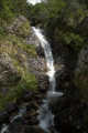
(3) At the next Y-junction, take the GR®54 downhill to the left. Continue along the signposted path and avoid taking any other paths to the right. After crossing a waterfall via a bridge, the path joins another trail.
(4) Carry on straight down, still following the GR®54. The GR®54 joins another path.
(5) Take the path on the right, then turn right again to join a gravel track leading to the village.
(6) In the village, leave the GR®54 and head towards La Loubière on the right. The path (marked in yellow) climbs slightly and passes through the centre of the La Charrière stopover lodge.
(7) Cross the bridge and turn left at the next junction, still heading towards La Loubière. Stay on the right bank of the stream and follow it to the D985a departmental road, where you’ll find the dam and car park on the opposite side (E).
 Visorando Member
 Difficult
 Very difficult