Country:

 City:
City:


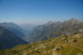
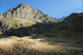
(S) Join the GR®54 (red and white markings), then cross the bridge. Continue along the marked path and descend to the next fork.
(1) Leave the GR®54 and take a path leading uphill to the right towards the Col de Colombes.
(2) When you reach a flat area at a barely visible junction, carry straight on into the valley; do not take the path on the right. The path you should follow climbs gently, then the slope becomes steeper and steeper. The path rejoins the GR®54.
(3) Turn left onto it, keeping in the same direction, until you reach the Col de Colombes.
(4) At the Col de Colombes, you have two options:
- Straight ahead to avoid climbing to the summit; continue along the GR®54 towards Lac Lautier (E).
- Turn right (as shown on the map) to begin the ascent (and descent) of Pic Turbat (allow 2 hours and ~ 600 m of elevation gain):
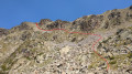
Please note, this section (see photo) is challenging; from (5) to (6), the terrain is at times steep and rugged and is suitable only for experienced hikers. Although there are no technical difficulties, some steep slopes, extensive scree slopes and snowfields may remain.
Leave the GR®54 and turn right to begin the ascent of a broad ridge (due north). The route to Pic Turbat follows a path irregularly marked with red paint strokes. Keep well to the left-hand side (west face of the peak) and avoid going any further to the right (east face), where there is a drop-off.
Go round a rocky outcrop on the left, then join (see photo) the rocky ridge on the right (see photo). The path veers slightly to the left, descending a few steps to go round a fissure on the right (see photo). Continue to the left through a stony gully (see photo). Cross it to reach, further up, a false summit of red rock.
(5) Tackle a steeper section (use your hands for support) of about twenty metres, then emerge into a gently sloping area covered in white granite and boulders. Then climb up onto a rounded ridge of scree and make your way towards the summit by sight, heading due north.
The ridge gradually narrows into a rocky ridge of compact gneiss covered in lichens, along which you must carefully wind your way, clinging to the rock (easy), as there are sheer drops on either side. The final ascent (see photo) is along a dizzying ridge, over sound granite boulders where you’ll need to use your hands (see photo). The true summit lies a few metres north of the secondary summit, marked by a large cairn.
(6) The return to the Col des Colombes follows the same route in the opposite direction; take care. Please note: the red markings are scarce on the descent.
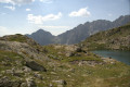
(4) Join the GR®54 again on the right, heading west, and follow the signs for Lac Lautier; descend for less than 15 minutes to reach the lake (E).
 Visorando Member
 Moderate