


sarahhcfe

 Visorando Member
 Moderator
 Premium user
About
My name is Sarah and I live in County Durham. I love to walk but having mobility issues means I can only manage short walks mainly in the towns and cities and along the coastline of the North East. Many of my walks are easy day walks and include visitor attractons meaning that walks can be done in smaller sections to enable more walkers to get out and enjoy the beautiful places here in the North East.
Sign up:
Published route(s)
 Greenfield Heritage Park
 2.19 mi
 +177 ft
 -177 ft
 1h 10
 Easy
 Departure from Holywell (Flintshire)
A pleasant stroll through Greenfield Heritage Park taking in St Winefride's Well, Basingwerk Abbey and the heritage museum. There are many quiet places to sit, industrial buildings as well as woodland to explore. This route follows the start of the Pilgrim’s Way, part of Wat’s Dyke.
Killhope Circular
3.82 mi
+404 ft
-436 ft
2h 05
Easy
Departure from Stanhope (County Durham)
This is the first of a series of circular routes following sections of the Weardale Way, which begins here at Killhope Lead Mining Museum and ends at the coast in Sunderland. This route first climbs, follows the Killhope Burn before ascending through trees, passing several dams before turning back along Killhope Burn to the museum. This is County Durham at its wildest.
Rainton Meadows - Dragonfly Route and Joe's Pond
0.75 mi
+20 ft
-20 ft
0h 20
Easy
Departure from Hetton (England)
A short, accessible walk taking in Joe's Pond, a deep pond fringed with reeds. There are plenty of viewing points along the way to look for wildlife. Look out for common teal, common pochard, and tufted duck in winter and, in summer, great crested grebes. This walk is along well-made paths and boardwalks suitable for all abilities.
Smoo Cave Circular
 1.24 mi
+148 ft
-144 ft
0h 40
Easy
Departure from Highland
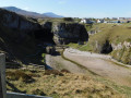
This walk takes in Smoo Cave and its surrounding area. It starts with a walk to the village hall and John Lennon Memorial Garden, then down steps to the cave itself, finishing with a view of the cove.
Seaham to South Hetton - Durham Round Trail (Alternative Route)
4.91 mi
+325 ft
-13 ft
2h 30
Easy
Departure from Seaham (County Durham)
This alternative section leaves the seafront and passes through some of the more charming parts of Seaham with its parks and streams before passing through the village of Dalton-le-Dale. The route continues past Dalton Park providing an opportunity to explore its shops, restaurants and footpaths before rejoining the original route.
Sunderland Beach and Park Circular
2.77 mi
+92 ft
-95 ft
1h 20
Easy
Departure from Sunderland (England)
This walk begins and ends on the Promenade taking in a stroll through Mowbray Park, a visit of Sunderland Museum and Winter Gardens. After returning through the more industrial areas of Sunderland along a section of the England Coast Path, end with a walk on the beach.
Kennet and Avon Canal, Newbury
1.62 mi
+13 ft
-13 ft
0h 45
Easy
Departure from Newbury (West Berkshire)
A gentle walk along the banks of the Kennet and Avon Canal, taking in Victoria Park. Great for a Sunday afternoon and suitable for all. Couple this with a visit to the museum or a canal boat trip for a perfect day.
River Wear Trail
10.46 mi
+262 ft
-269 ft
5h 00
 Moderate
Departure from Sunderland (England)
This full day trail follows the northern bank of the River Wear from the tranquil section of the river at Fatfield, through the industrial outer reaches of Sunderland, finishing at Roker Pier at the mouth of the Wear. This is an alternative finish to the Weardale Way, which follows the southern bank of the Wear.
Hartlepool Marina Circular
 2.36 mi
+33 ft
-33 ft
1h 05
Easy
Departure from Hartlepool
This short accessible walk begins in the historic Church Square and encircles the marina passing the famous Hartlepool monkey statue, new developments and some of the historic buildings in the area.
Newcastle City Walls Circular
3.21 mi
+262 ft
-292 ft
1h 40
Easy
Departure from Newcastle upon Tyne (England)
Newcastle was once a walled city with a castle (the clue is in the name). This city walk traces the route of the old city walls, some of which remains, through the modern city centre and along Newcastle Quayside passing many notable sites along the way.
Ouseburn Circular
2.10 mi
+105 ft
-108 ft
1h 05
Easy
Departure from Newcastle upon Tyne (England)
This short circular walk will take you along the banks of Ouseburn through the former industrial area of Newcastle, now a centre for creativity with its galleries, farm and abundance of restaurants and bars. This walk is excellent for children as there is so much to do and see along the way.
Along the Great North Road (County Durham)
40.69 mi
+1,532 ft
-1,407 ft
4 days
 Difficult
Departure from Hurworth (Darlington)
The Great North Road ran from London in the south to Edinburgh in the north. This was once a coaching route, but in later years this has been replaced by the A1 which sadly bypasses many of the pretty villages and towns along the route. This trail traces the route from Croft-on-Tees in the south on the border of North Yorkshire and County Durham to Newcastle-upon-Tyne. There are still remnants of that bygone age to be seen on this historical journey.
Gateshead to Gosforth Along the Great North Road
4.29 mi
+203 ft
-171 ft
2h 10
Easy
Departure from Gateshead (England)
The 9th and final section of the Great North Road crosses the River Tyne, the original boundary between County Durham and Northumberland, over the iconic Tyne Bridge into Newcastle Upon Tyne and traces the route through the city, passing the Town Moor to Gosforth along the Great North Road - look out signs bearing this name as you walk.
Birtley to Gateshead Along the Great North Road
4.86 mi
+194 ft
-148 ft
2h 25
Easy
Departure from Gateshead (England)
The 8th section of the Along the Great North Road walk continues through urban landscapes of many different architectural types, traditional Tyneside flats, modern developments, Victorian and interwar semi-detached houses, and many inns, both new and old, giving plenty of evidence of the Great North Roads route. The walk also passes the iconic Angel of the North and the beautiful Victorian Saltwell Park, allow plenty of time for diversions.
Chester Moor to Birtley Along the Great North Road
4.44 mi
+92 ft
-157 ft
2h 05
Easy
Departure from County Durham
The 7th section of the Along the Great North Road walk begins at the Chester Moor pub and then becomes an urban walk through small towns and past industrial developments. Throughout the walk you will see evidence of the route of the Great North Road through buildings and pubs, and also of the industrial history of the area. The route closely follows the East Coast Mainline so do look out for the Chester-le-Street viaduct which is an impressive structure.
Croft-on Tees to Darlington Along the Great North Road
3.49 mi
+72 ft
-3 ft
1h 40
Easy
Departure from Hurworth (Darlington)
Starting in the pretty village of Croft-on-Tees, the first section of the walk follows the route of the Great North Road through countryside and into the heart of Darlington, once a busy market town with many street names indicating the history of the town ending at the impressive clock tower above the market hall.
Durham to Chester Moor Along the Great North Road
4.74 mi
+210 ft
-177 ft
2h 20
Easy
Departure from City of Durham (County Durham)
The 6th section of the Great North Road walk begins in Durham, allowing plenty of time to explore the city, then follows one of the newer roads in Durham to the outskirts, passing through Framwellgate Moor before picking up the A167 again. The route continues through the countryside passing through the village of Plawsworth before ending at Chester Moor.
Croxdale to Durham Along the Great North Road
4.93 mi
+246 ft
-486 ft
2h 30
Easy
Departure from Spennymoor (County Durham)
This 5th section of the Along the Great North Road, from Croxdale, starts in open countryside, then crosses the old Sunderland Bridge which once carried the Great North Road across the River Wear. The route then passes the landmark Cock o' the North roundabout, then follows South Road past the modern university buildings down New Elvet into the heart of Durham City finishing in the historic Market Place.
Rushyford to Croxdale - Along the Great North Road
4.50 mi
+318 ft
-164 ft
2h 20
Easy
Departure from Chilton (County Durham)
The 4th section of the Along the Great North Road walk joins two former coaching inns and roughly follows the modern day A167 through countryside, diverting into the former mining communities of Ferryhill and Chilton. Along the way is evidence of the old coaching route if you look out for it.
Coatham Mundeville to Rushyford - Along the Great North Road
5.43 mi
+82 ft
-69 ft
2h 35
Easy
Departure from Coatham Mundeville (Darlington)
This 3rd section of the Along the Great North Road passes a number of inns both new and old along the route and takes in the pretty Aycliffe Village. The rest of the route follows the A167 but the path is surrounded by trees for most of the route and is therefore shaded in summer months.
Darlington to Coatham Mundeville Along the Great North Road
4.02 mi
+115 ft
-33 ft
1h 55
Easy
Departure from Darlington
This 2nd section starts in Darlington town centre and follows the route out of town up North Road past the historic Skerne Bridge and Stockton and Darlington Railway development at Hopetown to the village of Coatham Mundeville. Look out for evidence of the history of this railway town during the walk.
Kepier and Gilesgate Circular
2.87 mi
+190 ft
-190 ft
1h 30
Easy
Departure from City of Durham (County Durham)
This walk will take you through the history and development of the districts to the west of Durham City. Starting at the modern developments on the river bank, past the medieval Kepier Hospital, through post-war housing developments to one of the older streets in Durham and finally past the ruins of a 13th Century chapel.
Cromer Promenade and Pier
1.57 mi
+66 ft
-62 ft
0h 45
Easy
Departure from Cromer (Norfolk)
This short circular walk takes in the promenade, pier and town centre with the church of St Peter and St Paul at the end.
Pittington to Durham City - Durham Round Trail
5.50 mi
+262 ft
-305 ft
2h 45
Easy
Departure from Pittington (County Durham)
The 39th and final section of the walk continues through former mining villages of County Durham, leading to a final stretch along the River Wear with views of the castle and cathedral, the finishing point for this walk.
South Hetton to Pittington - Durham Round Trail
5.03 mi
+187 ft
-318 ft
2h 30
Easy
Departure from South Hetton (County Durham)
The 38th section of the walk takes in some of the farming land and woodland between the former mining villages of South Hetton, Littletown and Pittington.
Seaham to South Hetton - Durham Round Trail
4.66 mi
+335 ft
-16 ft
2h 25
Easy
Departure from Seaham (County Durham)
The 37th section of the walk leaves Seaham seafront. The route follows the old South Hetton railway line up Stoney Cut Bank which gives a view back to the North Sea from the top. The route then passes through new developments still following the old railway line until it arrives in South Hetton.
An alternative, more scenic, route is available via Dalton-le-Dale.
Easington to Seaham - Durham Round Trail
4.62 mi
+72 ft
-217 ft
2h 10
Easy
Departure from Easington Colliery (County Durham)
The 36th section of the walk continues along one of the most spectacular stretches of the Durham Coast Path giving a further opportunity to explore more of the denes along the coast, taking in Hawthorn Viaduct and finishing in the coastal town of Seaham providing further opportunity to explore the harbour and seafront.
Horden to Easington - Durham Round Trail
3.53 mi
+305 ft
-223 ft
1h 55
Easy
Departure from Horden (County Durham)
Section 35 of the walk takes in more of the beautiful County Durham coast finishing in Easington Colliery where some evidence of the mining past of the area is still evident. The beach is worth visiting now, but was once the dumping site of waste from the pit. A pit cage is visible in the nature reserve and the old pay office is now a cafe.
Crimdon to Horden - Durham Round Trail
4.13 mi
+253 ft
-259 ft
2h 05
Easy
Departure from Monk Hesleden (County Durham)
Section 34 of the walk follows the Durham Heritage Coast along a section of the Durham Coast Path. Look carefully and you may see traces of the mining industry which was prevalent along this stretch of the coast. Along the way you will need to navigate several of the coastal denes and gills.
Hesleden to Crimdon - Durham Round Trail
3.60 mi
+92 ft
-308 ft
1h 45
Easy
Departure from Monk Hesleden (County Durham)
The 33rd section of the walk begins in the village of Hesleden and follows an easy downhill walk along the Hart to Haswll Walkway (cycle path) to the coast. The route then follows the Durham Coast Path, allowing plenty of time to explore the dunes at Crimdon or Crimdon Dene.
Station Town to Hesleden - Durham Round Trail
3.14 mi
+20 ft
-125 ft
1h 30
Easy
Departure from Hutton Henry (County Durham)
The 32nd section of the walk connects with the Castle Eden Walkway and the Hart to Haswell Walkway. A short section passes through the village of Station Town before descending to Hope Heads Dene. There are many denes along the Durham coast, these are steepsided valleys, usually with a stream at the bottom. After passing through the village of Castle Eden, the route then follows a well-made cycle path. An alternative, accessible route, has been given in the description.
Wynyard to Station Town - Durham Round Trail
4.85 mi
+171 ft
-16 ft
2h 25
Easy
Departure from Sedgefield (County Durham)
This is the 31st of the Durham Round Trail which follows the Castle Eden Walkway (Cycle Path 1) from Wynyard Village to Station Town passing through agricultural land and affording good views of Hurworth Burn Reservoir. This section of the walk is accessible.
Stillington to Wynyard - Durham Round Trail
5.44 mi
+167 ft
-75 ft
2h 40
Easy
Departure from Stillington and Whitton (Stockton-on-Tees)
The 30th section of the walk starts in Stillington and crosses open farmland until it reaches the Castle Eden Walkway Country Park at Thorpe Thewles. From there follows the Castle Eden Walkway, a cycle and walking route which follows the route of old railway lines.
Sadberge to Stillington - Durham Round Trail
5.55 mi
+62 ft
-102 ft
2h 35
Easy
Departure from Sadberge (Darlington)
The 29th section is another walk through open countryside and farms finishing in the village of Stillington where evidence of the industrial past is evident through the rows of terraced houses and the railway which runs through the centre of the village.
Middleton One Row to Sadberge - Durham Round Trail
4.45 mi
+148 ft
-16 ft
2h 10
Easy
Departure from Middleton St George (Darlington)
The 28th section of the walk takes in several villages before crossing open farmland before arriving in Sadberge. An alternative, more accessible route has been given which is equally as charming.
Croft-on-Tees to Girsby - Durham Round Trail
5.08 mi
+203 ft
-154 ft
2h 30
Easy
Departure from Croft-on-Tees (North Yorkshire)
The 26th section of the walk continues through beautiful countryside and the pretty villages of Croft-on-Tees, Hurworth, Neasham and Girsby giving occasional glimpses of the River Tees.
Girsby to Middleton One Row - Durham Round Trail
4.16 mi
+46 ft
-108 ft
1h 55
Easy
Departure from Girsby (North Yorkshire)
The 27th section of the walk is through open countryside and through woodland, crossing the River Tees midway through the walk and then following the river to Middleton One Row.
Low Coniscliffe to Croft-on-Tees - Durham Round Trail
5.21 mi
+33 ft
-69 ft
2h 25
Easy
Departure from Darlington
The 25th section of the walk veers away from the River Tees today, crossing farmland and following bridle paths through the villages of Blackwell, Stapleton and ending at Croft-on-Tees.
Piercebridge to Low Coniscliffe - Durham Round Trail
5.06 mi
+26 ft
-59 ft
2h 20
Easy
Departure from Piercebridge (Darlington)
The 24th section of the route follows the Teesdale Way along the banks of the River Tees passing through villages along the way. The River Tees is very tranquil and picturesque here so there are plenty of opportunities to stop and enjoy the area.
Winston to Piercebridge - Durham Round Trail
5.42 mi
+46 ft
-131 ft
2h 30
Easy
Departure from Winston (County Durham)
The 23rd section follows the banks of the River Tees from Winston through the pretty village of Gainford which is well worth a stop, then continues to the ancient settlement of Piercebridge with its Roman fort and bridge.
Greta Bridge to Winston - Durham Round Trail
5.81 mi
+157 ft
-194 ft
2h 50
Easy
Departure from Rokeby (County Durham)
This walk follows the River Greta and River Tees, taking in some beautiful countryside, ancient bridges and river view.
Rutherford Bridge to Greta Bridge - Durham Round Trail
4.38 mi
+131 ft
-413 ft
2h 10
Easy
Departure from Scargill (County Durham)
The 21st section of the route continues to follow the River Greta from Rutherford Bridge through picturesque countryside to the pretty village of Greta Bridge.
Bowes to Rutherford Bridge - Durham Round Trail
3.50 mi
+167 ft
-308 ft
1h 45
Easy
Departure from Bowes (County Durham)
The 20th section of the trail continues from the village of Bowes through the Greta Valley, following the River Greta to Rutherford Bridge and the waterfalls.
God's Bridge to Bowes - Durham Round Trail
3.54 mi
+52 ft
-299 ft
1h 40
Easy
Departure from Bowes (County Durham)
The 19th section of the walk starts from the naturally formed God's Bridge to the ancient ruins of Bowes Castle, this route follows the banks of the River Greta through open farmland.
Baldersdale Reservoir - God's Bridge - Durham Round Trail
4.50 mi
+525 ft
-492 ft
2h 30
Moderate
Departure from Hunderthwaite (County Durham)
The 18th section of the walk begins in Hannah's Meadow, made famous in the documentary about Hannah Hauxwell who lived alone at a farm here. The route drops down and passes Balderhead and Blackton Reservoirs before climbing Cotherstone Moor finishing at the Roman Road.
Selset Reservoir to Balderhead Reservoir - Durham Round Trail
3.45 mi
+417 ft
-400 ft
1h 55
Moderate
Departure from Lunedale (County Durham)
The 17th section of the Durham Round Trail walk begins to the north of Selset Reservoir, then continues across the Pennines following the Pennine Way towards Balsdersdale Reservoir. Views of the numerous reservoirs can be seen throughout the walk.
Bowlees to Selset Reservoir - Durham Round Trail
4.97 mi
+768 ft
-558 ft
2h 55
Moderate
Departure from Newbiggin (County Durham)
The 16th section of the Durham Round Trail begins in Bowlees, crosses the Tees once more, and then crosses moorland to the first of several reservoirs in the area. This section includes a climb for the first half of the walk which is rewarded with stunning views across the Pennines.
Langdon Beck to Bowlees - Durham Round Trail
4.89 mi
+161 ft
-502 ft
2h 25
Easy
Departure from Forest and Frith (County Durham)
The 15th section of the Durham Round Trail follows the River Tees downstream past the stunning High Force waterfall to the visitor centre in Bowlees. This is one of the most picturesque stretches of the River Tees as it passes through County Durham.
Rough Rigg to Cow Green - Durham Round Trail
2.68 mi
+367 ft
-404 ft
1h 35
Moderate
Departure from Forest and Frith (County Durham)
The 13th section of the Durham Round Trail is short and can easily be added to the previous section. The section starts with a walk down through fields which affords good views of the surrounding land. The route then climbs again across farmland and moorland until it reaches Cow Green Reservoir.
Cow Green Reservoir to Langdon Beck - Durham Round Trail
5.43 mi
+82 ft
-512 ft
2h 35
Easy
Departure from Forest and Frith (County Durham)
The 14th section of the walk begins at Cow Green Reservoir and passes the impressive Cauldron's Snout before joining the Teesdale Way for a while along the banks of the River Tees