Nono

 Visorando Member
 Administrator
 Premium user
  Contributor 2025
 - Location: Buhl (68530)
- Gender: other
Sign up:
Published route(s)
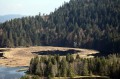
 Lac de Lispach and Rouge Feigne
 5.94 mi
 +1,230 ft
 -1,243 ft
 3h 50
3h 50
 Difficult
 Departure from La Bresse (Vosges)
Starting from Lake Lispach, this hike will take you through a variety of landscapes. From the peat bogs bordering Lake Lispach, you’ll see the Vosges forest and even some stubble fields at Rouge Feigne at an altitude of over 1,100 metres. The return journey along the mountainside will convince you that the Vosges are not just mountains for cows... Please note: some sections are tricky, particularly for those prone to vertigo or in wet or icy conditions.
⚠️ 27/05/2026: The Diehlaine trail between (4) and (2) is currently closed for safety works.If this trail reopens, please do let us know in the comments section for this hike.
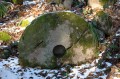
The quarries of Buhl
 3.74 mi
+728 ft
-699 ft
2h 20
3.74 mi
+728 ft
-699 ft
2h 20
 Easy
Departure from Buhl (Haut-Rhin) (Haut-Rhin)
Easy
Departure from Buhl (Haut-Rhin) (Haut-Rhin)
This hike could also be called 'Les Balcons de Buhl' (the Buhl balconies). It crosses the Buhlois vineyard, offering magnificent views of the Florival and the Grand Ballon. An additional point of interest is that the circuit crosses old abandoned red sandstone quarries in the Vosges.
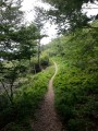
Towards Rainkopf
 3.93 mi
+988 ft
-984 ft
2h 40
Easy
Departure from Wildenstein (Haut-Rhin)
3.93 mi
+988 ft
-984 ft
2h 40
Easy
Departure from Wildenstein (Haut-Rhin)
A hike on and below the great ridge in an almost alpine setting, offering breathtaking views of the Munster Valley.
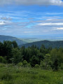
The Lac du Grand Ballon and waterfall of Kletterbach
 5.35 mi
+991 ft
-981 ft
3h 20
5.35 mi
+991 ft
-981 ft
3h 20
 Average
Departure from Lautenbachzell (Haut-Rhin)
Average
Departure from Lautenbachzell (Haut-Rhin)
An original route to get to Lac du Grand Ballon avoiding the road. You will discover beautiful trees, a waterfall and views over the Petit Ballon and the Black Forest along the way.
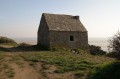
The Lude Valley and the Vauban Cabin from Carolles
 3.13 mi
+456 ft
-427 ft
1h 50
Easy
Departure from Carolles (Manche)
3.13 mi
+456 ft
-427 ft
1h 50
Easy
Departure from Carolles (Manche)
A short hike along the sea in a protected environment and with beautiful views of the bay of Mont Saint Michel.
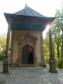
The ruins of Hohrupf
 3.82 mi
+1,270 ft
-1,273 ft
2h 50
Average
Departure from Murbach (Haut-Rhin)
3.82 mi
+1,270 ft
-1,273 ft
2h 50
Average
Departure from Murbach (Haut-Rhin)
The hike starts in Murbach and allows you to discover several attractions in the valley: Murbach Abbey, the Notre Dame de Lorette Chapel and the ruins of an ancient castle, the Hohrupf.
The Fuchsfelsen and the Belacker
 6.99 mi
+2,188 ft
-2,185 ft
5h 05
Average
Departure from Haut-Rhin
6.99 mi
+2,188 ft
-2,185 ft
5h 05
Average
Departure from Haut-Rhin
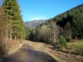
This hike offers magnificent views of the Doller Valley and the Ballon d'Alsace on a former volcanic massif.
From Sewen to Lake Alfeld
 3.99 mi
+384 ft
-387 ft
2h 10
Easy
Departure from Sewen (Haut-Rhin)
3.99 mi
+384 ft
-387 ft
2h 10
Easy
Departure from Sewen (Haut-Rhin)
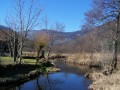
A peaceful hike that will take you to Sewen Lake and its peat bogs, then to Alfeld Lake, which is very different with its dam. The path is flat until you reach the foot of the dam, then climbs a little.
The Ballon d'Alsace from Lake Alfeld
 7.54 mi
+2,621 ft
-2,664 ft
5h 45
Difficult
Departure from Sewen (Haut-Rhin)
7.54 mi
+2,621 ft
-2,664 ft
5h 45
Difficult
Departure from Sewen (Haut-Rhin)
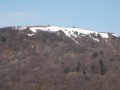
A short distance but a steep climb await you. This is therefore a fairly challenging hike. The main attraction of the hike is discovering the steep slopes of the Vosges on the Alsace side. The summit of Ballon d'Alsace is accessible by car.
Around the Lac des Perches
 6.16 mi
+1,923 ft
-1,896 ft
4h 30
Average
Departure from Rimbach-près-Masevaux (Haut-Rhin)
6.16 mi
+1,923 ft
-1,896 ft
4h 30
Average
Departure from Rimbach-près-Masevaux (Haut-Rhin)
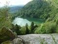
This walk takes you to the Lac des Perches ; a lake that nestles at the bottom of a very steep-sided cirque. Then the path leads you on to a stubble field where there is a very beautiful view over the valley of the Doller and even of the Alps when the sky is clear.
The Sudel from Masevaux
 4.43 mi
+1,473 ft
-1,463 ft
3h 20
Average
Departure from Masevaux (Haut-Rhin)
4.43 mi
+1,473 ft
-1,463 ft
3h 20
Average
Departure from Masevaux (Haut-Rhin)
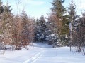
Starting from Masevaux, this hike will take you to Sudel, the south-eastern tip of the Vosges. It offers a beautiful view of the Belfort area, the Jura and the Alps. The hike is not difficult, there is just a slight incline.
From Masevaux to Rossberg
 9.96 mi
+2,874 ft
-2,874 ft
7h 05
Difficult
Departure from Masevaux (Haut-Rhin)
9.96 mi
+2,874 ft
-2,874 ft
7h 05
Difficult
Departure from Masevaux (Haut-Rhin)
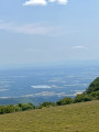
This beautiful hike takes you from Masevaux to the summit of Rossberg at an altitude of 1,191 metres. From the top, you can enjoy magnificent views of the Vosges, the Alsace plain, the Black Forest, the Jura and the Alps. The elevation gain is significant, but the route is otherwise easy.
The Lakes of Neuweiher and Gresson
 5.00 mi
+1,345 ft
-1,348 ft
3h 30
Easy
Departure from Rimbach-près-Masevaux (Haut-Rhin)
5.00 mi
+1,345 ft
-1,348 ft
3h 30
Easy
Departure from Rimbach-près-Masevaux (Haut-Rhin)
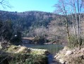
In the Doller valley, this walk will let you discover the lakes of Neuweiher and some of the most beautiful landscapes in the Vosges. It's an easy walk and accessible to anyone.
Around Lake Kruth
 3.45 mi
+30 ft
-30 ft
1h 35
Easy
Departure from Kruth (Haut-Rhin)
3.45 mi
+30 ft
-30 ft
1h 35
Easy
Departure from Kruth (Haut-Rhin)
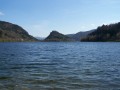
More of a Sunday stroll than a real hike, this trail around Lake Kruth-Wildenstein, which is accessible to people with disabilities, will give you a breath of fresh air. It is particularly pleasant in summer when it is very hot in the valley.
The source of the Doller at the start of the Lachtelweiher
 5.17 mi
+1,142 ft
-1,155 ft
3h 20
Average
Departure from Haut-Rhin
5.17 mi
+1,142 ft
-1,155 ft
3h 20
Average
Departure from Haut-Rhin
This hike will take you to the Source de la Doller, which, contrary to what you might think, does not originate at the Ballon d'Alsace, but below the Schlumpf. During the hike, you will enjoy beautiful views of the Doller valley and have the opportunity to eat at one of the farmhouse inns along the route.
A quick tour of the Ballon d'Alsace
 1.65 mi
+249 ft
-249 ft
1h 00
Easy
Departure from Lepuix (Territoire-de-Belfort)
1.65 mi
+249 ft
-249 ft
1h 00
Easy
Departure from Lepuix (Territoire-de-Belfort)
The ultimate Sunday outing for Belfort residents! In good weather, this short circuit allows you to get a breath of fresh air accompanied by a magnificent view of the Vosges, the Jura and the Alps (you can even see Mont Blanc on a very clear day!).
The Dent d'Oche from the start of the Fetiuère
 4.20 mi
+3,271 ft
-3,274 ft
4h 45
Difficult
Departure from Bernex (Haute-Savoie)
4.20 mi
+3,271 ft
-3,274 ft
4h 45
Difficult
Departure from Bernex (Haute-Savoie)
This hike takes you to the Dent d'Oche. From this distinctive peak overlooking Lake Geneva, you can enjoy a magnificent 360° panorama of the Lake Geneva basin, the Jura and the Alps, including the Dents du Midi and the Mont Blanc massif. It's a difficult and exposed route, but the reward is well worth the effort when you reach the top!
Gaube lake and Oulettes de Gaube refuge
 9.68 mi
+2,329 ft
-2,326 ft
6h 30
Average
Departure from Cauterets (Hautes-Pyrénées)
9.68 mi
+2,329 ft
-2,326 ft
6h 30
Average
Departure from Cauterets (Hautes-Pyrénées)
Departing from Le Pont d'Espagne, this moderately demanding hike will take you into the Pyrenees National Park to discover Lac de Gaube and the Oulettes de Gaube refuge, from where you can admire the Vignemale, the highest peak in the Pyrenees at 3298m. If you're lucky, you might even spot some marmots.
Towards the lakes of Embarrat, Pourtet and Nère
 12.19 mi
+3,274 ft
-3,241 ft
8h 25
Difficult
Departure from Cauterets (Hautes-Pyrénées)
12.19 mi
+3,274 ft
-3,241 ft
8h 25
Difficult
Departure from Cauterets (Hautes-Pyrénées)
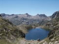
This hike, starting from Pont d'Espagne, will take you to the heart of the Pyrenees National Park. You will follow the Marcadau valley to reach the lakes of Embarrat, Pourtet and Nère at an altitude of over 2,400 metres.
Bionnassay Glacier footbridge - Col de Voza
 4.54 mi
+1,391 ft
-1,391 ft
3h 20
Average
Departure from Saint-Gervais-les-Bains (Haute-Savoie)
4.54 mi
+1,391 ft
-1,391 ft
3h 20
Average
Departure from Saint-Gervais-les-Bains (Haute-Savoie)
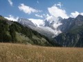
This hike is not particularly difficult, despite one slightly steep section, and will take you to the foot of the terminal tongue of the Bionnassay Glacier, then to the Col de Voza. All along the way, you will enjoy magnificent views of the Bionnassay Glacier, then the Chamonix Valley and the Mont Blanc Massif.
The Jovet lakes
 9.43 mi
+3,310 ft
-3,310 ft
7h 15
Average
Departure from Les Contamines-Montjoie (Haute-Savoie)
9.43 mi
+3,310 ft
-3,310 ft
7h 15
Average
Departure from Les Contamines-Montjoie (Haute-Savoie)
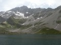
On the border between the Mont Blanc, Beaufortain and Tarentaise massifs, this hike will take you through alpine pastures to discover the Lacs Jovets at an altitude of over 2,100 metres.
Moreau Falls
 4.04 mi
+781 ft
-774 ft
2h 30
Average
Departure from Goyave (Guadeloupe)
4.04 mi
+781 ft
-774 ft
2h 30
Average
Departure from Goyave (Guadeloupe)
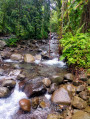
This hike will take you into the heart of Guadeloupe's tropical rainforest. The trail leads to the Moreau Falls, where you can swim.
Access is prohibited by municipal decree until further notice due to an extremely high risk of rockfalls and mudslides. See here.
La Soufrière
 3.96 mi
+1,739 ft
-1,722 ft
3h 20
Difficult
Departure from Saint-Claude (Guadeloupe) (Guadeloupe)
3.96 mi
+1,739 ft
-1,722 ft
3h 20
Difficult
Departure from Saint-Claude (Guadeloupe) (Guadeloupe)
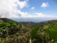
This hike takes you to La Soufrière, the highest point in Guadeloupe and a dormant volcano. In good weather, the view is magnificent. At the summit, you can truly appreciate the power that lies beneath your feet.
Please note that a large section of this trail is currently closed due to the risk of rockfalls and increased volcanic activity.
Pointe des Châteaux
 0.78 mi
+82 ft
-85 ft
0h 25
Easy
Departure from Saint-François (Guadeloupe) (Guadeloupe)
0.78 mi
+82 ft
-85 ft
0h 25
Easy
Departure from Saint-François (Guadeloupe) (Guadeloupe)
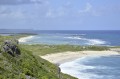
Facing the trade winds, Pointe des Châteaux bears the brunt of the waves that have crossed the Atlantic. It is the western tip of Guadeloupe. This route is more of a short stroll than a real hike.
Pointe du Souffleur
 4.55 mi
+614 ft
-604 ft
2h 40
Average
Departure from Anse-Bertrand (Guadeloupe)
4.55 mi
+614 ft
-604 ft
2h 40
Average
Departure from Anse-Bertrand (Guadeloupe)
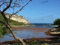
A trail runs along the coastal cliffs, offering views of blowholes: geyser-like formations created by the waves and holes in the rocks.
Le Piolit
 9.60 mi
+3,793 ft
-3,793 ft
7h 45
Difficult
Departure from Ancelle (Hautes-Alpes)
9.60 mi
+3,793 ft
-3,793 ft
7h 45
Difficult
Departure from Ancelle (Hautes-Alpes)
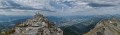
A challenging hike in the hills above Ancelle. A very pretty hike with an initial climb through the woods, then the vegetation thins out to reveal breathtaking views of Lake Serre-Ponçon, the Gapençais basin and even Mont Ventoux. 360° view from the summit.
La Dôle from Les Dappes
 4.16 mi
+1,424 ft
-1,427 ft
3h 10
Average
Departure from Prémanon (Jura)
4.16 mi
+1,424 ft
-1,427 ft
3h 10
Average
Departure from Prémanon (Jura)
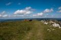
Without doubt, the shortest path up to the summit of La Dôle (1677m altitude) from the French side of the border. In good weather, the views are breathtaking and go on for over 250km: from the Swiss Alps to Mont Blanc and on to the Vanoise and the Ecrins, all of this with plunging views down over Geneva and its lake.
The Grand Ballon by a lake and waterfalls
 9.65 mi
+2,589 ft
-2,569 ft
6h 40
Difficult
Departure from Lautenbachzell (Haut-Rhin)
9.65 mi
+2,589 ft
-2,569 ft
6h 40
Difficult
Departure from Lautenbachzell (Haut-Rhin)
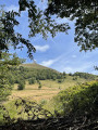
Above Lautenbachzell, this day hike will take you through several different landscapes of the Vosges: orchards and villages in the valley, pine forests, beech woods and stumps. You will reach the Grand Ballon, the highest peak in the Vosges, after walking along the Lac du Grand Ballon and passing near waterfalls.
Montbert Forest and Chauvet Lake
 4.45 mi
+354 ft
-361 ft
2h 20
Easy
Departure from Picherande (Puy-de-Dôme)
4.45 mi
+354 ft
-361 ft
2h 20
Easy
Departure from Picherande (Puy-de-Dôme)
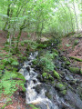
An easy family hike with beautiful views of the Monts Dore (Sancy Massif), the Cantal and, of course, Lake Chauvet.
Puy de Sancy from the Super-Besse cable cars
 2.75 mi
+692 ft
-689 ft
1h 50
Average
Departure from Chambon-sur-Lac (Puy-de-Dôme)
2.75 mi
+692 ft
-689 ft
1h 50
Average
Departure from Chambon-sur-Lac (Puy-de-Dôme)
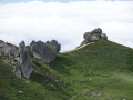
Relatively easy access to the summit of the Massif Central, which offers spectacular views. Please note that to reach the starting point of this circuit, you will need to take the Super-Besse cable cars, which are subject to a charge.
The main monuments of Paris along the Seine
 5.12 mi
+26 ft
-30 ft
2h 25
Easy
Departure from Paris
5.12 mi
+26 ft
-30 ft
2h 25
Easy
Departure from Paris
This urban but relatively open route allows you to discover the main monuments of Paris on foot. You will see the Eiffel Tower, the Louvre and Notre-Dame Cathedral, among others. The start and finish points are accessible by underground.
Long tour of the Caravelle Peninsula Nature Reserve
 5.71 mi
+837 ft
-846 ft
3h 20
Average
Departure from La Trinité (Martinique) (Martinique)
5.71 mi
+837 ft
-846 ft
3h 20
Average
Departure from La Trinité (Martinique) (Martinique)
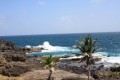
This hike takes you through a variety of landscapes, allowing you to discover the Caravelle Peninsula Nature Reserve and its endemic flora and fauna. In just a few dozen metres, you will go from the Atlantic coast, battered by the waves, to the calm of the mangroves.
Short route of the Caravelle Peninsula Nature Reserve
1.63 mi
+217 ft
-226 ft
0h 55
Easy
Departure from La Trinité (Martinique) (Martinique)
On the Caravelle Peninsula, this short route will allow you to discover the mangrove, a very special environment where the forest extends over the sea.
The "megaliths" of Steinberg
 1.03 mi
+161 ft
-161 ft
0h 35
Easy
Departure from Luttenbach-près-Munster (Haut-Rhin)
1.03 mi
+161 ft
-161 ft
0h 35
Easy
Departure from Luttenbach-près-Munster (Haut-Rhin)
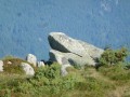
A short and easy hike that will allow you to discover the imposing granite ‘megaliths’ of the Steinberg, with views stretching far into the distance. Ideal after a meal at one of the farmhouse inns near the Petit Ballon.
Le Petit Ballon without too much climbing
 1.41 mi
+358 ft
-358 ft
1h 00
Easy
Departure from Sondernach (Haut-Rhin)
1.41 mi
+358 ft
-358 ft
1h 00
Easy
Departure from Sondernach (Haut-Rhin)
The aim of this hike is to reach the Petit Ballon with as little climbing as possible. Due to its position, away from the other peaks of the Vosges, the view stretches far into the distance.
The Kapor Trail
 4.97 mi
+1,240 ft
-1,240 ft
3h 20
Difficult
Departure from Sainte-Rose (La Réunion) (Réunion)
4.97 mi
+1,240 ft
-1,240 ft
3h 20
Difficult
Departure from Sainte-Rose (La Réunion) (Réunion)
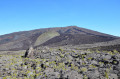
This trail, laid out in the Enclos Fouqué, allows you to immerse yourself in the mineral landscapes of Piton de la Fournaise, with a distance and elevation gain that remain accessible to most people. You will discover several types of lava: cordée, grattons, scories, etc., and cross relatively recent lava flows (2016).
Please note that this hike is not accessible in the event of a volcanic eruption (which have been relatively frequent in the 2010s). Check in advance.
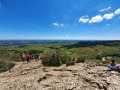
Ascent of the Roche de Solutré
 2.02 mi
+476 ft
-476 ft
1h 20
Easy
Departure from Solutré-Pouilly (Saône-et-Loire)
2.02 mi
+476 ft
-476 ft
1h 20
Easy
Departure from Solutré-Pouilly (Saône-et-Loire)
A family hike offering magnificent views of the Mâconnais vineyards and, if the sky is clear, much further afield towards the Mont Blanc Massif.
Hinteres Alpjoch circular loop
 2.63 mi
+1,795 ft
-1,818 ft
2h 45
Average
Departure from Imst (Bezirk Imst)
2.63 mi
+1,795 ft
-1,818 ft
2h 45
Average
Departure from Imst (Bezirk Imst)
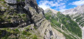
A hike that’s a bit challenging in places but offers magnificent views over much of Tyrol. Please note that access to the start is via a cable car for which a fare is charged.
Rovijokfossen
 0.23 mi
+105 ft
-105 ft
0h 10
Difficult
Departure from Norway
0.23 mi
+105 ft
-105 ft
0h 10
Difficult
Departure from Norway
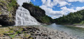
A very short hike down to Rovijokfossen, a 28-metre-high waterfall.
Panoramic view of Kiruna and its iron mine
 1.11 mi
+479 ft
-476 ft
0h 55
Easy
Departure from Sweden
1.11 mi
+479 ft
-476 ft
0h 55
Easy
Departure from Sweden
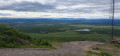
A short walk offering a 360° panoramic view of Kiruna, its gigantic iron ore mine and the vast Lapland landscapes.
The Lapland Gate
 10.52 mi
+705 ft
-712 ft
5h 25
Average
Departure from Sweden
10.52 mi
+705 ft
-712 ft
5h 25
Average
Departure from Sweden
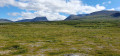
Starting from Abisko, this hike offers magnificent views of Lake Tornetrask, the Lapland Gate and the surrounding mountains. You will pass through birch forests and tundra landscapes and follow a river. It also crosses a reconstruction of a Sami camp. There are no significant difficulties, apart from the distance.
Panorama of the Lofoten Islands
 3.89 mi
+1,617 ft
-1,601 ft
3h 10
Average
Departure from Norway
3.89 mi
+1,617 ft
-1,601 ft
3h 10
Average
Departure from Norway
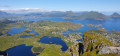
This hike offers magnificent views of the Lofoten Islands on a clear day. If you are not sure of your footing, be careful, as some sections are on scree and the descent is a little slippery.
Bacon Rind Creek
 6.39 mi
+955 ft
-955 ft
3h 45
Average
Departure from United States
6.39 mi
+955 ft
-955 ft
3h 45
Average
Departure from United States
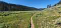
This is a round-trip route in a wide, partially shaded valley on the edge of Yellowstone National Park. It is not particularly difficult and can be adapted to suit your preferences.
Mammoth Terraces
 0.71 mi
+118 ft
-121 ft
0h 25
Easy
Departure from United States
0.71 mi
+118 ft
-121 ft
0h 25
Easy
Departure from United States
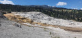
A short trail through the Mammoth Hot Springs in Yellowstone National Park. These springs have deposited calcium carbonate, which gives them their characteristic white colour and creates basins and platforms.
Norris Geyser Basin
 0.92 mi
+105 ft
-102 ft
0h 30
Easy
Departure from United States
0.92 mi
+105 ft
-102 ft
0h 30
Easy
Departure from United States
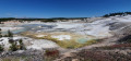
A trail in Norris Geyser Basin. Access is easy and the route allows you to discover numerous geysers and hot springs. All this with the forest and mountains of Yellowstone National Park in the background.
Artists Paintpots
 1.06 mi
+105 ft
-105 ft
0h 35
Average
Departure from United States
1.06 mi
+105 ft
-105 ft
0h 35
Average
Departure from United States
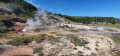
This place is aptly named: the colours are very varied at Artists Paintpots, contrasting with other geysers nearby. The route is easily accessible and does not present any particular difficulties.
Artist Point and Yellowstone River
 0.22 mi
+30 ft
-26 ft
0h 10
Easy
Departure from United States
0.22 mi
+30 ft
-26 ft
0h 10
Easy
Departure from United States
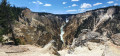
A very short walk to admire the Yellowstone River Canyon and its waterfall. The trail is well-maintained and safe, and as with many places in Yellowstone, parking is readily available.
The ghost town of Bodie
 0.79 mi
+30 ft
-30 ft
0h 25
Easy
Departure from United States
0.79 mi
+30 ft
-30 ft
0h 25
Easy
Departure from United States
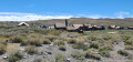
Bodie is a ghost town that has been partially preserved in a very hostile environment. Its creation is linked to the discovery of gold. You can wander freely around the town to discover some iconic buildings such as the school. Please note that there is an admission fee.