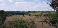
The Lude Valley

A round trip to the sea following the Lude, a small river which flows into the Bay of Mont Saint-Michel. Its valley is said to have been created by the Archangel Saint Michael, who, whilst fighting the dragon, is said to have struck it with his sword so powerfully that he carved a deep gash into the rock.

Details

95415521
Creation:
Last update:
Last review:
  • Walking
    Activity: Walking
  • ↔
    Distance: 1.04 mi
  • ◔
    Average duration: 0h 35 
  • ▲
    Difficulty: Easy

  • ⚐
    Back to start: Yes
  • ↗
    Ascent: + 141 ft
  • ↘
    Descent: - 141 ft

  • ▲
    Highest point: 167 ft
  • ▼
    Lowest point: 26 ft
  • ⚐ Country: France
  • ⚐ City: Carolles (50740|)
  • ⚑
    Start/End: N 48.747772° / W 1.563805°
  • ❏
    IGN map(s): Ref. 1215ET
  • Hour-by-hour weather

Photos

Description of the walk

Park in the car park signposted “Vallée du Lude” in Carolles.

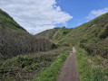
(S/E) Set off due west and head down into the forest of the Lude Valley.

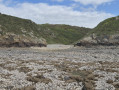
(1) At the junction, turn right and follow the River Lude. The path is sometimes fitted with wooden walkways. Carry on, ignoring the paths on either side, until you reach Port du Lude and its pebble beach. At low tide, the rocks are exposed and you can find various shells there.

(2) Return to the car park (S/E) by following the route in reverse.

Waypoints

  1. S/E : mi 0 - alt. 167 ft - Car park - Lude (fleuve) - Manche
  2. 1 : mi 0.16 - alt. 82 ft - Path junction
  3. 2 : mi 0.53 - alt. 26 ft - Port du Lude
  4. S/E : mi 1.04 - alt. 167 ft - Car park - Vallée du Lude

Notes

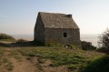
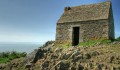
There are several alternative routes easily accessible for the return journey, including one via the Cabane Vauban. This involves a bit of an uphill climb.

Other walks in the area

For more walks, use our search engine .

The GPS track and description are the property of this route's author. Please do not copy them without permission.