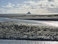
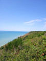
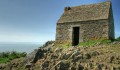
The Grouin du Sud as seen from its car park

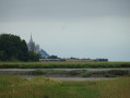
A very short round trip to see Mont Saint-Michel from the Grouin du Sud. It is best to do this walk at high tide, one or two hours before the tide is at its peak, so that you can watch it come in and cover the sand.

Details

95415365
Creation:
Last update:
Last review:
  • Walking
    Activity: Walking
  • ↔
    Distance: 0.42 mi
  • ◔
    Average duration: 0h 15 
  • ▲
    Difficulty: Easy

  • ⚐
    Back to start: Yes
  • ↗
    Ascent: + 33 ft
  • ↘
    Descent: - 33 ft

  • ▲
    Highest point: 59 ft
  • ▼
    Lowest point: 26 ft
  • ⚐ Country: France
  • ⚐ City: Vains (50300)
  • ⚑
    Start/End: N 48.656477° / W 1.444702°
  • ❏
    IGN map(s): Ref. 1215ET
  • Hour-by-hour weather

Photos

Description of the walk

Park in the car park signposted at the side of the Route du Grouin du Sud (C7).

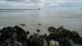
(S/E) Follow the path southwards, then turn right onto the small rocky headland. At the end of it, the view stretches across much of the Bay of Mont Saint-Michel.

(1) Retrace your steps back to the car park (S/E).

Waypoints

  1. S/E : mi 0 - alt. 59 ft - Grouin du Sud car park
  2. 1 : mi 0.21 - alt. 26 ft - Le Grouin du Sud
  3. S/E : mi 0.42 - alt. 59 ft - Grouin du Sud car park

Notes

Warning
Venturing onto the sand at low tide without a professional guide is dangerous (quicksand, sandbanks and the rising tide). Do not stray from the headland if you go down onto the sand.

Worth a visit

Other walks in the area

For more walks, use our search engine .

The GPS track and description are the property of this route's author. Please do not copy them without permission.