Hinteres Alpjoch circular loop

A hike that’s a bit challenging in places but offers magnificent views over much of Tyrol. Please note that access to the start is via a cable car for which a fare is charged.

Details

37383075
Creation:
Last update:
Last review:
  • Walking
    Activity: Walking
  • ↔
    Distance: 2.63 mi
  • ◔
    Average duration: 2h 45 
  • ▲
    Difficulty: Moderate

  • ⚐
    Back to start: Yes
  • ↗
    Ascent: + 1,795 ft
  • ↘
    Descent: - 1,818 ft

  • ▲
    Highest point: 7,890 ft
  • ▼
    Lowest point: 6,293 ft

Photos

Description of the walk

Drive to Hoch-Imst. You’ll find a large free car park there. From there, you can reach the start of the hike via two consecutive cable cars. See the practical information section for fares.
Take the first cable car: the Untermarkter Alm Bahn, then the second one, which departs right next to the arrival point of the first: the Alpjoch Bahn. In about fifteen minutes, you’ll reach the start of the hike, at an altitude of 2,020 metres.

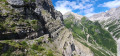
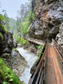
(S/E) As you exit the cable car, follow the path on your right. A sign points towards the Muttekopfhütte, a 45-minute walk away. Go down the few steps and follow the path as it gradually curves to the left. You’ll reach a designated viewpoint, then pass through the turnstile and set off along the cliff face. The path is then fitted with a handrail for a few hundred metres, and some sections are quite vertiginous. Once you’ve passed these tricky sections, cross the Malbach via wooden bridges and admire the waterfall above. You’ll then reach the Muttekopfhütte.

(1) Take the path furthest to the left, which climbs gradually as it follows the valley. Continue until you reach a flat area.

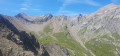
(2) Turn left and wade across the stream. From here, look out for the red and white markings on the rocks and the cairns. Follow the path, which isn’t always very well marked amongst the scree of varying sizes, and which becomes increasingly steep. Make your way up a few switchbacks between the overhanging rocks and reach the ridge. Apart from one section where you’ll need to use your hands, this stretch – although impressive when viewed from below – is far less vertiginous than at the start of the route.

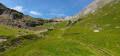
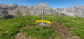
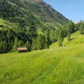
(3) Turn right and follow the path through the mountain pastures. Reach the summit, the Hinteres Alpjoch (2,425 m), a few hundred metres further on.

(4) Turn back and stay on the path that descends through the mountain pastures towards the cable car visible below, and return to the previous junction.

(3) Carry on straight ahead, leaving the path you took on the way up to your left. At the next junction, turn left. Finally, take a slight detour to the left to reach the Vorderes Alpjoch (2,121 m). Follow the few fairly steep hairpin bends to reach the top station of the Alpjochbahn (S/E).

Waypoints

  1. S/E : mi 0 - alt. 6,637 ft - Alpjochbahn top station
  2. 1 : mi 0.73 - alt. 6,358 ft - Muttekopfhütte
  3. 2 : mi 1.05 - alt. 6,791 ft - Flat section
  4. 3 : mi 1.52 - alt. 7,631 ft - Crossroads of the circular loop
  5. 4 : mi 1.71 - alt. 7,887 ft - Hinteres Alpjoch
  6. S/E : mi 2.63 - alt. 6,637 ft - Alpjochbahn top station

Notes

Cable car fares are available via the following link
For timetables
You’ll need to buy a return ticket for sections 1 and 2.

In wet weather, certain sections of this walk can be very slippery, particularly at the start, but also on the descent. This can make the walk extremely difficult. In snowy conditions, it is impassable without specialist equipment and sufficient experience.

In any case, good walking boots and plenty of water are essential. This is a fairly exposed, almost high-mountain route, and weather conditions can change rapidly. However, it is manageable with older children (we completed it with a 9-year-old).

Worth a visit

You can get something to eat and find shelter at the Muttekopfhütte. More information at

Fun fact: on the way down, you can take the summer toboggan run instead of section 1 of the cable car. It’s 3.5 km long. There’s no extra charge. Leave your rucksack at the midway station; the staff will take it down for you, as you can’t take it with you on the toboggan run. Please note, however, that the wait can be long, so remember to take a numbered ticket from the information point next to the toboggan run’s starting point to avoid waiting unnecessarily in the queue.

Reviews and comments

5 / 5
Based on 2 reviews

Reliability of the description
5 / 5
Ease of following the route
5 / 5
Route interest
5 / 5
User 26834813

Overall rating : 5 / 5

Date of your route : Aug 19, 2025
Reliability of the description : ★★★★★ Very good
Ease of following the route : ★★★★★ Very good
Route interest : ★★★★★ Very good
Very busy route : No

We didn't see all the signs and did the circuit in the opposite direction, without any major problems in dry weather. In rainy weather, it is advisable to do the circuit in the recommended direction. Depending on your departure time, it may be a good idea to eat at the refuge around 12-2 p.m. (and therefore do the circuit in either direction). The staff are very friendly and the prices are reasonable.
The route is very beautiful and the scenery is magnificent. Some sections are reminiscent of high mountains and can be quite dizzying.

Machine-translated

Bixlid
Bixlid

Overall rating : 5 / 5

Date of your route : Jul 21, 2024
Reliability of the description : ★★★★★ Very good
Ease of following the route : ★★★★★ Very good
Route interest : ★★★★★ Very good
Very busy route : No

Great hike, a bit strenuous but nothing insurmountable. The scenery is magnificent and well worth the effort involved in the climb.

Machine-translated

Other walks in the area

For more walks, use our search engine .

The GPS track and description are the property of this route's author. Please do not copy them without permission.