The Cabezo de Piqueras, starting from the Puerto de Piqueras

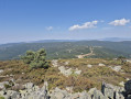
Starting from Puerto de Piqueras (road pass), this hike, which presents no major difficulties, takes you to the Cabezo de Piqueras in the Sierra Cebollera, at an altitude of over 1,900 metres. At the summit, the 360° view stretches for miles.

Details

104376362
Creation:
Last update:
Last review:
  • Walking
    Activity: Walking
  • ↔
    Distance: 1.65 mi
  • ◔
    Average duration: 1h 25 
  • ▲
    Difficulty: Easy

  • ⚐
    Back to start: Yes
  • ↗
    Ascent: + 712 ft
  • ↘
    Descent: - 712 ft

  • ▲
    Highest point: 6,319 ft
  • ▼
    Lowest point: 5,607 ft

Photos

Description of the walk

Park at Puerto de Piqueras, a mountain pass on the N-111A. There is plenty of space.

(S/E) Set off along a grassy path between some trees, heading north-west.

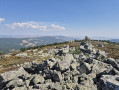
(1) You’ll soon come to a more clearly marked path; follow it to the left. Continue for a few hundred metres until you reach a larger, flat grassy area, then cross the fence. Follow this fence to the summit. The path occasionally passes through very low, fairly dense vegetation. The highest point is marked by a clearly visible, cemented geodetic marker.

(2) Take the same path as on the way up, but in the opposite direction, to return to the starting pass (S/E).


Waypoints

  1. S/E : mi 0 - alt. 5,607 ft - Puerto de Piqueras (1710 m)
  2. 1 : mi 0.08 - alt. 5,646 ft - T-junction
  3. 2 : mi 0.82 - alt. 6,319 ft - Cabezo de Piqueras (1931 m)
  4. S/E : mi 1.65 - alt. 5,607 ft - Puerto de Piqueras (1710 m)

For more walks, use our search engine .

The GPS track and description are the property of this route's author. Please do not copy them without permission.