
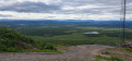
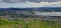
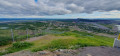
Panoramic view of Kiruna and its iron mine

A short walk offering a 360° panoramic view of Kiruna, its gigantic iron ore mine and the vast Lapland landscapes.

Details

56743786
Creation:
Last update:
Last review:
  • Walking
    Activity: Walking
  • ↔
    Distance: 1.11 mi
  • ◔
    Average duration: 0h 55 
  • ▲
    Difficulty: Easy

  • ⚐
    Back to start: Yes
  • ↗
    Ascent: + 479 ft
  • ↘
    Descent: - 476 ft

  • ▲
    Highest point: 2,402 ft
  • ▼
    Lowest point: 1,919 ft

Photos

Description of the walk

Park in the car park at the foot of the ski lifts.

(Start/Finish) Go round the back of the chairlift and take the path that climbs to the right. This joins a road (or rather, what remains of it). Carry on until you reach a ski run, then turn left and follow it until you rejoin the road on the left. 50 metres further on, follow the path to the right, which will take you to the summit of Luossavaara. Please note: there are several marked downhill mountain-bike trails; ignore them.

(1) “At the summit, admire the view to the south towards Mount Kiirunavaara, which has been completely scarred by the mining of the iron ore vein running through it, as well as its entirely industrial surroundings. In the distance, to the west, you can make out the mountains, notably Kebnekaise, Sweden’s highest peak at 2,097 metres. And at the foot of Luossavaara, which has also been scarred by iron ore mining, look out over the town of Kiruna, part of which – at risk of collapse – is currently being rebuilt at a slightly safer distance. Then head back down via the track, the start of which is situated between the large building at the summit and an old ski lift (S/E).


Waypoints

  1. S/E : mi 0 - alt. 1,923 ft - Car park
  2. 1 : mi 0.65 - alt. 2,388 ft - Luossavaara
  3. S/E : mi 1.11 - alt. 1,926 ft - Car park

Notes

The landscape changes very quickly here; very recent alterations to the ski runs were visible and the path didn’t seem to be properly maintained. Its route is likely to change. That said, the summit isn’t very high and is clearly visible from below: you’ll easily find an alternative route should the path described here disappear.

Worth a visit

If you’re interested in visiting the world’s largest underground iron mine, it’s possible to do so. See here for an excellent supplement to this walk.

For more walks, use our search engine .

The GPS track and description are the property of this route's author. Please do not copy them without permission.