


Refine your search for walks in Saint-Perreux
Saint-Perreux walks


 Bailey Bridge seen from Saint-Perreux
 Visorando Member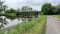
 5.64 mi
 +20 ft
 -16 ft
 2h 35
2h 35
 Easy
Easy
 Departure from Saint-Perreux (Morbihan)
A pleasant route along the Oust and the Arz, ideal for anglers.
The tour of Île aux Pies, starting from La Potinais
 13.25 mi
+492 ft
-492 ft
6h 30
13.25 mi
+492 ft
-492 ft
6h 30
 Difficult
Departure from Saint-Vincent-sur-Oust (Morbihan)
Difficult
Departure from Saint-Vincent-sur-Oust (Morbihan)
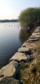
To cross the geological fold that extends the Landes de Lanvaux, the Oust has carved its way through the rocky plateau to wind its way through the Île aux Pies gorge. Upstream, at the confluence of the Oust and the Aff, the alluvial plain is sometimes dry, sometimes covered in water. You need to choose the right time to set off. Early spring seems to be the best season to fully enjoy the landscapes you pass through... without getting your feet wet.
Île aux Pies and Vallée de l'Oust
 19.02 mi
+719 ft
-719 ft
9h 20
Difficult
Departure from Redon (Ille-et-Vilaine)
19.02 mi
+719 ft
-719 ft
9h 20
Difficult
Departure from Redon (Ille-et-Vilaine)
Discover the Oust Valley and the Nantes-Brest Canal, near Redon, and Bains-sur-Oust with this circular route that combines towpaths, forest paths and communal roads.
A few high points will give you a magnificent view of Île aux Pies and the Oust Valley.
Saint-Vincent-sur-Oust Day 1/2
 11.26 mi
+387 ft
-361 ft
5h 30
11.26 mi
+387 ft
-361 ft
5h 30
 Moderate
Departure from Saint-Vincent-sur-Oust (Morbihan)
Moderate
Departure from Saint-Vincent-sur-Oust (Morbihan)
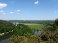
This first day of a two-day route will take us up the River Oust via the upper reaches. We’ll be walking above the river, offering lovely views of Île aux Pies.
The final stretch will be mainly through woodland and meadows.
Along the Oust to discover the Chapel of Saint-Méen
 3.68 mi
+243 ft
-217 ft
1h 55
Easy
Departure from Bains-sur-Oust (Ille-et-Vilaine)
3.68 mi
+243 ft
-217 ft
1h 55
Easy
Departure from Bains-sur-Oust (Ille-et-Vilaine)
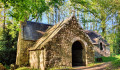
This circular walk allows you to enjoy the panoramic views of Île-aux-Pies, then head off in search of the Chapel of Saint-Méen, the last remaining vestige of the former Abbey of Busal.
It is a place to connect with nature, silence and serenity.
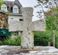
Short circular around Moulin de Quip
 3.04 mi
+177 ft
-187 ft
1h 35
Easy
Departure from Allaire (Morbihan)
3.04 mi
+177 ft
-187 ft
1h 35
Easy
Departure from Allaire (Morbihan)
This is a gentle, enchanting walk that allows you to enjoy the woodland paths and the coolness of the long pond at the 18th-century Moulin de Quip mill.
From La Gacilly to the Chapel of Saint-Jugon via the Black Forest
 7.95 mi
+436 ft
-410 ft
4h 00
Moderate
Departure from La Gacilly (Morbihan)
7.95 mi
+436 ft
-410 ft
4h 00
Moderate
Departure from La Gacilly (Morbihan)
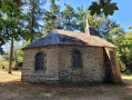
Starting from the marina, we begin by following the banks of the Aff, a charming little Breton river. Then, crossing the Forêt Neuve, we cross the Ruisseau des Brelles to enter the Forêt Noire. At the end of the path, we can stop for refreshments in the shade of the Chapelle Saint-Jugon.
The return journey is just as peaceful, taking the sunken lanes and ending up in the streets where the craftspeople's stalls are well worth stopping at.
Tour of the Étang du Val
4.49 mi
+233 ft
-240 ft
2h 15
Easy
Departure from Saint-Just (Ille-et-Vilaine) (Ille-et-Vilaine)
Walk around the Étang du Val, crossing the Lande de Cojoux and then skirting the Château du Val.
Around the Roho Mill and the Saint-Dolay marshes
4.58 mi
+335 ft
-308 ft
2h 25
Easy
Departure from Saint-Dolay (Morbihan)
Saint-Dolay features the typical landscapes of the region, though with a notable abundance of water and mills.This runoff and surface water has created marshes and ponds around the Moulin de Roho.This circular route is part ofthe PR®® known as the Boucle du Marais de Roho.
Étang du Val and megaliths in Saint-Just
 3.43 mi
+167 ft
-194 ft
1h 45
Easy
Departure from Saint-Just (Ille-et-Vilaine) (Ille-et-Vilaine)
3.43 mi
+167 ft
-194 ft
1h 45
Easy
Departure from Saint-Just (Ille-et-Vilaine) (Ille-et-Vilaine)
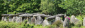
Walk along the Étang du Val, then along the river, under the cover of the forest, then climb up to the plateau in the moorland to explore the varied megaliths of this exceptional site. There are many paths on the site, offering numerous possible variations.
The Saint-Pierre Cross at the Saint-Just megalithic alignments
 1.18 mi
+75 ft
-75 ft
0h 35
Easy
Departure from Saint-Just (Ille-et-Vilaine) (Ille-et-Vilaine)
1.18 mi
+75 ft
-75 ft
0h 35
Easy
Departure from Saint-Just (Ille-et-Vilaine) (Ille-et-Vilaine)
It’s a short walk suitable for children and ideal for families, whatever the season.
This short circular loop runs along the western side of the Allée des Demoiselles de Cojoux, offering a view over the Étang du Val.
Adults can extend the walk by heading east to see the famous Demoiselles de Cojoux and the Alignements du Moulin.
Finally, it’s well worth rounding off the walk by exploring the magnificent Allée Couverte de Tréal, which is just a 3-minute drive away.
Roho moors and marshes
 6.71 mi
+453 ft
-459 ft
3h 30
Moderate
Departure from Saint-Dolay (Morbihan)
6.71 mi
+453 ft
-459 ft
3h 30
Moderate
Departure from Saint-Dolay (Morbihan)
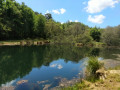
The village of Saint-Dolay overlooks the plateau that borders the south bank of the Vilaine. This flat landscape is cut by a valley with sometimes steep slopes, where the Moulin Neuf stream flows. While moors cover the slopes and heights of the valley, marshes and peat bogs cover the bottom. Add to this variety of vegetation a remarkable geological diversity, and you will have many reasons to explore this route.
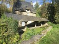
Rochefort-en-Terre and the slate quarries of Pluherlin
 9.32 mi
+577 ft
-551 ft
4h 45
Moderate
Departure from Malansac (Morbihan)
9.32 mi
+577 ft
-551 ft
4h 45
Moderate
Departure from Malansac (Morbihan)
Set amidst moors and woods, Rochefort-en-Terre, perched on a rocky outcrop, is one of the most beautiful villages in France. With its cobbled streets and stylish shop signs, the town is a little gem nestled in the heart of Morbihan. Starting from this village, enjoy a lovely walk along the ridges and through the old slate quarries of Pluherlin.The route is very varied, taking in moorland, woodland and ridges.Passing through the villages of Rochefort-en-Terre and Pluherlin.
Circuit de Trévineuc
6.27 mi
+591 ft
-568 ft
3h 25
Easy
Departure from Nivillac (Morbihan)
Le port de Foleux marque la limite occidentale des marais de Redon. À cet endroit, la Vilaine se resserre et se fraie un passage entre les reliefs du Sillon de Bretagne. Le circuit proposé permet de découvrir la rive Sud de ce goulet. Il parcourt le bord de l'eau et joue aux montagnes russes à travers le relief assez accidenté de Nivillac.
Route from the Chapel of Saint-André
5.04 mi
+272 ft
-292 ft
2h 35
Easy
Departure from Péaule (Morbihan)
The commune of Péaule is located on a plateau that has been carved out by rivers, creating valleys of varying depths. In the eastern part of the commune, these valleys, which lead towards the Vilaine, create a forest atmosphere that is pleasant to walk through. Deciduous trees on the slopes and at the bottom of the valley, and conifers on the moors at the top, provide the setting for this well-shaded walk, where sunken paths give way to tree-lined avenues.
 The Oust Valley towards Malestroit: between towpath and greenway
28.70 mi
+243 ft
-220 ft
3 hrs
Easy
Departure from Saint-Congard (Morbihan)
The Oust Valley is designated a “Grand Site National”, and cycling through it is a great way to explore it.
The Malestroit region offers several ways to explore it, whether by following the Nantes-Brest Canal along the towpath, or by crossing the countryside along the Voie Verte, a cycle path built on the former Questembert-Mauron railway line.
Saint-Cornely route
 6.84 mi
+692 ft
-699 ft
3h 45
Moderate
Departure from Péaule (Morbihan)
6.84 mi
+692 ft
-699 ft
3h 45
Moderate
Departure from Péaule (Morbihan)
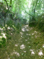
Saint Cornely is the patron saint of horned animals. It is therefore fitting that his chapel is located in a very agricultural part of Péaule. But during this walk, which criss-crosses the plateau above the Vilaine, you will have other things to do than count cows and other quadrupeds. Keep your eyes open, there is much to see in this meander of the Vilaine
A circular route starting from Nivillac
5.74 mi
+295 ft
-295 ft
2h 55
Easy
Departure from Nivillac (Morbihan)
On either side of La Roche-Bernard, the Vilaine flows through the South Armorican Fold, the first range of hills behind the coastline. Here, the river has carved out a steep-sided valley, and the proposed route allows you to explore the section immediately upstream of the Morbihan Bridge. The wooded slopes, varying in steepness, line the mirror-like surface formed by the dark waters of the Vilaine.
From the Vieux Doyenné to the chapels of Saint-Leufroy and Saint-André
9.81 mi
+522 ft
-518 ft
5h 00
Moderate
Departure from Péaule (Morbihan)
Following the suggested route is a lovely way to explore the northern part of the commune of Péaule. Whilst the first few kilometres of this route simply take you through beautiful, undulating countryside with little variation in elevation, the landscape changes completely once you reach the Ruisseau du Pesle, to the north of the commune.
And along the way, you can admire some fine examples of local architecture, such as old mills or the chapels of Saint-Leufroy and Saint-André, as well as many other civil buildings.
Cycling loop between Guenrouët and the Bellion lock
23.65 mi
+436 ft
-433 ft
3 hrs
Moderate
Departure from Plessé (Loire-Atlantique)
The Isac Valley connects Guenrouët to the Vilaine. Small country roads and wide carriageways, then the towpath of the Nantes-Brest Canal, lead to the Bellion Lock, a nautical stop at the confluence of the canal and the Vilaine. The return journey is the same, via other equally pleasant routes. A bucolic atmosphere is guaranteed on this ride on the edge of the Pays de Redon.
From Fescal to the Vilaine
 6.57 mi
+505 ft
-505 ft
3h 30
Moderate
Departure from Péaule (Morbihan)
6.57 mi
+505 ft
-505 ft
3h 30
Moderate
Departure from Péaule (Morbihan)
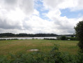
North of La Roche-Bernard, the Vilaine has carved its bed into a rocky plateau, and the streams that join it have also settled in fairly steep valleys. The remains of windmills on the heights and watermills along the streams mark this route, which winds around the former estate of Fescal Castle. This route runs mainly through wooded areas, interspersed with wooded hedgerow landscapes.
Long route east of Péaule
 12.64 mi
+1,188 ft
-1,191 ft
6h 50
Moderate
Departure from Péaule (Morbihan)
12.64 mi
+1,188 ft
-1,191 ft
6h 50
Moderate
Departure from Péaule (Morbihan)
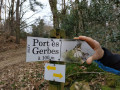
The Péaule countryside has a rather unique network of paths. Land consolidation has not been destructive here, and large, beautiful hedges still line the roads.
Elsewhere, the Vilaine and its tributary streams have carved into the rocky plateau to create a generally wooded landscape where you can take a stroll.
The long route on offer allows you to enjoy these different but always interesting landscapes, which follow one another during a beautiful day's walk.
Route of the Mills in Marzan
6.17 mi
+479 ft
-472 ft
3h 15
Easy
Departure from Marzan (Morbihan)
Located opposite La Roche-Bernard, on the other bank of the Vilaine, the commune of Marzan stretches across a plateau overlooking the river. On these heights, exposed to sea winds, the remains of several windmills can still be seen. Streams have carved out the rock and flow at the bottom of the valleys. Where it was possible to dam them, water mills were built. The proposed route takes you from one to the other through varied and pleasant countryside.
The Vilaine river, right bank and left bank at La Roche-Bernard
5.96 mi
+522 ft
-518 ft
3h 10
Moderate
Departure from Nivillac (Morbihan)
As you approach La Roche-Bernard, the Vilaine river winds its way through the geological folds of southern Armorica. The result is a rugged, wooded landscape that is very pleasant to walk through.
La Roche-Bernard bridge loop
 3.07 mi
+518 ft
-499 ft
1h 50
Moderate
Departure from La Roche-Bernard (Morbihan)
3.07 mi
+518 ft
-499 ft
1h 50
Moderate
Departure from La Roche-Bernard (Morbihan)
An hour-and-a-half circuit with a few tricky sections. This pleasant walk alternates seamlessly between passages at water's edge and ridge-climbing, and also spans two bridges some 50 m above the Vilaine. The bridge circuit allows you to discover a small section of the river as it crosses the Sillon de Bretagne. Get your calves ready!
The banks of the Vilaine
 11.32 mi
+614 ft
-614 ft
5h 45
Moderate
Departure from La Roche-Bernard (Morbihan)
11.32 mi
+614 ft
-614 ft
5h 45
Moderate
Departure from La Roche-Bernard (Morbihan)
A very pretty route which starts in the countryside and forest and then follows the course of the Vilaine river.
The start and finish are at the very pretty port of La Roche-Bernard.
Around La Roche-Bernard
5.30 mi
+272 ft
-266 ft
2h 40
Easy
Departure from La Roche-Bernard (Morbihan)
Although La Roche-Bernard is an urban centre that locals refer to as a ‘town’, its area (40 ha) and population (approx. 700 inhabitants) make it one of the smallest county towns in France. It is surrounded by the communes of Nivillac, Herbignac and Férel, across which the majority of the urban area is spread. The proposed route takes you around the area.
Monteneuf megalithic circular loop
 Tourist office
 7.18 mi
+331 ft
-322 ft
3h 35
Moderate
Departure from Monteneuf (Morbihan)
7.18 mi
+331 ft
-322 ft
3h 35
Moderate
Departure from Monteneuf (Morbihan)
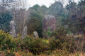
Set off to explore the dry and wet moors, home to a wide variety of flora and fauna. You will then come across several Neolithic burial monuments (La Loge Morinais, the Bordouès Covered Walkway). A little further on is the Pierres Droites megalithic site, one of the most important archaeological sites in central Brittany. It has 420 menhirs, around forty of which have been re-erected in their original location.
Heathland, ponds and megaliths in Monteneuf
 6.99 mi
+180 ft
-180 ft
3h 20
Moderate
Departure from Monteneuf (Morbihan)
6.99 mi
+180 ft
-180 ft
3h 20
Moderate
Departure from Monteneuf (Morbihan)
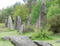
Come and discover a remarkable megalithic site in the Landes de Monteneuf: a collection of standing stones, covered walkways and isolated menhirs. Although less spectacular than Carnac, it is nonetheless very interesting due to the presence of a site currently undergoing renovation, where regional archaeologists have recreated both the dwellings of the period and the methods used to raise the stones.
Circular Melneuf from Notre-Dame de Grâce
 5.68 mi
+148 ft
-167 ft
2h 45
Easy
Departure from Guenrouet (Loire-Atlantique)
5.68 mi
+148 ft
-167 ft
2h 45
Easy
Departure from Guenrouet (Loire-Atlantique)
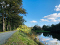
Passing through villages, tree-lined paths and the towpath of the Nantes-Brest Canal, this walk is an opportunity to observe ducks, foxes, swans, coots and deer, if you keep a low profile.