


Refine your search for walks in Thiron-Gardais
Thiron-Gardais walks


 Near Thiron-Gardais Abbey
 Tourism professional
 7.06 mi
 +233 ft
 -210 ft
 3h 25
3h 25
 Moderate
 Departure from Thiron-Gardais (Eure-et-Loir)
At the start, visit Thiron-Gardais Abbey, its themed gardens and the Grange aux Dîmes, then the route continues through the Perche countryside to Saint-Denis-d’Authou.
Around La Vinette
 Visorando Member9.94 mi
+823 ft
-823 ft
5h 15
Moderate
Departure from Coudreceau (Eure-et-Loir)
Visorando Member9.94 mi
+823 ft
-823 ft
5h 15
Moderate
Departure from Coudreceau (Eure-et-Loir)
Beautiful views of the hills of Perche and the Vinette Valley. This route follows paths and small roads with little traffic.
The Berthe Valley starting from Rougemont
4.66 mi
+512 ft
-518 ft
2h 35
 Easy
Departure from Vichères (Eure-et-Loir)
Easy
Departure from Vichères (Eure-et-Loir)
From the Church of Notre-Dame (listed building), you can admire the traditional architecture of Vichères, built from red sandstone and white stone. This rural route, with its ups and downs, links Rougemont Hill (the highest point in Eure-et-Loir at 285 m) to the picturesque Berthe Valley via sunken paths.
The Étang des Panses
 7.73 mi
+299 ft
-272 ft
3h 50
Moderate
Departure from Beaumont-les-Autels (Eure-et-Loir)
7.73 mi
+299 ft
-272 ft
3h 50
Moderate
Departure from Beaumont-les-Autels (Eure-et-Loir)
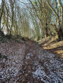
The Étang des Panses lake can be seen along a path where it is not uncommon to encounter forest animals. After the forest, you will discover Percheron fruit trees at the Miermaigne conservation orchard; in mid-November, you can take part in the Apple Festival.
In the footsteps of the Maquis fighters in Plainville
 Association / Club / Walk leader
 7.41 mi
+630 ft
-600 ft
3h 55
Easy
Departure from Marolles-les-Buis (Eure-et-Loir)
7.41 mi
+630 ft
-600 ft
3h 55
Easy
Departure from Marolles-les-Buis (Eure-et-Loir)
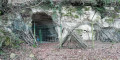
As you walk along the paths once used by the Maquis fighters, discover a key site of the Resistance in Eure-et-Loir: the Plainville Maquis.
The Cloche ponds
 4.50 mi
+312 ft
-312 ft
2h 20
Easy
Departure from Montlandon (Eure-et-Loir)
4.50 mi
+312 ft
-312 ft
2h 20
Easy
Departure from Montlandon (Eure-et-Loir)
Warning! Do not rely on the signposts – there are paths leading in all directions! However, this walk is very pleasant. A quarter of the route is through woodland, whilst the rest follows quiet tarmac roads.
Frazé Castle and manor houses
7.32 mi
+131 ft
-131 ft
3h 30
Moderate
Departure from Frazé (Eure-et-Loir)
Frazé’s architectural heritage is exceptional. Frazé Castle and Carcahu Manor are prime examples of this. The castle comprises various structures (15th, 17th and 19th centuries), whilst Carcahu Manor (16th–17th centuries) is unlike any other…
The Abbeys of the Loir
 6.58 mi
+98 ft
-98 ft
3h 05
Moderate
Departure from Champrond-en-Gâtine (Eure-et-Loir)
6.58 mi
+98 ft
-98 ft
3h 05
Moderate
Departure from Champrond-en-Gâtine (Eure-et-Loir)
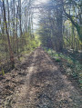
On the edge of the Perche region, the Chemin de César winds its way through the forest to the Abbayes du Loir.
Bois Landry
7.71 mi
+171 ft
-174 ft
3h 40
Moderate
Departure from Champrond-en-Gâtine (Eure-et-Loir)
The route alternates between open countryside and woodland. The private Bois Landry forest is managed sustainably. It also serves as a venue for forest school and nature discovery trips. Along the way stands the fortified farm of Grand Bois Landry (17th century), still surrounded by moats.
The Chemin des Demoiselles
5.25 mi
+236 ft
-230 ft
2h 35
Easy
Departure from Saint-Victor-de-Buthon (Eure-et-Loir)
A walk offering numerous views of the Perche countryside: orchards, sunken lanes lined with hedgerows, and Normandy or Limousin cattle.
The Thironne at Montigny-le-Chartif
4.46 mi
+66 ft
-66 ft
2h 05
Easy
Departure from Montigny-le-Chartif (Eure-et-Loir)
Set amongst woods and rivers, this route takes walkers through the lush countryside so dear to Marcel Proust, the illustrious guest of Illiers-Combray.
Nogent-le-Rotrou, town of the Counts of Rotrou
 2.25 mi
+157 ft
-171 ft
1h 10
Easy
Departure from Nogent-le-Rotrou (Eure-et-Loir)
2.25 mi
+157 ft
-171 ft
1h 10
Easy
Departure from Nogent-le-Rotrou (Eure-et-Loir)
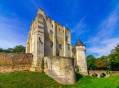
A historical and heritage tour of the capital of the Perche region, following in the footsteps of Rotrou III, Count of the Perche, Maximilien de Béthune, Duke of Sully, and Rémy Belleau, poet of the Pléiade.
Circular of the ponds starting from Perruchet
 5.88 mi
+167 ft
-184 ft
2h 50
Easy
Departure from Saint-Victor-de-Buthon (Eure-et-Loir)
5.88 mi
+167 ft
-184 ft
2h 50
Easy
Departure from Saint-Victor-de-Buthon (Eure-et-Loir)
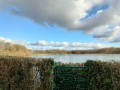
Although many birds can be found here despite global warming, parakeets have not yet colonised the site! Discover these ponds, an integral part of the Perche landscape. Although medium-sized (20 hectares), they constitute a wetland of great importance. Starting from the hamlet of Perruchet between the ponds, the route offers beautiful views of the lakes from the small road overlooking the valley. A road, believed to be Roman, the Chemin de Jules César, approaches the Étang de Perruchet. Leave it to go around it to the south. The route then leads to the Touraille farm and returns via Haut Coudray and the heights of the Teillière Pond, where an information board provides a better understanding of these landscapes between Beauce and Perche.
Castles and Calvary Sights starting from Le Thieulin
6.34 mi
+98 ft
-98 ft
3h 00
Moderate
Departure from Le Thieulin (Eure-et-Loir)
The open space beyond the village offers views of the traditional buildings and the châteaux that dot the route: La Couture, Le Châtaignier and Lignerolles. The latter estate was vast in the 19th century; it stretched into the village and also included numerous woodlands. This route was developed in collaboration with the Eure-et-Loir Departmental Hiking Committee. Follow the yellow markings.
 Les Terres Douces
14.13 mi
+433 ft
-410 ft
3 hrs
Moderate
Departure from Authon-du-Perche (Eure-et-Loir)
The "Terres Douces" countryside reveals a heritage full of charm: the former Priory of Les Châtaigniers and the Manoir de la Guillerie.
Touraille circular starting from Saint-Éliph
 7.92 mi
+102 ft
-102 ft
3h 45
Moderate
Departure from Saint-Éliph (Eure-et-Loir)
7.92 mi
+102 ft
-102 ft
3h 45
Moderate
Departure from Saint-Éliph (Eure-et-Loir)
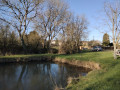
This route, starting from the wash house in Saint-Éliph, allows you to discover the two aspects of the countryside around the village. It passes through Auberdière and Grande Cour, then Petite Butte and follows Chemin de César to Touraille through a landscape of meadows and hedgerows typical of the Perche region. It returns to Saint-Eliph along roads and paths on the plain, the first signs of the Beauce region. With many quiet, small tarmac roads, it is recommended as a winter route when the nearby forest paths become difficult.
Saint-Éliph circular: Be open to Vaufermé
 4.78 mi
+279 ft
-266 ft
2h 25
Easy
Departure from Saint-Éliph (Eure-et-Loir)
4.78 mi
+279 ft
-266 ft
2h 25
Easy
Departure from Saint-Éliph (Eure-et-Loir)
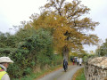
This circular loop takes you along the most beautiful paths in the commune, but returns via roads. Don't hesitate to take this route, as the beautiful site of the Saint-Éliph wash house with its picnic area, the pretty hamlet of Vaufermé, the sunken path leading up to La Haisonnière, and the views of the Perruchet and Théllière ponds, a protected bird sanctuary, make for a varied and enjoyable walk.
No hills or mountains in Montécot
 6.55 mi
+105 ft
-105 ft
3h 05
Moderate
Departure from Le Favril (Eure-et-Loir) (Eure-et-Loir)
6.55 mi
+105 ft
-105 ft
3h 05
Moderate
Departure from Le Favril (Eure-et-Loir) (Eure-et-Loir)
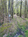
In fact, here you will only find a few undulations caused by the streams flowing towards the nearby Eure. This small 637-hectare national forest is surrounded by a bridle path and criss-crossed by straight paths. The D103 crosses it from east to west and is not very busy. A high-voltage power line divides the forest. Parallel to the D103, it overlooks a large clearing and is bordered by a well-maintained path. A long north-south lane, formerly part of the GR®35 hiking trail, marks the boundary of the private woods to the west. Finally, the Merise forest road connects the D920 to the D103: closed to cars from Rond de la Félicité to Rond de Diane.This network of paths allows you to combine numerous circular paths or take shortcuts. Just make sure you don't leave the state-owned forest, which is bordered by an embankment. Private woods are located all around. These woods are rich in game, and large animals are shot there, so it is wise not to venture in on hunting days!
Walk along the Ozanne in Brou
3.20 mi
+36 ft
-36 ft
1h 30
Easy
Departure from Brou (Eure-et-Loir)
The Ozanne and its riverside walk offer a relaxing route to explore the old wash houses. Brou ‘la Noble’, a barony of Perche Gouet, has preserved its beautiful architecture, including two listed half-timbered houses.