The Chemin des Demoiselles

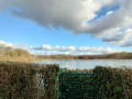
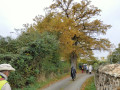
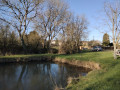
A walk offering numerous views of the Perche countryside: orchards, sunken lanes lined with hedgerows, and Normandy or Limousin cattle.

Details

23023419
Creation:
Last update:
Last review:
  • Walking
    Activity: Walking
  • ↔
    Distance: 5.25 mi
  • ◔
    Average duration: 2h 35 
  • ▲
    Difficulty: Easy

  • ⚐
    Back to start: Yes
  • ↗
    Ascent: + 236 ft
  • ↘
    Descent: - 230 ft

  • ▲
    Highest point: 886 ft
  • ▼
    Lowest point: 702 ft

Description of the walk

Park at the playground.

(S/E) With your back to the car park, follow the D5 as it climbs to the left.

(1) At the cross in the cemetery, turn right towards La Houlière. Between La Houlière and Le Clos aux Demoiselles, take the path on the left at the bottom of the ditch. Do not follow the edge of the field along the higher part. Walk through the hamlet of Le Clos aux Demoiselles.

(2) At the junction, carry on straight ahead along the path. At the Barre aux Popelins farm, follow the D349-7 to the right. In the bend, carry on straight ahead along the path for about 100 metres.

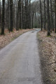
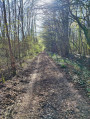
(3) Follow the path on the left, which is the old railway line from La Loupe to Brou.

(4) Take the D5 on the left. Pass the old Madeleine gatekeeper’s house, then turn right towards Les Orieux (views over the bocage). Pass through the hamlets.

(5) At the Grisonnière farm (small orchard on the right), take the path on the left between the tree-lined avenues.

(6) At the crossroads, head straight ahead and then continue to the right along the small road. You’ll reach the pumping station.

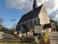
(7) Cross the D143 towards Pointe-aux-Canards. At the next Fork in the road, take the path on the left (view of the church’s openwork bell tower). After the water tower, head down to the left between the two silos and join the D5.

(8) Take the D5 to the left to reach the village and the playground (S/E).

Waypoints

  1. S/E : mi 0 - alt. 705 ft - Playground
  2. 1 : mi 0.18 - alt. 751 ft - Cross, on the right
  3. 2 : mi 0.94 - alt. 787 ft - Clos aux Demoiselles
  4. 3 : mi 1.43 - alt. 728 ft - Le Goulet
  5. 4 : mi 2.16 - alt. 705 ft - D5
  6. 5 : mi 2.85 - alt. 781 ft - La Grisonnière
  7. 6 : mi 3.42 - alt. 876 ft - Junction, opposite
  8. 7 : mi 4.06 - alt. 840 ft - Pumping station
  9. 8 : mi 4.68 - alt. 778 ft - D 5
  10. S/E : mi 5.25 - alt. 705 ft - Playground

Notes

Route created in collaboration with the Eure-et-Loir Departmental Hiking Committee.
Follow the yellow markings.

Reviews and comments

4.3 / 5
Based on 3 reviews

Reliability of the description
4.7 / 5
Ease of following the route
5 / 5
Route interest
3.3 / 5
lolo28300
lolo28300

Overall rating : 4.3 / 5

Date of your route : May 21, 2024
Reliability of the description : ★★★★☆ Good
Ease of following the route : ★★★★★ Very good
Route interest : ★★★★☆ Good
Very busy route : Yes

The track on the second Thiers is very muddy. Best used by 4x4s.

Machine-translated

tl6771
tl6771
• Edited:

Overall rating : 4 / 5

Date of your route : Jul 20, 2023
Reliability of the description : ★★★★★ Very good
Ease of following the route : ★★★★★ Very good
Route interest : ★★☆☆☆ Disappointing
Very busy route : No

A rather monotonous route that follows straight paths… the scenery isn’t very varied. Best suited as a gentle stroll after a meal…

Machine-translated

LOLADOL
LOLADOL

Overall rating : 4.7 / 5

Date of your route : Sep 19, 2022
Reliability of the description : ★★★★★ Very good
Ease of following the route : ★★★★★ Very good
Route interest : ★★★★☆ Good
Very busy route : No

Very well signposted

Machine-translated

Other walks in the area

For more walks, use our search engine .

The GPS track and description are the property of this route's author. Please do not copy them without permission.