The Abbeys of the Loir

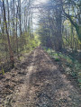
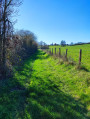
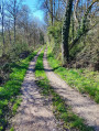
On the edge of the Perche region, the Chemin de César winds its way through the forest to the Abbayes du Loir.

Details

23039925
Creation:
Last update:
Last review:
  • Walking
    Activity: Walking
  • ↔
    Distance: 6.58 mi
  • ◔
    Average duration: 3h 05 
  • ▲
    Difficulty: Moderate

  • ⚐
    Back to start: Yes
  • ↗
    Ascent: + 98 ft
  • ↘
    Descent: - 98 ft

  • ▲
    Highest point: 846 ft
  • ▼
    Lowest point: 755 ft

Photos

Description of the walk

Parking is available at the side of the road leading to the hamlet of Beaurepaire.

(S/E) Take the D129 (Rue du Lavoir) towards Champrond-en-Gâtine. 300 m after the hamlet of La Foucauderie, take the path on the right until you reach the D941.

(1) Cross the road carefully and follow the road to the right for about 200 metres, then take the path on the left which climbs gently towards the Grand Beauvais estate. You will come out onto the D346.8; follow it to the right as far as Petit Beauvais.

(2) Continue to the right to rejoin the D143. Cross it carefully and follow this gravel pit road for about 380 m.

(3) Take the path on the far right which leads down into the woods. Pass the pumping station and continue to a junction.

(4) Head right-hand side up the small path through the woods to the Abbayes du Loir farm.

(5) Continue along the path to the right. Walk alongside the fence of the sand quarry until you reach the Bois des Abbayes.

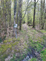
(6) At the entrance to the woods, turn right onto the ‘Chemin de César’ and follow it for 2.6 km. Cross the D29 with care and, much further on, join the D15.

(7) Follow the D15 to the right for 300 m and take the road on the right at La Graiserie. 300 m further on, turn right onto the path that runs along the edge of the woodland and joins a small road. Follow this road, which continues from the path.

(8) Pass through Bois Gilet and continue to the D129. Turn left onto it and follow it to Beaurepaire. Turn right and return to the car park (S/E).

Waypoints

  1. S/E : mi 0 - alt. 840 ft - Beaurepaire to Champrond-en-Gâtine
  2. 1 : mi 0.88 - alt. 830 ft - Cross the D941
  3. 2 : mi 1.79 - alt. 833 ft - Le Petit Beauvais
  4. 3 : mi 2.44 - alt. 774 ft - Path leading to the woods
  5. 4 : mi 2.72 - alt. 758 ft - Junction
  6. 5 : mi 3.14 - alt. 820 ft - Ferme des Abbayes du Loir
  7. 6 : mi 3.46 - alt. 837 ft - Bois des Abbayes – Chemin de César
  8. 7 : mi 5.07 - alt. 837 ft - D15 road
  9. 8 : mi 6.03 - alt. 837 ft - Le Bois Gilet
  10. S/E : mi 6.58 - alt. 840 ft - Beaurepaire to Champrond-en-Gâtine

Notes

Route created in collaboration with the Eure-et-Loir Departmental Hiking Committee.
Follow the yellow markings.

Worth a visit

Craftsman.
Calligraphy workshop.

Local produce.
Ferme des Vitriers.

Reviews and comments

4.1 / 5
Based on 4 reviews

Reliability of the description
4 / 5
Ease of following the route
4.5 / 5
Route interest
3.8 / 5
Sylvain_rando22
Sylvain_rando22

Overall rating : 4.3 / 5

Date of your route : Mar 18, 2026
Reliability of the description : ★★★★☆ Good
Ease of following the route : ★★★★★ Very good
Route interest : ★★★★☆ Good
Very busy route : No

A very pleasant walk with varied scenery, especially between points 3 and 8. I didn’t see a single soul the whole way!
I can confirm the previous reviews: there is no path ‘opposite’ point 1. You therefore need to head down the D941 to the right and then, after 200m, take the path on the left.
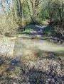
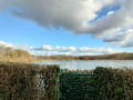
After point 4, you have to wade across the Loir at this time of year (see photo).

Machine-translated

Steph. R
Steph. R

Overall rating : 3.7 / 5

Date of your route : Oct 07, 2024
Reliability of the description : ★★★★☆ Good
Ease of following the route : ★★★★☆ Good
Route interest : ★★★☆☆ Average
Very busy route : No

A lovely walk, mainly through the woods. No places of particular interest.
Take care, as some sections are private paths with locked gates

Machine-translated

mam28
mam28

Overall rating : 4 / 5

Date of your route : Nov 12, 2022
Reliability of the description : ★★★★☆ Good
Ease of following the route : ★★★★☆ Good
Route interest : ★★★★☆ Good
Very busy route : No

A lovely route from (3) to (8), particularly along the Chemin Ferré, known as the ‘Chemin de César’, which runs through the woodland and is very pleasant.

The description and route map are incorrect at (1): there is no path “opposite”, just a gate and a large field. So head down the D941 to the right for 200 metres and turn left onto the path (thus turning your back on the road leading down to Beaurepaire); this takes you to Grand Beauvais.

Machine-translated

Anher
Anher

Overall rating : 4.3 / 5

Date of your route : Sep 29, 2022
Reliability of the description : ★★★★☆ Good
Ease of following the route : ★★★★★ Very good
Route interest : ★★★★☆ Good
Very busy route : Yes

An easy and enjoyable walk. Plenty of cover.

Machine-translated

Other walks in the area

For more walks, use our search engine .

The GPS track and description are the property of this route's author. Please do not copy them without permission.