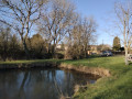
The Cloche ponds

Warning! Do not rely on the signposts – there are paths leading in all directions! However, this walk is very pleasant. A quarter of the route is through woodland, whilst the rest follows quiet tarmac roads.

Details

n°19755831
Creation:
Last update:
Last review:
  • Walking
    Activity: Walking
  • ↔
    Distance: 4.50 mi
  • ◔
    Average duration: 2h 20 
  • ▲
    Difficulty: Easy

  • ⚐
    Back to start: Yes
  • ↗
    Ascent: + 312 ft
  • ↘
    Descent: - 312 ft

  • ▲
    Highest point: 925 ft
  • ▼
    Lowest point: 696 ft

Photos

Description of the walk

Park at the junction in front of a house; there is space, but take care not to obstruct anyone.

(S/E) Take the dead-end street signposted ‘les Usages’.

(1) Once at the end, carry on straight ahead towards the path and head into the forest. Turn left at the first Fork in the road and continue, keeping the Étang de la Magnanne on your right.

(2) At the next Fork in the road, turn right onto the barely visible path, which is not shown on the IGN map. Follow the fence on your right and join theGR®35variant.

(3) Turn right, join a tarmac road and continue to a four-way junction.

(4) Turn right towards Montlandon via the D351.1.

(5) Cross La Cloche. Pass the access road to Haudouin on your left and continue for about a hundred metres.

(6) Turn right onto the D103 and head uphill to another four-way junction.

(7) Turn right to return to the starting point (S/E).

Waypoints

  1. S/E : mi 0 - alt. 915 ft - Uses
  2. 1 : mi 0.19 - alt. 922 ft - Junction
  3. 2 : mi 0.9 - alt. 781 ft - Fence on the right-hand side
  4. 3 : mi 1.27 - alt. 869 ft - GR°°®°° junction
  5. 4 : mi 2.31 - alt. 843 ft - Crossroads
  6. 5 : mi 2.6 - alt. 696 ft - Cross the - Cloche (rivière) - Affluent de l'Huisne
  7. 6 : mi 3.2 - alt. 735 ft - Junction
  8. 7 : mi 4.27 - alt. 919 ft - Crossroads
  9. S/E : mi 4.5 - alt. 915 ft - Uses

Always be cautious and plan ahead when you're outdoors. Visorando and the author of this route cannot be held responsible for any accidents occurring on this route.

The GR® and PR® markings are the intellectual property of the Fédération Française de Randonnée Pédestre.

Reviews and comments

4 / 5
Based on 2 reviews

Reliability of the description
4 / 5
Ease of following the route
4.5 / 5
Route interest
3.5 / 5
lolo28300
lolo28300

Overall rating : 4.7 / 5

Date of your route : Mar 03, 2025
Reliability of the description : ★★★★★ Very good
Ease of following the route : ★★★★★ Very good
Route interest : ★★★★☆ Good
Very busy route : No

to be done again; a long way to go

Machine-translated

FARGAS Jean-Claude
FARGAS Jean-Claude

Thank you for your reply. Yes, the weather has been so lovely for walking these days that we have no trouble at all with the sections along the roads. And then, from Brimont, the views over the Cloche Valley open up, offering a glimpse of the Perche hills.
On Monday, I’ll go and check out the routes to the starting point from the church or the town hall in Montlandon.
Kind regards

Machine-translated

Gamibyck
Gamibyck

Hello,
There really is so much tarmac that it could be a mountain bike ride. Actually, I plot my future rides on the IGN map, and then I head out into the countryside. And so I realised once I was there that there were lots of private properties with no-entry signs, particularly between points 3 and 4 towards the Moulin des Bouillons, and also between points 5 and 6 towards Brimont, where I’d thought I could take the forest track shown on the map. As a result, it’s true that the ponds are no longer visible.
To sum up, I’m also disappointed with this walk, the only appeal of which is the walking itself – and that’s good for your health
Kind regards

Machine-translated

FARGAS Jean-Claude
FARGAS Jean-Claude

Overall rating : 3.3 / 5

Date of your route : Mar 24, 2022
Reliability of the description : ★★★☆☆ Average
Ease of following the route : ★★★★☆ Good
Route interest : ★★★☆☆ Average
Very busy route : No

- The starting point is difficult to find. There are no signs indicating the location or access routes. Parking is limited to the indicated starting point – is this private land?
- A very pleasant route from the start to point 3.
- Between points 2 and 3, the section along a path not marked on the IGN map – and which may be private – could be avoided by continuing to follow the PR route as far as the Rond de l’Enfer. You would then turn right onto the GR 35 alternative route to rejoin the main route at point 3.
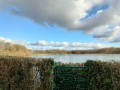
- The ponds mentioned in the title are only (barely) visible at point 5. The route circles a huge fenced-off private estate within which they are situated.
- Too much tarmac along the entire route (from point 3 to the finish).
Suggestions:
- From point 3, continue along the PR to the hamlet of l’Enfer via the Chemin de la Magnanne, then return to point 4 via La Boudonnière
- Link the start to the village of Montlandon via the mountain bike route passing through Vieux Landon and then along small roads. Return via La Tesserie.
The route would become much longer (around 12 km) but would still be reasonable.
NB. There are plans to alter the route of the GR 35 so that it passes through Montlandon and Vieux Landon. Currently, the alternative route shown on the map is the main route. The section marked in red, passing by the Vélarderie equestrian centre, has already been removed.

Machine-translated

Other walks in the area

For more walks, use our search engine .

The GPS track and description are the property of this route's author. Please do not copy them without permission.