Castles and Calvary Sights starting from Le Thieulin

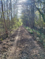
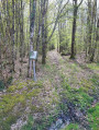
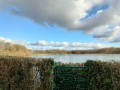
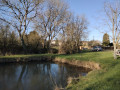
The open space beyond the village offers views of the traditional buildings and the châteaux that dot the route: La Couture, Le Châtaignier and Lignerolles. The latter estate was vast in the 19th century; it stretched into the village and also included numerous woodlands. This route was developed in collaboration with the Eure-et-Loir Departmental Hiking Committee. Follow the yellow markings.

Details

24238551
Creation:
Last update:
Last review:
  • Walking
    Activity: Walking
  • ↔
    Distance: 6.34 mi
  • ◔
    Average duration: 3h 00 
  • ▲
    Difficulty: Moderate

  • ⚐
    Back to start: Yes
  • ↗
    Ascent: + 98 ft
  • ↘
    Descent: - 98 ft

  • ▲
    Highest point: 833 ft
  • ▼
    Lowest point: 732 ft

Description of the walk

Park in the car park not far from the starting point, at the junction between Rue de la Guérinière and Rue du Lavoir.

(S/E) Walk down Rue de la Guérinière. Take the first small path on the left between a hedge and some houses. At the end of the path, turn left, then left again onto Rue du Poirier.

(1) Opposite Rue Neuve, turn right. Walk past the rest area and ignore a small road on the right.

(2) Turn into the path on the left. At the next junction (marker 230), turn left again. At the next junction, go straight on and head south-west.

(3) At the wayside cross, cross the D128 and continue straight ahead along the track leading into the woods.

(4) Take the D139 on the left, then turn right towards Petit Beauvais.

(5) Take the first track on the left. This bends right twice. Pass through the hamlet of L’Orgerie and come out onto the D346.7. Follow this road to the left.

(6) At Petit Beauvais, turn left onto the track that runs between the fields. Head south-east until you reach a junction with roads.

(7) Cross a road and continue south-east on the D143. Further on, cross the D128 and continue straight ahead towards Villebon.

(8) Turn left towards Le Thieulin and follow the path alongside the grounds of Château de La Couture. Then turn into thefirst path on the left and head for the hamlet of Les Châtaigniers.

(9) After the farm, veer right towards the village. Walk alongside the grounds of Lignerolles Castle.

(10) At the wayside cross, follow the D139 to the right to return to the starting point (S/E).

Waypoints

  1. S/E : mi 0 - alt. 778 ft - Village hall
  2. 1 : mi 0.21 - alt. 764 ft - Junction – Rue du Lavoir
  3. 2 : mi 0.65 - alt. 751 ft - Edge of the fields
  4. 3 : mi 1.59 - alt. 771 ft - D128 road
  5. 4 : mi 2.24 - alt. 807 ft - D139 road
  6. 5 : mi 2.47 - alt. 801 ft - Farm track
  7. 6 : mi 3.55 - alt. 827 ft - Petit Beauvais
  8. 7 : mi 4.04 - alt. 787 ft - Crossroads
  9. 8 : mi 4.71 - alt. 732 ft - Junction - Château de la Couture (Le Thieulin)
  10. 9 : mi 5.38 - alt. 778 ft - Le Châtaignier Farm
  11. 10 : mi 6.17 - alt. 784 ft - Calvary
  12. S/E : mi 6.34 - alt. 778 ft - Village hall

Reviews and comments

4.1 / 5
Based on 3 reviews

Reliability of the description
4.3 / 5
Ease of following the route
4.7 / 5
Route interest
3.3 / 5
LOLADOL
LOLADOL

Overall rating : 3.3 / 5

Date of your route : Sep 10, 2025
Reliability of the description : ★★★★☆ Good
Ease of following the route : ★★★★☆ Good
Route interest : ★★☆☆☆ Disappointing
Very busy route : No

At point no. 3, we couldn't find the Calvary. Nothing particularly interesting about this route, too many straight lines between the fields and on the road

Machine-translated

Igor le breton
Igor le breton

Overall rating : 4.3 / 5

Date of your route : Apr 28, 2025
Reliability of the description : ★★★★☆ Good
Ease of following the route : ★★★★★ Very good
Route interest : ★★★★☆ Good
Very busy route : No

It’s peaceful; it’s the countryside, with two castles and two wayside crosses on the final stretch of the walk.
Not recommended in summer due to a lack of shade.
In my view, the walk lacks points of interest but is still enjoyable.
Its main attraction is the tranquillity, despite the numerous sections along roads.

Machine-translated

eclo5326
eclo5326

Overall rating : 4.7 / 5

Date of your route : Feb 19, 2023
Reliability of the description : ★★★★★ Very good
Ease of following the route : ★★★★★ Very good
Route interest : ★★★★☆ Good
Very busy route : No

The walk was completed in 2 hours and 10 minutes by two 66-year-olds.

Machine-translated

Other walks in the area

For more walks, use our search engine .

The GPS track and description are the property of this route's author. Please do not copy them without permission.