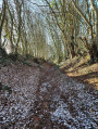
Walk along the Ozanne in Brou

The Ozanne and its riverside walk offer a relaxing route to explore the old wash houses. Brou ‘la Noble’, a barony of Perche Gouet, has preserved its beautiful architecture, including two listed half-timbered houses.

Details

n°24817923
Creation:
Last update:
Last review:
  • Walking
    Activity: Walking
  • ↔
    Distance: 3.20 mi
  • ◔
    Average duration: 1h 30 
  • ▲
    Difficulty: Easy

  • ⚐
    Back to start: Yes
  • ↗
    Ascent: + 36 ft
  • ↘
    Descent: - 36 ft

  • ▲
    Highest point: 548 ft
  • ▼
    Lowest point: 489 ft
  • ⚐ Country: France
  • ⚐
    Area: Perche
  • ⚐ City: Brou (28160)
  • ⚑
    Start/End: N 48.20964° / E 1.167831°
  • ❏
    IGN map(s): Ref. 2018SB
  • Hour-by-hour weather

Description of the walk

Parking is available on the Place des Halles in Brou, except on Wednesday mornings (market day).

(S/E) Take Rue de la Tête Noire, then turn left into Rue Hacault. Turn right into Rue de Châteaudun, then take the first left. Cross the Ozanne and turn left, following the river. At the end of this lane, cross the river again and turn right onto Rue de Châteaudun. Turn right and take Route de Vaugelan, crossing three bridges.

(1) At Vaugelan, turn left onto the track.

(2) At the crossroads where the paths fan out, take the first path on the right.

(3) Cross the D15 and take the small road opposite.

(4) Turn onto the second track on the right and head towards Brou.

(5) Take Rue de la Grosse Pierre, then turn left onto Rue de Courtalain. Then turn right onto a small road that leads to the river. Cross the bridge to reach the church. Take Rue de la Chevalerie opposite, then go round the church to the right via Rue Bisson. Turn left into a small cobbled street and turn right onto Rue des Changes to reach Place des Halles (S/E).

Waypoints

  1. S/E : mi 0 - alt. 512 ft - Place des Halles, Brou - Ozanne (rivière) - Affluent du Loir
  2. 1 : mi 0.7 - alt. 515 ft - Vaugelan
  3. 2 : mi 1.07 - alt. 522 ft - Star-shaped trail
  4. 3 : mi 1.59 - alt. 525 ft - D15 road
  5. 4 : mi 1.93 - alt. 531 ft - Towards Brou
  6. 5 : mi 2.58 - alt. 512 ft - Rue de la Grosse Pierre
  7. S/E : mi 3.2 - alt. 512 ft - Place des Halles, Brou

Notes

Route created in collaboration with the Eure-et-Loir Departmental Hiking Committee. Follow the yellow markings.

Worth a visit

- Brou Leisure Park.

- Brou lakes and the River Ozanne – certified fishing spots – family trail.

Reviews and comments

4.3 / 5
Based on 2 reviews

Reliability of the description
5 / 5
Ease of following the route
4.5 / 5
Route interest
3.5 / 5
Angèle28
Angèle28

Overall rating : 4.3 / 5

Date of your route : Feb 22, 2025
Reliability of the description : ★★★★★ Very good
Ease of following the route : ★★★★☆ Good
Route interest : ★★★★☆ Good
Very busy route : No

A pleasant walk, especially along the water’s edge; the section through the fields is less enjoyable.

Machine-translated

KoofyKoof
KoofyKoof

Overall rating : 4.3 / 5

Date of your route : Sep 01, 2024
Reliability of the description : ★★★★★ Very good
Ease of following the route : ★★★★★ Very good
Route interest : ★★★☆☆ Average
Very busy route : No

All right, but I won’t be going on this walk if the weather’s bad.
In some places, the grass comes almost up to your knees.

Machine-translated

Other walks in the area

For more walks, use our search engine .

The GPS track and description are the property of this route's author. Please do not copy them without permission.