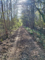
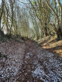
The Thironne at Montigny-le-Chartif

Set amongst woods and rivers, this route takes walkers through the lush countryside so dear to Marcel Proust, the illustrious guest of Illiers-Combray.

Details

23009121
Creation:
Last update:
Last review:
  • Walking
    Activity: Walking
  • ↔
    Distance: 4.46 mi
  • ◔
    Average duration: 2h 05 
  • ▲
    Difficulty: Easy

  • ⚐
    Back to start: Yes
  • ↗
    Ascent: + 66 ft
  • ↘
    Descent: - 66 ft

  • ▲
    Highest point: 633 ft
  • ▼
    Lowest point: 551 ft

Description of the walk

Parking available at the cemetery, large car park.

(S/E) Head down towards the village via Rue de l'Église. Do not cross the bridge (with the restored thatched-roof wash house), but turn right up Rue de Brou and continue along the D124-3 towards Frazé.
After 100 m, turn left towards the dairy farm. At the next fork, continue straight ahead following the white-and-red markings ofthe GR® 35 and you will soon reach a crossroads.

(1) Continue left along the road towards La Boussardière. At the bend, just before the farm, take the path on the left.

(2) Turn left and pass to the right of Moulin Ronce, use its access road and cross the footbridge over the Thironne. Cut across the D922 and continue along the path leading to the Bois de Méréglise (view of the village of Méréglise).
Cross the ditch on the left to enter the woods and continue straight on to the exit. Follow the edge of the woods with the woods on your left.

(3) Leave theGR®35and take the path on the left between the fields. Turn left at the fork (elevation 189) and enter the village of Montigny-le-Chartif. At the junction, head down to the right along Rue des Cornières.

(4) Cross the D922 and continue straight ahead along Rue de Fouleray, then carry on straight through the woods.
Then head down to the left along the small road which turns left again and leads to Fouleray.

(5) Turn right between the fences, cross the footbridge over the Thironne and, in the woods, follow the main path which leads directly to the car park (S/E).


Waypoints

  1. S/E : mi 0 - alt. 574 ft - Montigny-le-Chartif Church
  2. 1 : mi 0.31 - alt. 617 ft - GR 35 – route to La Boussardière
  3. 2 : mi 1.44 - alt. 554 ft - The Moulin Ronce. Footbridge over the - Thironne (rivière) - Affluent du Loir
  4. 3 : mi 2.34 - alt. 587 ft - Turn left, Bois de Méréglise
  5. 4 : mi 3.52 - alt. 614 ft - D922
  6. 5 : mi 4.07 - alt. 581 ft - Fouleray, turn right
  7. S/E : mi 4.46 - alt. 577 ft - Montigny-le-Chartif Church

Notes

Route created in collaboration with the Eure-et-Loir Departmental Hiking Committee.

Follow the yellow markings.

Always be cautious and plan ahead when you're outdoors. Visorando and the author of this route cannot be held responsible for any accidents occurring on this route.

The GR® and PR® markings are the intellectual property of the Fédération Française de Randonnée Pédestre.

Reviews and comments

4.5 / 5
Based on 5 reviews

Reliability of the description
4.8 / 5
Ease of following the route
4.6 / 5
Route interest
4 / 5
FARGAS Jean-Claude
FARGAS Jean-Claude

Overall rating : 4.7 / 5

Date of your route : Jul 28, 2025
Reliability of the description : ★★★★★ Very good
Ease of following the route : ★★★★★ Very good
Route interest : ★★★★☆ Good
Very busy route : No

A route that remains enjoyable, despite the shortening of its original version due to the closure of a path that was, however, listed in the P.D.I.P.R.
At the start, the facilities around the church and the wash house are well maintained and very pleasant, ideal for a picnic stop.
On the border between the Perche and the Beauce regions, the section through the fields is less pleasant. We console ourselves with the thought that it offers fine views over the plain towards Illiers-Combray. We can only observe the ‘Swann-Guermantes’ landscapes that Marcel Proust had already described.
The information board near the woods is certainly very informative, but you still need to be able to read it! Dust from the trees has soiled it and it is in need of a good clean. Its slanted position may make it easier to read, but, as is the case elsewhere, it means it gets dirty more quickly.
The end of the route is far more picturesque. A magnificent footbridge crosses the Thironne, which, unfortunately, one encounters in only a few places. (Despite what the name of the route suggests).
It is clear, however, that the local council is making a real effort to showcase its built and natural heritage. Thank you.

Machine-translated

User 21944149

Overall rating : 4.7 / 5

Date of your route : Jul 28, 2025
Reliability of the description : ★★★★★ Very good
Ease of following the route : ★★★★★ Very good
Route interest : ★★★★☆ Good
Very busy route : No

No problem, just a short drive on the country road

Machine-translated

eclo5326
eclo5326

Overall rating : 4.7 / 5

Date of your route : Apr 14, 2024
Reliability of the description : ★★★★★ Very good
Ease of following the route : ★★★★★ Very good
Route interest : ★★★★☆ Good
Very busy route : No

No problem. Clear instructions.

Machine-translated

Le Kannatear
Le Kannatear

Overall rating : 4.7 / 5

Date of your route : Jul 06, 2023
Reliability of the description : ★★★★★ Very good
Ease of following the route : ★★★★★ Very good
Route interest : ★★★★☆ Good
Very busy route : No

A lovely walk – the section on the plain wasn't easy because the paths weren't well maintained.

Machine-translated

User 16683551

Overall rating : 3.7 / 5

Date of your route : Feb 20, 2023
Reliability of the description : ★★★★☆ Good
Ease of following the route : ★★★☆☆ Average
Route interest : ★★★★☆ Good
Very busy route : No

Very pleasant and straightforward, but the markings are sometimes unclear.

Machine-translated

Other walks in the area

For more walks, use our search engine .

The GPS track and description are the property of this route's author. Please do not copy them without permission.