


Refine your search for walks in Saint-Julien-du-Verdon
Saint-Julien-du-Verdon walks


 The Barre du Pidanoux starting from Saint-Julien-du-Verdon
 Visorando Member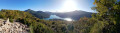
 4.30 mi
 +1,017 ft
 -1,017 ft
 2h 50
2h 50
 Moderate
 Departure from Saint-Julien-du-Verdon (Alpes-de-Haute-Provence)
The Barre du Pidanoux hike overlooks Lake Castillon and the village of Saint-Julien-du-Verdon. It offers exceptional panoramic views.
Note: The entire hike is marked with yellow lines.
The Pic de Chamatte, starting from Vergons
 8.95 mi
+2,815 ft
-2,815 ft
6h 35
8.95 mi
+2,815 ft
-2,815 ft
6h 35
 Difficult
Departure from Vergons (Alpes-de-Haute-Provence)
Difficult
Departure from Vergons (Alpes-de-Haute-Provence)
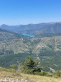
A very lovely walk leading to the Pic de Chamatte at an altitude of 1,879 metres. This walk may prove challenging due to the elevation gain for inexperienced walkers. However, there are no technical sections. Only the descent requires a sense of direction. The path, although marked on the map, is barely visible in places. From the summit, a magnificent 360° view awaits you, taking in the Mercantour, the Verdon massifs and Lac du Castillon.
La Ferme Brûlée
 3.71 mi
+915 ft
-919 ft
2h 30
3.71 mi
+915 ft
-919 ft
2h 30
 Easy
Departure from Demandolx (Alpes-de-Haute-Provence)
Easy
Departure from Demandolx (Alpes-de-Haute-Provence)
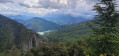
A short hike with beautiful views of the lakes of Chaudanne and Castillon, La Barre Rousse and the Crête du Teillon.
Issole Forest Circular Route
 6.79 mi
+994 ft
-1,010 ft
4h 00
Moderate
Departure from Saint-André-les-Alpes (Alpes-de-Haute-Provence)
6.79 mi
+994 ft
-1,010 ft
4h 00
Moderate
Departure from Saint-André-les-Alpes (Alpes-de-Haute-Provence)
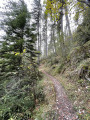
A lovely walk through the Issole State Forest, planted with magnificent pine trees.Throughout the walk, the gradient is gentle, on a path that’s very easy on the joints and which occasionally alternates with a forest track; both are always very well signposted.
Castellane - Senez
 11.17 mi
+2,454 ft
-2,270 ft
7h 15
Difficult
Departure from Castellane (Alpes-de-Haute-Provence)
11.17 mi
+2,454 ft
-2,270 ft
7h 15
Difficult
Departure from Castellane (Alpes-de-Haute-Provence)
Route Napoléon via theGR®® 406 – Stage 4/6: Castellane – Senez
Our Lady of the Rock
 3.08 mi
+1,076 ft
-1,076 ft
2h 20
Easy
Departure from Castellane (Alpes-de-Haute-Provence)
3.08 mi
+1,076 ft
-1,076 ft
2h 20
Easy
Departure from Castellane (Alpes-de-Haute-Provence)
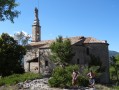
Through Castellane and along shaded paths, visit the famous and renowned Notre Dame du Roc.
Siréniens site at the start of the Col des Lèques
2.50 mi
+276 ft
-262 ft
1h 25
Easy
Departure from Castellane (Alpes-de-Haute-Provence)
Hidden within the Tabori Ravine lies one of the most remarkable sites in the Haute-Provence Geological Nature Reserve. A veritable marine graveyard dating back 40 million years, the Siréniens fossil site contains over two hundred bones of marine mammals closely related to today’s dugongs.
Robion Tower
 Association / Club / Walk leader
 10.53 mi
+2,484 ft
-2,487 ft
7h 00
Moderate
Departure from Castellane (Alpes-de-Haute-Provence)
10.53 mi
+2,484 ft
-2,487 ft
7h 00
Moderate
Departure from Castellane (Alpes-de-Haute-Provence)
A magnificent hike overlooking the Verdon. Very little traffic.
Puy de Rent
 10.25 mi
+3,301 ft
-3,274 ft
7h 35
Difficult
Departure from Allons (Alpes-de-Haute-Provence)
10.25 mi
+3,301 ft
-3,274 ft
7h 35
Difficult
Departure from Allons (Alpes-de-Haute-Provence)
A magnificent hike with no great technical difficulty, apart from the 1,000 m elevation gain and a distance of over 17 km. The ascent is gradual through a magnificent larch forest. At the summit, a 360° panorama awaits you. Breathtaking views at an altitude of nearly 2,000 metres over the Mercantour: the Grand Coyer, the Mole, the Pic de Chamatte, the Cheval Blanc, the Montagne de Cordeil and the Estrop in the distance, to name the most important. In spring, the flora is in full bloom.
From Allons station to Fugeret station
 8.90 mi
+1,975 ft
-2,349 ft
5h 50
Moderate
Departure from Allons (Alpes-de-Haute-Provence)
8.90 mi
+1,975 ft
-2,349 ft
5h 50
Moderate
Departure from Allons (Alpes-de-Haute-Provence)
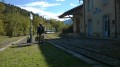
This allows you to use the ‘Train des Pignes’ as a means of exploring the area whilst hiking, by changing valleys. The route runs partly through former farmland and partly through mixed woodland (with remarkable trees during the descent towards Fugeret).
Three sections, three landscapes:1/ from the station to the village of Allons,2/ from the village to La Basse d’Annot,3/ from the ridge to Fugeret station.
Senez - La Clappe
11.85 mi
+2,703 ft
-1,837 ft
7h 50
Difficult
Departure from Senez (Alpes-de-Haute-Provence)
Route Napoléon via theGR®® 406 - Stage 5/6: Senez - La Clappe.
Circular route from Soleilhas to Saint-Pierre Chapel
 9.06 mi
+1,811 ft
-1,814 ft
5h 45
Moderate
Departure from Soleilhas (Alpes-de-Haute-Provence)
9.06 mi
+1,811 ft
-1,814 ft
5h 45
Moderate
Departure from Soleilhas (Alpes-de-Haute-Provence)
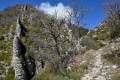
This hike on the edge of the Alpes-de-Haute-Provence offers a varied route through forests, rocky outcrops and even a riverbed. It is not particularly difficult, although some descents can be a little steep. It also gives you the opportunity to visit the pretty Saint-Pierre Chapel, tucked away in the woods.
The Combe Renard circular route starting from Annot
2.67 mi
+922 ft
-912 ft
2h 00
Easy
Departure from Annot (Alpes-de-Haute-Provence)
Follow the paths of La Colle Basse d’Annot to reach the Combe Renard Spring.
An easy hike featuring a steep climb at the start, followed by a flat forest path before beginning the descent.
(!) In winter, this section is very shaded and patches of ice may be present.
Vérimande - Colle Basse d'Annot
8.00 mi
+2,316 ft
-2,257 ft
5h 40
Moderate
Departure from Annot (Alpes-de-Haute-Provence)
Discover the trails of the Colle Basse d'Annot on this route, which offers stunning views of the Baou and the Grès d'Annot. After a rewarding climb, you’ll follow the Vaïre at the end of the walk, with the chance to take a refreshing dip.
The Baou d'Annot
2.68 mi
+1,020 ft
-1,007 ft
2h 05
Easy
Departure from Annot (Alpes-de-Haute-Provence)
A short and lovely walk with a magical view of the village, oak and chestnut trees amidst sandstone boulders. Much of the route is through the cool forest.
The Annot Sandstone
 3.58 mi
+1,394 ft
-1,378 ft
2h 50
Moderate
Departure from Annot (Alpes-de-Haute-Provence)
3.58 mi
+1,394 ft
-1,378 ft
2h 50
Moderate
Departure from Annot (Alpes-de-Haute-Provence)
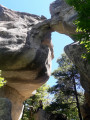
A very pretty, magical and interactive hike under oak trees, hundred-year-old chestnut trees and among huge sandstone boulders.
Most of the walk is in the cool forest.
The Grès d'Annot are world famous and are a listed and protected site.
Annot, land of chestnut trees and sandstone
 8.54 mi
+2,457 ft
-2,477 ft
6h 05
Moderate
Departure from Annot (Alpes-de-Haute-Provence)
8.54 mi
+2,457 ft
-2,477 ft
6h 05
Moderate
Departure from Annot (Alpes-de-Haute-Provence)
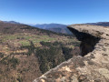
A very distinctive and unique forest.Rock formations that defy the laws of balance, dizzying cliffs and centuries-old chestnut trees. A hike that is a feast for the eyes.
Clue de la Melle
 9.55 mi
+2,126 ft
-2,100 ft
6h 15
Moderate
Departure from Senez (Alpes-de-Haute-Provence)
9.55 mi
+2,126 ft
-2,100 ft
6h 15
Moderate
Departure from Senez (Alpes-de-Haute-Provence)
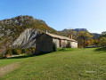
A hike above the Asse Valley offering views of the narrow Melle Gorges and the landscapes of the Alpes-de-Haute-Provence.
You can climb to 1,200 metres, where an isolated chapel on the plateau is the only remnant of a hamlet that was home to great acts of resistance before being destroyed.
The summit of La Bernarde as seen from the village of Ubraye
 11.29 mi
+3,294 ft
-3,317 ft
8h 05
Difficult
Departure from Ubraye (Alpes-de-Haute-Provence)
11.29 mi
+3,294 ft
-3,317 ft
8h 05
Difficult
Departure from Ubraye (Alpes-de-Haute-Provence)
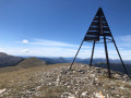
The ascent is gradual and straightforward. The highlight of the climb is reaching the ridges, followed by the Sommet de la Bernarde and its exceptional panoramic views of the Alpes de Hautes-Provence.
At the foot of the Cadières de Brandis via the Chapelle Saint-Jean
 7.54 mi
+1,535 ft
-1,542 ft
4h 50
Moderate
Departure from Castellane (Alpes-de-Haute-Provence)
7.54 mi
+1,535 ft
-1,542 ft
4h 50
Moderate
Departure from Castellane (Alpes-de-Haute-Provence)
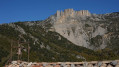
Chasteuil, like Villars-Brandis, is a hamlet nestled at the foot of the Cadières de Brandis cliffs. Initially abandoned in the early 20th century, it has been revitalised since the 1970s.
This walk stays at a high altitude, following a path that runs almost entirely along a ledge above the Verdon.
The tiny Saint-Jean Chapel offers a magnificent view of the Cadières de Brandis, and rumour has it that the Templars’ treasure can be found there.
Le Teillon as seen from Peyroules
 8.72 mi
+2,949 ft
-2,956 ft
6h 35
Difficult
Departure from Peyroules (Alpes-de-Haute-Provence)
8.72 mi
+2,949 ft
-2,956 ft
6h 35
Difficult
Departure from Peyroules (Alpes-de-Haute-Provence)
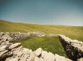
A route with a fairly steep climb, rewarding you, once at the summit, with a 360° view of the Southern Alps stretching all the way to the sea. Includes a visit to a chapel and the old village of Peyroules. Above 1,700 metres, there is no longer a clearly marked path; you’ll need to navigate using the GPX file, cairns and tracks on the ground.
Montagne de Robion via the Saint-Trophime Chapel
 9.09 mi
+3,904 ft
-3,907 ft
7 hrs
9.09 mi
+3,904 ft
-3,907 ft
7 hrs
 Very difficult
Departure from Castellane (Alpes-de-Haute-Provence)
Very difficult
Departure from Castellane (Alpes-de-Haute-Provence)
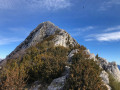
A beautiful hike that takes us to the Saint-Trophime Chapel and the summit for a view of the entire Verdon and the Pre-Alps.
Circular walk around Le Bourguet
 3.01 mi
+574 ft
-574 ft
1h 55
Easy
Departure from Le Bourguet (Var)
3.01 mi
+574 ft
-574 ft
1h 55
Easy
Departure from Le Bourguet (Var)
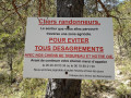
A pleasant walk through the Le Bourguet forest, with the added bonus, in summer, of possibly encountering a herd of goats watched over by a Pyrenean Shepherd dog.
Circular walk from Blieux to the Mont Chiran Observatory
 18.58 mi
+5,262 ft
-5,253 ft
2 days
Difficult
Departure from Blieux (Alpes-de-Haute-Provence)
18.58 mi
+5,262 ft
-5,253 ft
2 days
Difficult
Departure from Blieux (Alpes-de-Haute-Provence)
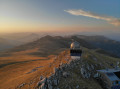
A magnificent, challenging and scenic two-day circular route in the heart of the Verdon Regional Nature Park, starting from the village of Blieux.
The route takes you along the ridges and iconic summits of the massif: the Mourre de Chanier (1,930 m), the Petit Mourre (1,873 m), the Grand Mourre (1,898 m), the Mont Chiran Observatory (1,905 m), then the Hauteur (1,777 m) and the Col de Reibert (1,464 m).
You’ll enjoy 360° views of Lake Sainte-Croix, the Verdon, the Mercantour peaks and the vast expanses of the Verdon. An ideal hike for a wild camp in the heart of nature, amongst airy ridges, scree slopes and pastoral trails.
From Blieux to the Mont Chiran Observatory via the Mourre de Chanier
10.30 mi
+4,626 ft
-1,542 ft
8h 45
Very difficult
Departure from Blieux (Alpes-de-Haute-Provence)
First stage of the circular route from the village of Blieux to the Mont Chiran Observatory. You’ll climb gradually towards the ridges to tackle the day’s peaks: the Mourre de Chanier (1,930 m), the highest point of the stage, the Petit Mourre (1,873 m) and the Grand Mourre (1,898 m), before reaching the Mont Chiran Observatory (1,905 m). The panoramic views stretch out over Lake Sainte-Croix, the Verdon and the surrounding mountain ranges, including the Mercantour. Arrival at the observatory marks the end of this first day, with a welcome water source for the campsite.
The village of Peyresq
 10.25 mi
+2,674 ft
-2,582 ft
7h 00
Difficult
Departure from Thorame-Haute (Alpes-de-Haute-Provence)
10.25 mi
+2,674 ft
-2,582 ft
7h 00
Difficult
Departure from Thorame-Haute (Alpes-de-Haute-Provence)
A journey on the Train des Pignes. An acrobatic river crossing and the magnificent village of Peyresq with its sweeping views.
Rougon via the bridges of Carajuan, Sautet and Tusset, passing through Trigance
 12.36 mi
+3,107 ft
-3,130 ft
8h 25
Very difficult
Departure from Rougon (Alpes-de-Haute-Provence)
12.36 mi
+3,107 ft
-3,130 ft
8h 25
Very difficult
Departure from Rougon (Alpes-de-Haute-Provence)
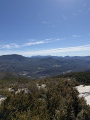
A beautiful circular loop for admiring the Gorges du Verdon in a more intimate way and from different viewpoints. Sumptuous panoramic views of the Grand Canyon and Colle de Breïs and, of course, Point Sublime. A challenging route, well suited to trail runners: it climbs for most of the route but with a reasonable gradient. Then comes a short but fairly steep descent, which proved less difficult than it looked.
The Suech Plateau
 5.25 mi
+1,243 ft
-1,243 ft
3h 30
Easy
Departure from Rougon (Alpes-de-Haute-Provence)
5.25 mi
+1,243 ft
-1,243 ft
3h 30
Easy
Departure from Rougon (Alpes-de-Haute-Provence)
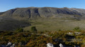
Overlooking the village of Rougon and located at an altitude of over 1,200 metres, the Plateau du Suech offers beautiful panoramic views where, with a little luck, you can admire the griffon vultures of the Verdon.
The Laval farm
4.30 mi
+709 ft
-709 ft
2h 50
Easy
Departure from Lambruisse (Alpes-de-Haute-Provence)
On 6 April 1944, the Maquis de la Ferme Laval was defeated after around twenty resistance fighters battled Nazi soldiers and militiamen for over six hours. This easy walk from Lambruisse takes you to the site of this tragedy.
Coulomp Waterfall
 9.91 mi
+3,238 ft
-3,238 ft
8 hrs
Very difficult
Departure from Castellet-lès-Sausses (Alpes-de-Haute-Provence)
9.91 mi
+3,238 ft
-3,238 ft
8 hrs
Very difficult
Departure from Castellet-lès-Sausses (Alpes-de-Haute-Provence)
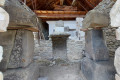
A lovely walk to the waterfall and the Source du Coulomp, with the option to visit the Aurent museum, which houses everything the descendants of the former inhabitants found in the ruins when they revived the hamlet. To reach the waterfall, you need to walk along the bed of the Coulomp for 1 km and cross it seven times, which can be dangerous if the flow is too strong.The archaeological remains of the Argenton Mausoleum bear witness to the presence of the Romans in the region.
Circular Mourre Frey, Tête de Travers and La Mélina loop, starting from the Col de Fa
 13.56 mi
+5,023 ft
-5,023 ft
7 hrs
Very difficult
Departure from Castellet-lès-Sausses (Alpes-de-Haute-Provence)
13.56 mi
+5,023 ft
-5,023 ft
7 hrs
Very difficult
Departure from Castellet-lès-Sausses (Alpes-de-Haute-Provence)
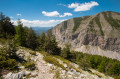
A long and beautiful circular route in the Alpes de Haute Provence, taking you along a magnificent ridge path to Aurent, perhaps one of the most beautiful remote little hamlets in France. Sturdy walking boots and walking poles are essential.
The Samson Corridor tunnels and the Trescaïre towers
 1.74 mi
+2,254 ft
-2,254 ft
2h 45
Easy
Departure from Rougon (Alpes-de-Haute-Provence)
1.74 mi
+2,254 ft
-2,254 ft
2h 45
Easy
Departure from Rougon (Alpes-de-Haute-Provence)
This round trip route takes you to the Samson Corridor, which marks the entrance to the Grand Canyon. It will take you through the tunnels of the Blanc-Martel trail to the Trescaïre viewpoint.The trail follows the Blanc-Martel trail, but is much more accessible and offers a unique experience thanks to the tunnels.The indicated elevation gain, calculated automatically, is incorrect.See the practical information section for details of the minimum equipment required.
Valderoure route, returning via Malamaire
 8.94 mi
+1,650 ft
-1,647 ft
5h 35
Moderate
Departure from Valderoure (Alpes-Maritimes)
8.94 mi
+1,650 ft
-1,647 ft
5h 35
Moderate
Departure from Valderoure (Alpes-Maritimes)
Starting from the charming village of Valderoure, this route with its varied landscapes will take you through a pine forest to the hamlet of Les Beaux. After crossing the Lane and Artuby rivers, you will pass through the hamlet of Malamaire before returning to Valderoure, still in the forest.
Crêtes du Bauroux
 7.35 mi
+1,827 ft
-1,827 ft
5h 00
Moderate
Departure from Séranon (Alpes-Maritimes)
7.35 mi
+1,827 ft
-1,827 ft
5h 00
Moderate
Departure from Séranon (Alpes-Maritimes)
A beautiful and pleasant hike, without any particular difficulty, dotted with historic sites and varied landscapes: rocky terrain, woodland and plains. You won’t be bored for a minute and, as a grand finale, a breathtaking 360° panorama from the highest point.