Circular walk around Le Bourguet

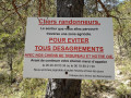
A pleasant walk through the Le Bourguet forest, with the added bonus, in summer, of possibly encountering a herd of goats watched over by a Pyrenean Shepherd dog.

Details

827268
Creation:
Last update:
Last review:
  • Walking
    Activity: Walking
  • ↔
    Distance: 3.01 mi
  • ◔
    Average duration: 1h 55 
  • ▲
    Difficulty: Easy

  • ⚐
    Back to start: Yes
  • ↗
    Ascent: + 574 ft
  • ↘
    Descent: - 574 ft

  • ▲
    Highest point: 3,333 ft
  • ▼
    Lowest point: 2,746 ft

Photos

Description of the walk

To get to Le Bourguet from Castellane, take the D952 which runs alongside the swimming pool. Park in the car park at the village exit. Coming from Comps, the car park is on the left at the village entrance.

(S/E) Leave the car park on the right towards Comps, cross the bridge and turn right straight away. Ignore a path branching off to the right and take the small track that climbs, initially heading west. Wind your way through the woods (ignore a few paths branching off to the right). The path climbs steadily until it reaches a T-junction at the highest point of the route (power pylon on the left).

(1) Follow the wide path to the right and head down to Bagarry.

(2) Ignore the path leading uphill to the left and continue along the main path, heading north-west.

(3) At the junction, follow the path on the right (ignore the path leading off to the left towards the Saint-Pierre sheepfold). The path soon becomes a small tarmac road.

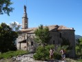
(4) Pass a farm on your left and continue along the road to the village. At the crossroads, turn right to return immediately to the car park (S/E).

Waypoints

  1. S/E : mi 0 - alt. 2,759 ft - Le Bourguet – Car park
  2. 1 : mi 0.85 - alt. 3,333 ft - T-junction
  3. 2 : mi 1.18 - alt. 3,264 ft - Bagarry
  4. 3 : mi 1.87 - alt. 3,068 ft - Junction
  5. 4 : mi 2.51 - alt. 2,867 ft - Farm
  6. S/E : mi 3.01 - alt. 2,759 ft - Le Bourguet – Car park

Notes

Please note: on the way back, at the entrance to the village there is a fountain on the right, but the water is not safe to drink.

Reviews and comments

4.8 / 5
Based on 2 reviews

Reliability of the description
5 / 5
Ease of following the route
5 / 5
Route interest
4.5 / 5
sophie1610
sophie1610

Overall rating : 5 / 5

Date of your route : Aug 18, 2019
Reliability of the description : ★★★★★ Very good
Ease of following the route : ★★★★★ Very good
Route interest : ★★★★★ Very good

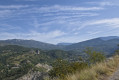
A walk with a baby in a baby carrier and a 6-year-old boy. It’s a bit of a climb at the start, but it’s more than manageable; what’s more, it’s in the shade in the middle of a woodland, which is lovely in summer. We met the lady from the Dei Reïcampadis farm, who was looking after her goats with her nine adorable dogs. In the village, there’s a pretty little fountain and a restored wash house. There’s a lovely view of the Lachens from the tarmac road towards the end, just before you reach the village.

Machine-translated

degna
degna

Overall rating : 4.7 / 5

Date of your route : Sep 10, 2018
Reliability of the description : ★★★★★ Very good
Ease of following the route : ★★★★★ Very good
Route interest : ★★★★☆ Good

An easy walk. The start is a bit steep, but it doesn’t last long. Watch out for herding dogs. You can contact the owners (telephone numbers are listed along the route).

Machine-translated

Other walks in the area

For more walks, use our search engine .

The GPS track and description are the property of this route's author. Please do not copy them without permission.