Country:

 City:
City:



Make sure you carry enough water with you, as the path runs mainly along ridges and there are no springs accessible along the way. The point (7) atthe 8th km will be your last accessible spring before reaching the refuge that evening.
Park at the edge of the village of Blieux. A recessed area serves as a car park opposite the start of the hiking trail.
(S) Cross the road and start the walk on the left, heading down the stony track.
(1) After the small river, take the track on the left.
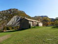
(2) Pass two consecutive signposts pointing towards Thon. Continue along the track: the yellow markings begin here. You’ll pass through a farm and then arrive at the hamlet of Quartier de Thon.
(3) At the hamlet, take the Chemin de la Thuilière on the right. The yellow markings continue. The track is clear, well-defined and easy to follow. The climb is steady and gradual.
(4) At the slight junction, carry on straight ahead. You’ll reach your first small ridge.
(5) The marked path continues to your left.
(6) The paths become less distinct. Head to the right towards the Mourre de Chanier. You can follow a few cairns through the thickets. There is a water source below, next to the shepherd’s hut. Head down to the water source.
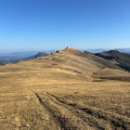
(7) Top up your water supplies; you won’t find another water source until you reach the observatory. Return to the path and head towards the ridges. You’ll gradually catch sight of the Mourre de Chanier, your next destination. Join the ridge line.
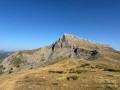
(8) Carry on towards the Mourre de Chanier. You’ll reach the summit of the Mourre de Chanier (1,930 m).
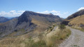
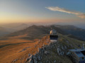
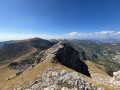
(9) The highest point of the day, marked by a metal structure. From here, you can see the Mont Chiran Observatory (your final destination), as well as the two peaks you are about to tackle. To your left lies Lake Sainte-Croix, into which the Verdon flows; to your right, the peaks of the Mercantour. Continue along the ridges towards the reservoir and the Petit Mourre. Pass to the right of the reservoir. You’ll reach the Petit Mourre (1,873 m).
(10) Enjoy the view, then retrace your steps and veer to the right to pass to the left of the reservoir; rejoin the ridges and follow them towards the Grand Mourre. You’ll arrive at the Grand Mourre (1,898 m).
(11) This is the final peak before the observatory. Descend due south, following the path below which joins the hairpin bends of the road. Caution! The descent is steep, with numerous loose and unstable rocks in an exposed scree slope. Take your time to descend safely.
(12) You’ll pass the signpost at the Portail de Blieux indicating that the Observatory is 3 km away (about 1 hour). Continue in this direction. You’ll rejoin the winding stony road.
(13) Follow it to the right until you reach the approach to the Observatory.
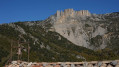
(14) Halfway up the final hairpin bend, leave the stony track and take the path leading up towards the Observatory (marked by rusty metal signposts). You’ll arrive at the Observatory and the Mont Chiran Refuge (1,905 m) (E), where you’ll (finally!) find water. You can choose to stay overnight in the refuge (subject to prior booking) or pitch your tent within the areas designated for this purpose.
 Visorando Member
 Difficult
 Moderate