Refine your search for walks in Saint-Bon-Tarentaise
Saint-Bon-Tarentaise walks
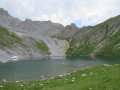
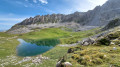
Lacs Merlet
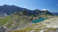
Starting from Pralin, the hike to the Merlet lakes takes you to a superb, peaceful site on the edge of the Vanoise National Park, dominated by the Aiguille du Fuit.
Markings are present but not everywhere.
Crossing Mont Jovet via the Dou de Moutiers and the Roc du Bécoin
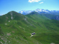
Mont Jovet is a magnificent vantage point in the heart of the Vanoise. It can be climbed fairly easily from its various sides, from Montagny, Bozel, Champagny, La Plagne or Notre-Dame du Pré. This circular route takes you across the mountain, passing through the various hills that surround it and along west-to-east ridgelines, adding a bit of challenge to the hike and offering a variety of views.
Mont Jovet as a long loop via the Belvédère de Grande Roche
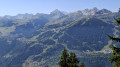
Hike on the southern slope of Mont Jovet in a fairly wide loop, passing by the Belvédère de Grande Roche. The first part is in a shaded area in the Bois de la Cour, then the Bois des Roches. The route includes a slightly exposed section on the ridge of Mont Jovet. The return journey is on the other side, along a stream where you can stop to cool off. The entire hike offers a succession of varied panoramic views between the Tarentaise and Haute-Tarentaise valleys.
Dents de la Portetta via the ridges of Mont Charvet
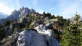
A very beautiful circular route in the Courchevel area, without being hindered by the pylons...
The route is unique and quite wild; I didn’t come across a single person that day... just the cows from the mountain pastures who came to visit me during my break, and further up, a herd of chamois that I’d clearly disturbed.
A quiet spot, except for the immediate vicinity of the car park and Lac de Rosière, and very charming.
La Dent du Villard from Courchevel
To the east of Courchevel, 1550m above Lac de la Rosière, the Dent du Villard is a white gypsum mountain perforated with multiple dissolution craters on its summit, making for an impressive crossing.
The southern slope of Mont Jovet with a small circular path.
This hike on the southern slope of Mont Jovet offers beautiful views of the Vanoise and beyond.
The route is well cleared and best done early in the morning or in spring after the snow has melted, or on a beautiful autumn day.
Le Châtelard and La Croix de la Duy via La Traye
This route offers a loop around Champagny-en-Vanoise via Le Châtelard and La Duy, then descends via Les Combes d'en haut and Les Combes d'en bas, ending at La Traye. No particular difficulty.
Balcon de la Forêt du Miollet, starting from Champagny-en-Vanoise
A lovely summer walk in Champagny-en-Vanoise.
After a fairly steep climb through the Bois des Chapelets, you follow a ridge walk in the Forêt du Miollet with magnificent views of the Vanoise Massif, the Grand Bec and the Vanoise Glaciers.
The descent then takes you through the Bois des Genévriers and past the alpine chalets at Combes d’en Haut and La Traye.
Mont de la Guerre via the Champagny cable cars
The proposed route allows you to climb Mont de la Guerre from Champagny-en-Vanoise and descend via the ski area. The route passes by the Champagny cable cars for those who wish to shorten the descent (please note that they are not operational on Saturdays). There are many alternatives for the descent; I have suggested this version to create a loop. Instead of going through the Bois des Génévriers, it is possible to descend via the forest track.
Pointe de la Vélière circular route from Champagny-en-Vanoise
A circular ascent of the Pointe de la Vélière (ascending via the Bois des Fougères and descending via the Bois des Cabanes) from the village of Champagny-en-Vanoise. A fairly varied loop with successive sections through woodland (Bois de la Fougère, des Chapelets, des Cabannes) and high-altitude mountain pastures (towards the Plan du Bouc). Viewpoints overlooking the Vanoise, and an ascent up a wild valley (Les Arriérés). The circular route also offers numerous variations (for example, it can be extended by following the ridge line from the Sommet de la Vélière to the Col de la Bauche de Mio).
La Tour du Merle via Plan Fournier from Champagny-en-Vanoise
A circular route starting and finishing at Pont des Chailles in Champagny-en-Vanoise. A fairly varied route alternating between forest sections, where blueberries line the path, and unobstructed views of the Vanoise, either over the Pralognan area (Portetta, Vanoise Glaciers) or the Champagny area (Mont de la Guerre, Pointe de la Vélière, Pointe des Chardes, etc.). The second part of the descent follows a fairly wide forest track.
The Bozelet Chapel as seen from the Champagny cable car
A lovely walk in very open countryside, with no major difficulties.
We did it at the end of July and it felt like we were in a flower garden.
The circuit around the Aiguille du Rateau
A physically demanding, off-the-beaten-track walk in a landscape that is at times very wild and rocky.
The Grand Bec Refuge, and a little more
A beautiful hike that will make you want to come back for several days.
Col de Jean above Les Allues
A lovely hike in the Allues Valley, best undertaken from June to October on well-maintained paths away from the ski lifts.
Le Rocher de Villeneuve - La Montagne
Although located on the edge of the Vanoise National Park, the Rocher de Villeneuve is a little-visited peak that nevertheless offers a stunning view of the Vanoise glaciers.
There are few markings, but there are directional signs at strategic points.
Notre Dame de la Salette and the Feissons Cross
Starting from the pretty village of Feissons-sur-Salins, set off along beautiful forest paths towards the Chapel of Notre-Dame de la Salette and the Cross of Feissons and enjoy the panoramic views offered by the peaks of the Doron de Bozel valley.
An easy hike, suitable for families, snowshoeing or mountain biking.
Les Hommes Courbés
Locals call this section of the hike “Les Hommes Courbés” (The Bent Men) because of the shape of the mountain. You be the judge...
This pleasant and varied hike is particularly suitable for a hot day as two-thirds of the route is in the shade.
For information on the difficulty, see the ‘Practical Information’ section.
Col de Leschaux - Grand Bec refuge - Vuzelle waterfall circular
A beautiful circular to do from Pralognan-la-Vanoise. The route is suitable for experienced hikers. The climb to the Col de Leschaux offers a magnificent view of the Mont-Charvet ridges and the Dents de la Portetta. The Grand Bec cirque is wild and the return trip allows you to admire the Vuzelle waterfall.
The 3-Pass Circular: Leschaux, Rosset and Vanoise, starting from Pralognan
A superb route with a particularly varied character.
A high-mountain atmosphere, depending on the areas you pass through.
Lush and green, with flora unique in Europe.
Wildlife is ever-present, with marmots, chamois and ibex to be spotted with a keen eye.
Its mountain lakes: the iconic Lac des Vaches, Lac de la Patinoire and Lac du Long.
Spectacular views of the surrounding peaks: the Grande Casse, to name but one.
Beautiful panoramic views of the valley and the various surrounding glaciers.
Refuge des Lacs Merlets – Refuge de la Valette
This third stage will take you from the Refuge des Lacs Merlets to the Refuge de la Valette.
This stage is undoubtedly the most challenging, with 1,400 metres of elevation gain. The ascent of the Petit Mont Blanc, a difficult descent to Les Prioux, followed by another beautiful and long climb (900m of elevation gain) to the Col de la Valette and its refuge, will make for a memorable day.
From the Lacs Merlet refuge to the Péclet-Polset refuge
After the long stages of the previous days, this one is more leisurely.The climb to the Col du Soufre is gradual until you reach the edge of the Gébroulaz glacier.The beauty of the Col du Soufre (the day’s highest point), with its ochre and white colours, more than makes up for the day’s efforts.
The ridges of Mont Charvet via the Col de la Grande Pierre
Another classic route from Pralognan with the very distinctive ridges of Mont Charvet. Magnificent views both towards Pralognan and its glacial domes and towards Courchevel. The path is exposed, sometimes narrow, and should not be used in wet weather. Schist peaks and dissolution cones dot this long ridge trail. Easy return via the mountain pastures.
Brèche Portetta and Col de Grande Pierre
A route passing through the Brèche Portetta, a cluster of small peaks including the Bec, the Dent du Biot and the Dent Portetta (2,629 m), …
We shall therefore confine ourselves to the Brèche Portetta and the various narrow passages between these jagged pillars of limestone and dolomite. The views are superb, taking in the Vanoise glaciers, the Grande Casse, the Aiguille du Fruit, the Chavière valley and Mont Blanc.
Rocher de Villeneuve via La Montagne
This hike takes you through the beautiful mountain pastures of La Montagne and Le Golet to Rocher de Villeneuve, where you can enjoy a 360° view of the Aiguilles de Portetta, the ridges of Mont Charvet, Col de Leschaux and even Courchevel 1850.
Napremont
Beautiful promontory facing Pralognan, with stunning views of the entire area, including the Portetta breach and the Aiguille d'Août, which dominate the route. Unfortunately, this is now a round trip since the path (still shown on the map) through the Bois de Chollière is closed. (2008, order renewed every year since then, given the danger).
Roc de la Pêche refuge
This is a long and very beautiful snowshoe hike with superb scenery and the chance to see chamois.
Towards Lac du Mont Coua
A hike in the Vanoise in search of the Lacs du Mont Coua. Mountain pastures, pastoral life, geology, torrents and glaciers add to the appeal of this outing.
Circuit of Mont Coua and its lakes
A long but scenic route passes through the Vallon du Fruit in the Plan de Tuéda Nature Reserve (Vanoise massif) between Méribel-Mottaret and the Refuge du Saut. Panoramic views of the Aiguille du Fruit ridge, a jagged massif. Below, a view of the confluence of the Doron des Allues and the Ruisseau de Chanrouge. The Mont Coua lakes are well worth the effort, and you may spot some ibex along the way as you reach the fourth lake.
Vallon du Fruit, Lac des Fées, Refuge du Saut and Lac de Tuéda in Méribel
A family hike on trails in the Tuéda Nature Reserve on the edge of the Vanoise National Park. A route where you can see marmots running along the path, with a stop at Lac des Fées, ideal for a long break. Finally, pass by the Refuge du Saut and then Lac de Tuéda and its plateau.
The Col du Soufre offers a panoramic view of the Gébroulaz Glacier
This hike offers a geological outing as it enters the Vanoise National Park, allowing you to get close to the magnificent Gébroulaz glacier.
The Col du Soufre offers a curious, rugged landscape of shapes and colours created by the presence of scree.
Chamois, ibex and marmots are also to be found here.
Circular route around the Grande Casse
Four-day hike around the Grande Casse in the Vanoise National Park, starting from Pralognan. Highlights: crossing the rocks of Lac des Vaches, views of the Grande Casse and the Leisse Valley, all in an idyllic setting and in the company of marmots.
Pralognan - Leisse Refuge
Day1 of the Grande Casse circular route, from Pralognan to the Refuge de la Leisse, passing close to the impressive Grande Casse, all in a wild setting dotted with lakes.
Lécheron mountain chalet
One of the first hikes to do when discovering the Champagny-le-Haut valley and a great way to pick up some cow's or goat's cheese for lunch. This hike can be extended to Froide Fontaine.
Loop on the left bank of the Doron de Champagny via La Sauvire
Alpine hike for experienced walkers on the wild left bank of the Doron de Champagny, with views of the chain of glaciers and rock faces stretching from the Grand Bec to the Grande Motte via the Grande Casse.
Pointe des Chardes
The Pointe des Chardes doesn’t seem to be very well known, yet it’s a beautiful, wild hike that isn’t too difficult, with an incredible view from the summit. We’re right in the heart of the Vanoise.
Circular route via the Passage de la Frête from Champagny-le-Haut
A circular route from Champagny-le-Haut has been made possible by the recent upgrading of a section of the path just below the Passage de la Frête. The latter is the highlight of the route, offering unobstructed views towards the Vanoise. This route can be walked in exactly the same way in the opposite direction, offering the same rewards. This also gives you the chance to buy some cheese at the Chalet d’Alpage du Lécheron on the way back.
Approach Mont Jovet and the Crête des Étroits via the Pas des Brebis
Heading to Mont Jovet via the Tête du Jarset then the Col du Lac and continuing along the Crête des Étroits remains a classic route in La Plagne. However, this ridge walk puts off hikers prone to vertigo due to a few steep slopes.
The suggested route avoids the difficult sections and allows everyone to admire the mountain accessible via the Pas des Brebis. The return journey offers views of the entire resort.
The length and elevation gain mean this circular route is best suited to experienced hikers.
Refuge du Bois - Pralognan
Day 4 of the circular route around the Grande Casse, from Champagny-le-Haut to Pralognan via the Tour du Merle and the Grand Bec.
Lac de la Patinoire
A very pleasant hike with a vast panorama from the Rosset Pass opening onto the Grande Casse and the Vanoise glaciers. The final point of the climb is the lake and its feeding glacier, which you will discover in the last few steps.
See § practical information
Le Napremont
This circular route offers beautiful views and 360° panoramas of the surrounding area and peaks. In terms of difficulty: there is a difference in altitude in the undergrowth; there is a passage through a chimney, but this has been made easier by the installation of steps and a handrail.
A trail with beautiful flora dominated by the Dents de Portetta and the Aiguille d'Août.
A pleasant descent in the sunshine before returning to the undergrowth. A very beautiful route, even in hot weather.
The Col de Leschaux circular route
An exposed hike requiring caution, offering a stunning view over the entire southern sector of Pralognan-la-Vanoise.
Refuge de la Vallette via the Pas de l’Âne
A challenging hike that passes through the Cirque du Petit Marchet, crosses the Roc du Tambour to reach the Refuge de la Vallette and ends at the hamlet of Le Prioux.
Tip: only undertake this hike when there is no snow and in dry weather.
The Tour de l’Aiguille de la Vanoise via the lakes and the Col du Moriond
This hike requires a bit of fitness but is accessible. To make it easier, it’s best to do it in the opposite direction; however, with our children aged 8 and 12, we prefer the route described below.
Mountain trolls and marmots are sure to be spotted. If you’re lucky, you might even spot some chamois.
The Col de la Vanoise via the Arcellin
This is a classic route in Pralognan, which takes theGR®55"motorway" on the way back. On the way there, the climb through the Cirque de l'Arcelin and Lac des Assiettes is truly superb and fairly uncrowded.
The Moriond loop from Pralognan-la-Vanoise
Le Moriond is a small peak located on the Aiguille de la Vanoise ridge. This summit is an easily accessible viewpoint from Pralognan, offering views of the Aiguille de la Vanoise and the Grande Casse. Marmots are never far away.
Etymology of Moriond: round mountain. Seen from Pralognan, this name is entirely justified!
Lac des Assiettes, Lac des Vaches, Lac Long and Lac de la Patinoire
Several descriptions on Visorando already pass through the Col de la Vanoise. This one offers an itinerary that strays from the beaten track, seeking out wild and little-used passages.
Whether on well-trodden paths or not, the scenery is spectacular throughout.
The Col de la Vanoise
Located in the heart of the Vanoise massif, this route is a good introduction to France's first national park and goes around the Aiguille de la Vanoise. In early summer (June), you'll easily spot ibex, marmots and maybe even chamois.
It is best to park at the Fontanettes car park above Pralognan-la-Vanoise, but you can also start from Pralognan.
Moderator's addition on 04/08/2021: Please note! For safety reasons, it is strongly recommended that you do this route in the opposite direction to the one suggested here. See the reviews at the bottom of this page.
From Les Fontanettes to Les Prioux via the Col du Grand Marchet and La Valette
A very beautiful high-altitude hike, a bit challenging but probably one of the most stunning. It passes through several little-visited cirques and offers high-mountain views throughout the route.
This is a one-way hike, so you’ll need to organise your return journey (see practical information).
Lac des Blanchets and Roc du Diable from Belle Plagne
This half-day hike is easy for most of the route but presents some difficulty during the (optional) ascent of the Roc du Diable. The rest of the route is mostly on paths prepared for mountain machinery, so there are no particular difficulties. There is a beautiful panoramic view from the top of the Roc du Diable (2,426 m). This hike is not signposted, so it is recommended that you use the app for certain sections.
Mont Saint-Jacques and Tête des l'Arpettes from Belle Plagne
This hike is not technically difficult and can be completed in half a day. It offers beautiful views, including two lookout points. The trails are sometimes difficult to see, so a GPS device may be useful, although the terrain is clear and the waypoints are visible from a distance at all times.You will pass through mountain pastures where cows may be present in season.
Le Petit Mont Blanc via the southern slope
A substantial but steady climb for a magnificent panorama.
The Frasses Circular Route via the Col du Seuchet from Belle Plagne
This walk takes you from meadows, where cows graze peacefully, to the fir forest overlooking the Tarentaise valley. It is a circular route that skirts around Mont Saint-Jacques. A very pleasant walk through the forest section during periods of hot weather.
Discover the Montagne de l'Arc via Lac du Carroley
This hike is a longer version of the one suggested by the La Plagne Tourist Office. You will see Les Inversens and the summit of Bellecôte as you pass by the Carroley mountain and its small lake.
You will descend to Belle Plagne via the foot of Mont Saint-Jacques (2,407 m).
Descent from Tougnète to Le Molard in summer using the ski lifts
Tougnète is an easy peak to reach in summer via the ski lifts and allows you to admire magnificent panoramic views with ease. The superb meadows come into view on the descent. There are no difficulties; just take the time to admire the scenery.
From Tougnète to Les Ménuires via the ski lifts
Spectacular panoramic views from the summit of Tougnète, at an altitude of 2,437 m. Magnificent panoramic views from vantage points along the entire route. Arrival at the top of the Roc 1 cable car, at 2,260 m.
This hike should be undertaken during the summer when the ski lifts are operating for hikers.
From Lac du Rateau to the Refuge du Saut
Second day of hiking on a 4-day route in the Vanoise massif.
A wonderful mountain experience as you cross the Col du Rateau and the Passage des Eaux Noires, which are rarely visited. Views of Mont Blanc.
Hautecour art trail (Le Breuil) - Circular Liberté
Walk with your nose in the air, your eyes wide open, and let yourself be surprised! You will discover original and ephemeral Land'art creations in an exceptional and relaxing setting. This easy trail has many surprises in store for you! Unusual and most pleasant for its setting, the view it offers and the tranquillity of the place, it is populated by around forty original artistic creations made of straw, wood and stones using the Land Art technique!
From the Refuge du Saut to the Refuge de l'Orgère via the Col du Soufre
From the Refuge du Saut to the Refuge Porte de l'Orgère, the route passes close to the Gébroulaz Glacier via the Col du Soufre (2,817 m) before descending towards Lac Blanc and, via theGR®55, the Col de Chavière (2,796 m) and the Tête Noire rocks.
From the Refuge du Saut to the Chalet du Clou
Third day of a 4-day route in the Vanoise Massif.
A beautiful ascent along the Gébroulaz Glacier and a lunar landscape via the Col du Soufre
La Valette Refuge
In the heart of the Vanoise National Park, discover the Refuge de la Valette, perched at an altitude of 2,585 m. An essential stop on multi-day hikes or simply a little corner of paradise for a well-deserved break at the foot of the Vanoise glaciers. Make the most of your hike to explore the old refuge and the nearby lake. The slope’s exposure encourages updrafts, ideal for birds of prey (golden eagles, bearded vultures, etc.) to soar – a truly spectacular sight!
The Chalet des Nants and the balcony trail
An easy walk in the Vanoise that is suitable for children or as a warm-up walk at the start of your stay. The circuit allows you to discover the Cirque des Nants and the Chavière valley from the balcony trail. There is a small lake on this trail that is a nice place to stop for the children.
Lac de la Valette
A hike beneath the Vanoise Glaciers towards the lovely Lac de la Valette, with the Grande Casse as a backdrop. The ascent follows an excellent path and includes a section off the beaten track, with magnificent views throughout.
Four days in the Vanoise
This four-day summer circular route is designed for independent hikers who do not wish to stay in or near mountain huts. Consequently, the bivouac sites are located outside the Vanoise National Park and the Plan de Tuéda Nature Reserve.
From the hamlet of Les Prioux to Lac du Rateau
First day of a 4-day route in the Vanoise massif.
A very pleasant climb along the ‘100-bend’ path to reach the summit of the Petit Mont Blanc and its orientation table. A lovely end to the day in the Combe du Rateau.
Le Petit Mont Blanc via the Sentier des cent virages
A must-do hike in the commune of Pralognan-la-Vanoise. Bucolic setting, magnificent views. Grande Casse and Mont Blanc, among others.
Le Pommier Blanc crossing
This summit is the end of a ridge descending from the Vanoise glaciers and allows you to immerse yourself on this slope of the right bank of the Torrent de Chavière overlooking the Prioux, without too much elevation gain or real technical difficulty, but at the cost of part of the route being off-trail.
Saut and Péclet-Polset mountain huts from Les Prioux - Chavière Valley
Two beautiful glacial valleys, two passes, two refuges, a lake... and views of glaciers and peaks rising to over 3,000 metres. The Alps as we love them, with vast panoramas and well-marked trails that allow you to rack up kilometres and elevation gain for a variety of views. Magnificent panoramas are guaranteed and, with a little luck, marmots and ibex will be there to greet you.
Valette Refuge - Col de la Vanoise Refuge
The 4th stage of this route, which will take you from the Valette refuge to the Col de la Vanoise refuge. One of the most challenging stages, featuring the ascent of the Col du Grand Marchet and its highly technical descent.
A balcony-like route above Pralognan, the Petit Marchet, the Grand Marchet cirque, and the pass of the same name, leading to the Lac des Vaches and its ford, with the Grande Casse and the Col de La Vanoise refuge in the background. A technical stage, but one of the most beautiful.
Lakes of Mont Coua via Col Rouge and Col du Soufre
This hike takes you to the Lacs du Mont Coua and Lac Blanc, passing through the Col Rouge and Col du Soufre. Please note that at the start of the season there may still be a lot of snow, and some sections may be tricky.
The Pointe Ariande tour
A walk that deviates from the balcony path, with a section off-trail, but no risk of getting lost.
The Péclet-Polset Refuge and Lac Blanc
This hike offers a beautiful excursion into the Vanoise National Park, where you can discover a glacial lake and enjoy splendid views of several glaciers, the Dômes de la Vanoise and Peclet Polset.
From Chalet Clou to Les Prioux
Fourth day of a four-day route in the Vanoise massif.
A very beautiful mountain route passing through the Petit and Grand Cirques du Marchet.
Pointe de Friolin
A lovely hike that allows you to enjoy very different terrains: forest, alpine pastures, rocks. Beautiful view of the Beaufortain, especially the Pierra Menta, and allows you to approach the menacing north face of Bellecôte. As a bonus, an easy 3000-metre peak.
More walks in Saint-Bon-Tarentaise
Select a point of interest below: