Country:

 City:
City:


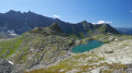
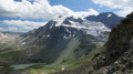
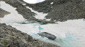
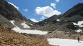
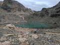
(S) Set off to climb the pass alongside Lac du Rateau (the lake will be on your left).
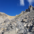
The climb on the path quickly gives way to scree; the route is marked by orange dots (more visible when heading in the opposite direction).
Ignore the ‘Col du Rateau’ sign, which is situated in the middle of the scree in a spot that bears no resemblance whatsoever to a pass!
Carry on until you reach the real Col du Rateau, the final section of which is on earth.
(1) Cross over to the other side, continuing to follow the orange markings through the scree.
(2) Once you’ve left the scree, carry on along the path towards the Col de Chanrouge.
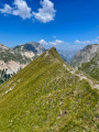
Cross the Ruisseau des Avals and reach the Col de Chanrouge to enjoy the views over the Beaufortain, the Tarentaise and the Mont Blanc massif.
(3) At the Col de Chanrouge, head down into the new valley that opens up before you.
Cross the Chanrouge stream and turn left to follow the stream upstream.
(4) Take the first visible path through the grass heading off to the right towards the Passage des Eaux Noires. Prepare for a good hour’s climb. The grass soon gives way to rocks and snowfields.
Find your own way as best you can – there are sometimes several cairn-marked routes! Reach the Passage des Eaux Noires.
(5) Continue straight ahead in the same direction (south) towards the Col des Fonds. You’ll continue through the same rocky and snowy terrain. You’ll pass close to the various lakes of Mont Coua: a flood-prone area (lake in August 2018), another lake on the right not far from the Passage des Eaux Noires, and the upper lake, which you’ll need to bypass via a snowfield. Carry on to the Col des Fonds.
Once you reach the Col des Fonds, you’ll be treated to another view of the upper Doron de Chavière valley.
(6) Turn back to reach the Passage des Eaux Noires.
(5) Turn left and head down towards the large Lac du Mont Coua.
(7) Do not attempt to descend to the lake’s outlet at 2,672 metres. Cross the torrent at the outlet and walk alongside the lake (keeping the lake on your left) for a good hundred metres.
Turn right to leave the lakeshore and begin the descent; you will rejoin the outflow torrent further down.
(8) A tricky section depending on snow conditions, precisely where the path joins the stream. The rest of the descent is easy. Head for the footbridge spanning the Doron des Allues.
(9) After crossing, turn right and head down to the Refuge du Saut to set up camp (E).
 Visorando Member
 Moderate
 Difficult