


Refine your search for walks in Saint-Blaise-la-Roche
Saint-Blaise-la-Roche walks


 The Flag Trail in Saint-Blaise-la-Roche
 Visorando Member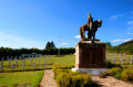
 4.53 mi
 +594 ft
 -620 ft
 2h 35
2h 35
 Easy
Easy
 Departure from Saint-Blaise-la-Roche (Bas-Rhin)
A commemorative walk retracing the Battle of Saint-Blaise-la-Roche during the First World War and the episode of the flag captured from the enemy. Numerous information boards line the route.
The banks of the Bruche from Saint-Blaise-la-Roche
 Tourist office10.83 mi
+1,155 ft
-1,171 ft
6h 00
Tourist office10.83 mi
+1,155 ft
-1,171 ft
6h 00
 Difficult
Departure from Saint-Blaise-la-Roche (Bas-Rhin)
Difficult
Departure from Saint-Blaise-la-Roche (Bas-Rhin)
Situated at the bottom of the valley, Saint-Blaise-la-Roche experienced significant population growth during the19th century with the establishment of weaving industries. The village is also situated on the first Strasbourg–Saâles–Saint-Dié-des-Vosges railway line, inaugurated in 1929 by Raymond Poincaré. Numerous engineering structures (including the Fouday viaduct further downstream) made it possible to create the first railway route through the Vosges.
From Colroy-la-Roche to Stampoumont in a circular.
 5.51 mi
+712 ft
-705 ft
3h 10
Easy
Departure from Colroy-la-Roche (Bas-Rhin)
5.51 mi
+712 ft
-705 ft
3h 10
Easy
Departure from Colroy-la-Roche (Bas-Rhin)
An easy walk to the hamlet of Stampoumont through a beautiful forest, then beautiful views of the pastures, the Donon and the Climont, not to mention the pretty chapel of Stampoumont with its minimalist stained glass windows. A calm and peaceful walk.
Nature, history and habitat around Ranrupt
 8.93 mi
+1,467 ft
-1,467 ft
5h 25
8.93 mi
+1,467 ft
-1,467 ft
5h 25
 Moderate
Departure from Colroy-la-Roche (Bas-Rhin)
Moderate
Departure from Colroy-la-Roche (Bas-Rhin)
This circular loop, which runs mostly through the woods, offers a pleasant variety of points of interest. Villages and landscapes, nature and habitat, crafts, history and places of worship (ornate chapels, sandstone crosses) all contribute to the appeal of this still little-known region of Alsace.
Around the smallest village in Alsace
4.61 mi
+787 ft
-764 ft
2h 50
Easy
Departure from Blancherupt (Bas-Rhin)
There is a proverb that says that everything small is cute. And it's true. With its 38 inhabitants, Blancherupt is the smallest municipality in Alsace and has a charm all of its own. In the 1990s, an award-winning advertising campaign described the commune as "In Blancherupt, there is nothing... nothing but the essentials", an invitation to discover this little corner of paradise without further delay.
Around Blancherupt
 4.97 mi
+843 ft
-817 ft
3h 00
Easy
Departure from Blancherupt (Bas-Rhin)
4.97 mi
+843 ft
-817 ft
3h 00
Easy
Departure from Blancherupt (Bas-Rhin)
With its 38 inhabitants, Blancherupt is the smallest commune in Alsace and has a charm all of its own. Discover this little corner of paradise.
Champ du Feu and Col de la Perheux from Fouday
 13.48 mi
+2,556 ft
-2,552 ft
8h 25
Difficult
Departure from Fouday (Bas-Rhin)
13.48 mi
+2,556 ft
-2,552 ft
8h 25
Difficult
Departure from Fouday (Bas-Rhin)
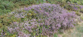
This hike will take you through Ban-de-la-Roche, a place dear to Pastor Jean-Frédéric Oberlin, who served there for 60 years. The route will take you through magnificent landscapes, past a little-known castle (or what remains of it) and to the highest point in the Bas-Rhin.It is a fairly long hike with a significant elevation gain, classified as difficult, which I completed in about 7 hours of walking.
Loop around Fouday and Belmont
 8.80 mi
+1,519 ft
-1,519 ft
5h 20
Moderate
Departure from Fouday (Bas-Rhin)
8.80 mi
+1,519 ft
-1,519 ft
5h 20
Moderate
Departure from Fouday (Bas-Rhin)
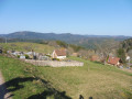
Loop connecting the various villages in the Chirgoutte valley, which were part of the former seigneury of Ban de la Roche.
Circuit on the western slope of the Champ du Feu, alternating between forest, pastures and gorse heathland.
Beautiful views of the Donon and Climont mountains.
Circular route around Saulxures
 6.71 mi
+755 ft
-764 ft
3h 45
Moderate
Departure from Saulxures (Bas-Rhin)
6.71 mi
+755 ft
-764 ft
3h 45
Moderate
Departure from Saulxures (Bas-Rhin)
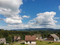
A pleasant walk around Saulxures, much of it in the shade. Beautiful views along the route.
Les Hauts du Ban de la Roche
 6.71 mi
+1,365 ft
-1,358 ft
4h 15
Moderate
Departure from Fouday (Bas-Rhin)
6.71 mi
+1,365 ft
-1,358 ft
4h 15
Moderate
Departure from Fouday (Bas-Rhin)
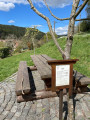
This superb walk in the heart of the Vosges mountains is, in itself, an open-air history book. From Foudray, the route climbs towards Solbach and the legendary Col de la Perheux, reaching the green landscapes around Belmont before descending towards Waldersbach and then Foudray. Its church, with its 13th-century Romanesque bell tower, is now a temple, beside which lies the tomb of Pastor Oberlin.
Circular route straddling Alsace and Lorraine, starting from Champenay
13.01 mi
+2,549 ft
-2,539 ft
8h 10
Difficult
Departure from Plaine (Bas-Rhin)
At the Col du Hantz, we cross into Lorraine; then, after a fairly long stretch along a quiet road, we follow a stream along an impressive medieval cobbled path, adorned with installations by ‘art student’ from the University of Nancy; a little further up, the tranquillity of a secluded peat bog is disturbed only by birdsong. The Chemin des Passeurs then takes us to La Haute-Loge and La Chatte Pendue. A journey for lovers of nature and history.
Champenay sandstone
10.34 mi
+1,916 ft
-1,909 ft
6h 25
Moderate
Departure from Plaine (Bas-Rhin)
Champenay is known for its quartzite sandstone quarry. This is a red sandstone veined with white, known as ‘grès des Princes’ in reference to the former status of this territory, which was the Principality of Salm. At the highest point of the route, there are old France–Germany boundary markers dating from 1870–1918. Finally, the route passes through the refreshing Falle Valley and past the lake of the same name.
The seigneury of Ban de la Roche
 4.91 mi
+850 ft
-840 ft
3h 00
Easy
Departure from Bellefosse (Bas-Rhin)
4.91 mi
+850 ft
-840 ft
3h 00
Easy
Departure from Bellefosse (Bas-Rhin)
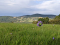
Bellefosse, known as ‘Béfoss’ in the local dialect, was part of the former seigneury of Ban de la Roche. This walk will take you up to the heights of Bellefosse to explore the ruins of La Roche Castle, known as ‘zum Stein’ or ‘Steinschloss’, then across the peaks, where you’ll discover the former seigneurial farmstead of Lachamp. Finally, you’ll have the chance to enjoy a meal at one of the two farmhouse inns: the Ban de la Roche or the Promont.
Farms and farmhouse inns around Ranrupt
7.42 mi
+1,316 ft
-1,286 ft
4h 35
Moderate
Departure from Ranrupt (Bas-Rhin)
Explore the trails above the village of Ranrupt and discover the hamlet of Fonrupt, a haven of tranquillity. Along the way, treat your taste buds to authentic local produce while enjoying splendid views of the Climontaine and Chiregoutte valleys.
From Haut-Ranrupt to Hauts-Bois
3.98 mi
+584 ft
-584 ft
2h 20
Easy
Departure from Ranrupt (Bas-Rhin)
Following the course of the Haut Bois stream, set off to explore the hills above the village of Ranrupt, where you’ll enjoy unobstructed views over the Climontaine valley. On your way, stop off at the Hauts-Bois farm inn to sample some local cuisine.
Circular route between Ranrupt and Colroy-La-Roche
 8.89 mi
+1,535 ft
-1,545 ft
5h 25
Moderate
Departure from Ranrupt (Bas-Rhin)
8.89 mi
+1,535 ft
-1,545 ft
5h 25
Moderate
Departure from Ranrupt (Bas-Rhin)
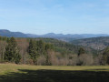
A circular walk starting from Ranrupt, taking us towards Stampoumont as far as Colroy-la-Roche, returning via Fonrupt.
A route alternating between open countryside and woodland, with two viewpoints overlooking the villages.
The first half is fairly gentle, the second half a little more challenging, with the Climont massif in view.
Château de la Roche from Haut Ranrupt
5.87 mi
+1,102 ft
-1,093 ft
3h 40
Moderate
Departure from Ranrupt (Bas-Rhin)
A beautiful walk through the forest and meadows, taking you from a small village to the old castle of La Roche with a splendid view of the valley. The first hill you see is the Col de la Perheux. Behind this pass, you will see the Donon. Along the way, you will have several views of the Climont.
Le Climont from the south side from the Col de Steige
 5.84 mi
+1,411 ft
-1,411 ft
3h 55
Difficult
Departure from Ranrupt (Bas-Rhin)
5.84 mi
+1,411 ft
-1,411 ft
3h 55
Difficult
Departure from Ranrupt (Bas-Rhin)
The Climont is a curious conical massif which you will approach from the south face. The climb is steep, but the view from the top of the Julius Tower, at an altitude of over 960m, is well worth the effort.
21/04/2025: Five years after its first publication, I revisited this route to check that the description still matches the terrain. I took the opportunity to clarify certain sections and add a few waypoints.
The descent is quite technical and difficult, and it is best to avoid it in wet weather, or else do the hike in the opposite direction. Enjoy the outing, everyone.
The Hang clearing at the foot of Climont
6.95 mi
+860 ft
-876 ft
3h 55
Moderate
Departure from Bourg-Bruche (Bas-Rhin)
This walk winds through a haven of peace and tranquillity at the foot of one of the valley's legendary peaks: Climont (966 m). The Bruche river rises at an altitude of 660 m and then crosses a vast basin: the Hang clearing. This is where families of glassmakers settled in 1723. Le Hang continued to prosper thanks to the arrival of Mennonite farmers of Swiss origin. They found here a place conducive to their pastoral and community life.
L'Alhan - Le Climont - The source of the Bruche
 9.68 mi
+2,037 ft
-2,031 ft
6h 15
Difficult
Departure from Bourg-Bruche (Bas-Rhin)
9.68 mi
+2,037 ft
-2,031 ft
6h 15
Difficult
Departure from Bourg-Bruche (Bas-Rhin)
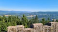
A beautiful hike with stunning views of all the surrounding valleys: the Bruche Valley, Donon, Saint-Dié-des-Vosges, Val de Villé, Sainte-Croix-aux-Mines, Haut-Koenigsbourg, etc.
It is quite difficult due to its length, elevation gain and rough terrain (narrow paths on the edge of the void or muddy forest paths).
La Chatte Pendue from Étang du Coucou
 4.12 mi
+1,145 ft
-1,135 ft
2h 55
Moderate
Departure from La Broque (Bas-Rhin)
4.12 mi
+1,145 ft
-1,135 ft
2h 55
Moderate
Departure from La Broque (Bas-Rhin)
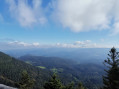
Mainly on shaded paths through the woods, this hike offers various points of interest, including the pretty Étang du Coucou lake surrounded by fir trees, the Chatte Pendue with its magnificent view of the Bruche valley and the Champs du Feu massif, and the Romanesque ruins of Salm Castle.
Salm Castle, La Chatte Pendue and the Maxe peat bog
 8.12 mi
+1,339 ft
-1,329 ft
4h 55
Moderate
Departure from La Broque (Bas-Rhin)
8.12 mi
+1,339 ft
-1,329 ft
4h 55
Moderate
Departure from La Broque (Bas-Rhin)
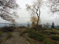
A circular walk mainly through forest. Starting from the enchanting setting of the Étang du Coucou, you will discover the ruins of the Château de Salm, currently undergoing restoration. You will then climb up to the promontory of the Chatte Pendue with its orientation table, make a short stop at the Monument des Passeurs, and then follow a slightly wilder path to the Tourbière de la Maxe.
July 2022 modification of the route between (8) and (9) due to poor trail maintenance: temporarily leave the blue cross markings in place.
La Chatte Pendue and La Haute Loge, starting from Étang du Coucou
 6.43 mi
+1,490 ft
-1,476 ft
4h 15
Moderate
Departure from La Broque (Bas-Rhin)
6.43 mi
+1,490 ft
-1,476 ft
4h 15
Moderate
Departure from La Broque (Bas-Rhin)
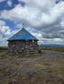
This walk will allow you to admire some stunning views whilst enjoying the tranquillity of the frequently used forest paths. A walk mainly through the forest, offering a chance to enjoy the cool, refreshing air.
The summit of Climont from Steige
10.52 mi
+2,267 ft
-2,290 ft
6h 50
Difficult
Departure from Steige (Bas-Rhin)
Starting from Steige, this hike will take you to the summit of Climont to discover the Julius Tower and several magnificent viewpoints over the Villé Valley, as well as the Bruche Valley and the Vosges.
This hike is difficult and includes sections with very steep climbs and technical passages. You will need to be in good physical condition and carry a small backpack.
More walks in Saint-Blaise-la-Roche
Select a point of interest below: