Country:

 City:
City:


The route starts at Saint-Blaise-la-Roche station, on the Strasbourg–Saint-Dié-des-Vosges line. Car parking is available here.
The route is signposted from start to finish by the ‘Blue Ring’
(S/E) From the station, head towards the village, turn right under the railway bridge, then immediately left onto the cycle path.
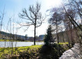
(1) At the fork, head to the right, pass by the Breux ponds, cross the Bruche and continue along the cycle path.
(2) Pass between the two houses and take the path on the right through the meadow. Cross the stream and continue uphill to reach Plaine once you’re back on the tarmac.
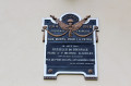
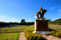
(3) At thesecond junction, turn left towards the Plaine National Cemetery. After your visit, head left again along Rue du Général Tabouis, passing the church and the cemetery whilst skirting them on the left. You’ll come out onto Rue de l’Église; turn left towards the town hall.
(4) Turn right onto the path that runs alongside the community hall and head towards the D296. Turn right and follow the road for about 300 metres until you reach the second car park.
(5) Head left and take the path uphill.
(6) Turn left to reach a plateau. Continue along this path until you reach a fork.
(7) Turn left and walk along the edge of the forest. Then turn right onto the path leading uphill, pass the site of an old cemetery on your left and reach a three-way junction. Turn left, keep left at the next two junctions, then reach the first houses in Diespach.
(8) Turn right atthe first track to descend to the Niargoutte farm. Continue down the slope until you reach the tarmac road.
(9) Follow the road to the right and reach the junction with the D296 at Poutay.
(10) Turn left to follow the departmental road, cross the Bruche and then turn left to reach St-Blaise-la-Roche station (S/E).

 Tourist office
 Difficult
 Visorando Member
 Moderate