Refine your search for walks in Puy-Saint-André
Puy-Saint-André walks


 The Rocher de Roure, starting from Puy-Saint-André
 Visorando Member
 5.94 mi
 +1,325 ft
 -1,302 ft
 3h 55
3h 55
 Moderate
 Departure from Puy-Saint-André (Hautes-Alpes)
The Rocher de Roure offers a remarkable view of the Durance valley, Briançon and the forts that protect them. This route, which is almost entirely in the shade, is a great option on very hot days.
The Ravin des Merles and the Demoiselles Décoiffées
 3.66 mi
+1,329 ft
-1,342 ft
2h 50
Moderate
Departure from Puy-Saint-André (Hautes-Alpes)
3.66 mi
+1,329 ft
-1,342 ft
2h 50
Moderate
Departure from Puy-Saint-André (Hautes-Alpes)
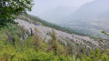
Loop starting from Pierre Feu. This circuit will take you to the chapels and hamlets around Puy-Saint-André, sundials and the "Décoiffées" fairy chimneys. An easy circuit, except for the descent to Pierre Feu, which has a few sections where you need to take care not to slip.
Partias Nature Reserve and Crête de Serre-Chevalier
8.66 mi
+3,068 ft
-3,068 ft
6h 40
 Difficult
Departure from Puy-Saint-André (Hautes-Alpes)
Difficult
Departure from Puy-Saint-André (Hautes-Alpes)
A very pleasant autumn walk through the mountain pastures. Stunning views of the Pelvoux glacier, which contrasts with the ski lift infrastructure in the Serre-Chevalier valley. Walking along the ridges allows you to immerse yourself completely in a site protected for its wildlife, flora and unique geological features.
Please note: this hike is made difficult by very steep, vertiginous and poorly maintained paths, as well as missing signposts; see the notice dated 13/07/2023
The Chalets of Ratière
5.60 mi
+1,962 ft
-1,962 ft
4h 15
Moderate
Departure from Saint-Martin-de-Queyrières (Hautes-Alpes)
The Briançonnais region is home to over twenty hamlets overlooking the valley, each as charming as the next. Here is Ratière, above the village of Prelles.
A very nice circular loop starting from Villaret.
2.84 mi
+479 ft
-463 ft
1h 45
 Easy
Departure from Saint-Martin-de-Queyrières (Hautes-Alpes)
Easy
Departure from Saint-Martin-de-Queyrières (Hautes-Alpes)
A walk through the land of owls painted on the pebbles of the Durance by the pupils of the Saint-Martin-de-Queyrières primary school.
The Chapel Route
 3.18 mi
+1,181 ft
-1,175 ft
2h 30
Easy
Departure from Puy-Saint-Pierre (Hautes-Alpes)
3.18 mi
+1,181 ft
-1,175 ft
2h 30
Easy
Departure from Puy-Saint-Pierre (Hautes-Alpes)
A very pleasant walk to discover the chapels of the commune of Puy-Saint-Pierre above Briançon.
Notre-Dame des Neiges
 4.65 mi
+2,425 ft
-2,425 ft
4h 15
Moderate
Departure from Puy-Saint-Pierre (Hautes-Alpes)
4.65 mi
+2,425 ft
-2,425 ft
4h 15
Moderate
Departure from Puy-Saint-Pierre (Hautes-Alpes)
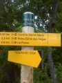
Visit a chapel overlooking Briançon, offering remarkable views of the Durance valley.
The Combarine Mine, starting from Puy-Saint-Pierre
2.12 mi
+541 ft
-541 ft
1h 25
Easy
Departure from Puy-Saint-Pierre (Hautes-Alpes)
Here’s a very short circular walk to explore the remains of the Briançon mines, particularly the Combarine mine in the commune of Puy-Saint-Pierre.
The Saint-Hippolyte Chapel as seen from the Iscle de Prelles campsite
 6.79 mi
+1,568 ft
-1,591 ft
4h 30
Moderate
Departure from Saint-Martin-de-Queyrières (Hautes-Alpes)
6.79 mi
+1,568 ft
-1,591 ft
4h 30
Moderate
Departure from Saint-Martin-de-Queyrières (Hautes-Alpes)
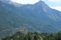
A circular route allowing you to explore the narrow streets of the village of Prelles, then admire the Briançon valley and its surrounding peaks, with Mont Charberton visible in the distance. After passing above the Chapelle Saint-Hippolyte, the climb up to it is a must. The return to the campsite finishes by following the Durance.
Circular route of the Canal Neuf and the Canal des Queyrelles
6.26 mi
+299 ft
-289 ft
3h 10
Easy
Departure from Puy-Saint-Pierre (Hautes-Alpes)
Circular Loop starting from Le Pinet via the irrigation canals used to water the land west of Briançon.
The Chalets du Mélézin, starting from Villar-Saint-Pancrace
4.10 mi
+1,995 ft
-1,995 ft
3h 35
Moderate
Departure from Villar-Saint-Pancrace (Hautes-Alpes)
The Chalets du Mélézin overlook Briançon and therefore offer a remarkable view of the town as well as the valleys of the Durance and its tributary, the Guisane.
Circular Mélézin and Les Ayes starting from Villar-Saint-Pancrace
7.39 mi
+2,051 ft
-2,057 ft
5h 10
Moderate
Departure from Villar-Saint-Pancrace (Hautes-Alpes)
A classic route in the Briançon area, allowing you to visit two of the main alpine hamlets in the commune of Villar-Saint-Pancrace.
La Tête des Lauzières
 9.00 mi
+4,400 ft
-4,393 ft
8h 00
Difficult
Departure from Puy-Saint-André (Hautes-Alpes)
9.00 mi
+4,400 ft
-4,393 ft
8h 00
Difficult
Departure from Puy-Saint-André (Hautes-Alpes)
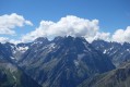
The Tête des Lauzières, also known as the Sablier, lies in the extension of the Montbrison massif, facing the prestigious peaks of the Écrins and the Cime de la Condamine, from which it is separated by the Col de Vallouise. The view of the Écrins is ever-present from this pass all the way up to the summit, where the panorama is truly stunning.
The route is partly off-trail or on-trail, depending on the option chosen.
The Croix d’Aquila
 4.16 mi
+1,998 ft
-1,995 ft
3h 40
Moderate
Departure from Puy-Saint-André (Hautes-Alpes)
4.16 mi
+1,998 ft
-1,995 ft
3h 40
Moderate
Departure from Puy-Saint-André (Hautes-Alpes)
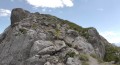
A climb to a summit offering a stunning panoramic view of the surrounding mountains of the Briançonnais and some of the peaks of the Écrins.
The Col de Vallouise
6.20 mi
+2,402 ft
-2,402 ft
4h 55
Difficult
Departure from Puy-Saint-André (Hautes-Alpes)
Discover this interesting pass, which links the Briançonnais and the Durance Valley to the Pays des Ecrins and the Gyronde Valley.
Summit of the Eychauda via the Crête de Serre-Chevalier
 6.86 mi
+2,730 ft
-2,730 ft
5h 30
Difficult
Departure from Puy-Saint-André (Hautes-Alpes)
6.86 mi
+2,730 ft
-2,730 ft
5h 30
Difficult
Departure from Puy-Saint-André (Hautes-Alpes)
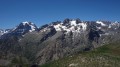
A traverse through a nature reserve in the Écrins National Park, rich with wildflowers; a ridge walk and an ascent to a summit offering a vast and stunning panorama of the Écrins, the Cerces, Italy and the Queyras. These are the ingredients of this magnificent hike.
I recommend using the Visorando app for this route.
La Condamine
 7.95 mi
+3,497 ft
-3,497 ft
6h 40
Difficult
Departure from Puy-Saint-André (Hautes-Alpes)
7.95 mi
+3,497 ft
-3,497 ft
6h 40
Difficult
Departure from Puy-Saint-André (Hautes-Alpes)
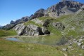
This summit, rounded like a Vosges balloon, will captivate you with its marvellous panorama of the Écrins, stretching from the Vanoise to Mont Viso.
Fort de la Grande Maye
 13.23 mi
+3,802 ft
-3,793 ft
9h 25
Moderate
Departure from Villar-Saint-Pancrace (Hautes-Alpes)
13.23 mi
+3,802 ft
-3,793 ft
9h 25
Moderate
Departure from Villar-Saint-Pancrace (Hautes-Alpes)
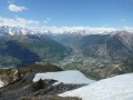
A hike to a fort situated on the heights of Briançon, offering a breathtaking panorama of the Ecrins massif, Italy, the Queyras, and some peaks of the Vanoise. You can also see the other surrounding forts, such as those of La Lausette, Les Gondrans and L’Infernet, which La Grande Maye was supposed to protect.
Prelles – Bouchier – La Blétonée – Prelles
 6.34 mi
+1,913 ft
-1,906 ft
4h 35
Moderate
Departure from Saint-Martin-de-Queyrières (Hautes-Alpes)
6.34 mi
+1,913 ft
-1,906 ft
4h 35
Moderate
Departure from Saint-Martin-de-Queyrières (Hautes-Alpes)
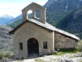
A circular route along the edge of the Écrins National Park that follows two GR® routes, the 653d and the 50.
Starting from La Guisane
 3.37 mi
+938 ft
-938 ft
2h 20
Easy
Departure from Briançon (Hautes-Alpes)
3.37 mi
+938 ft
-938 ft
2h 20
Easy
Departure from Briançon (Hautes-Alpes)
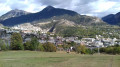
A short walk in the shade for three-quarters of the route. This walk is only possible when there is no snow, as the ski run is off-limits to walkers
30/10/2023: the start of the walk has been changed to avoid private property.
The Fort des Têtes
 3.16 mi
+991 ft
-991 ft
2h 20
Easy
Departure from Briançon (Hautes-Alpes)
3.16 mi
+991 ft
-991 ft
2h 20
Easy
Departure from Briançon (Hautes-Alpes)
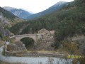
In the footsteps of the military constructions of the Briançonnais region.
Puy-Saint-Pierre circular
 6.74 mi
+1,621 ft
-1,624 ft
4h 30
Moderate
Departure from Briançon (Hautes-Alpes)
6.74 mi
+1,621 ft
-1,624 ft
4h 30
Moderate
Departure from Briançon (Hautes-Alpes)
Suburban walk.
A few steep sections but no real difficulties.
Secondary summit of the Pic de Montbrison
 5.19 mi
+3,612 ft
-3,615 ft
7 hrs
5.19 mi
+3,612 ft
-3,615 ft
7 hrs
 Very difficult
Departure from Saint-Martin-de-Queyrières (Hautes-Alpes)
Very difficult
Departure from Saint-Martin-de-Queyrières (Hautes-Alpes)
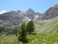
A circular off-trail hike with a distinctly alpine character, offering panoramic views over the Durance and Vallouise valleys, the Écrins, Mont Blanc, the Queyras and the Viso. A challenging hike requiring a good sense of direction, but also a very beautiful route.
I recommend using the Visorando app.
The Fort du Randouillet at the start of the route from Briançon
 5.28 mi
+1,430 ft
-1,427 ft
3h 40
Moderate
Departure from Briançon (Hautes-Alpes)
5.28 mi
+1,430 ft
-1,427 ft
3h 40
Moderate
Departure from Briançon (Hautes-Alpes)
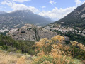
The Fort du Randouillet overlooks Briançon, and a visit offers a wonderful insight into this former garrison on the Franco-Italian border. Listed as a UNESCO World Heritage Site in 2008, along with the other forts in the Briançon area, it was once used to transport goods between Briançon and the forts of L’Infernet and La Cochette via several cableways.
The Queyrelles and Gaillard Canal Circular Loop
 5.31 mi
+404 ft
-384 ft
2h 45
Easy
Departure from Briançon (Hautes-Alpes)
5.31 mi
+404 ft
-384 ft
2h 45
Easy
Departure from Briançon (Hautes-Alpes)
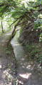
An easy walk along the canals of Briançon, offering a chance to discover the skill of our ancestors who, without any measuring tools, managed to dig these canals to supply Briançon and its fountains, as well as the vegetable gardens.
The Canal des Queyrelles
4.39 mi
+325 ft
-322 ft
2h 20
Easy
Departure from Briançon (Hautes-Alpes)
Briançon and the surrounding valleys are full of canals, which are a boon to farmers and gardeners. The Canal des Queyrelles irrigates the land overlooking the Guisane and Durance rivers and, in dry, hot weather, offers a pleasant walk in the shade of the forest.
The Guisane Canals
 6.15 mi
+869 ft
-869 ft
3h 35
Easy
Departure from Briançon (Hautes-Alpes)
6.15 mi
+869 ft
-869 ft
3h 35
Easy
Departure from Briançon (Hautes-Alpes)
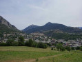
A very pleasant walk along the banks of the Guisane canals.
The Canal Neuf starting from Briançon
 6.05 mi
+633 ft
-620 ft
3h 20
Easy
Departure from Briançon (Hautes-Alpes)
6.05 mi
+633 ft
-620 ft
3h 20
Easy
Departure from Briançon (Hautes-Alpes)
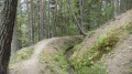
A pleasant, shaded walk, suitable for all ages, following the canals along the right bank of the Guisane.
Coste Rousse Ridge
 4.71 mi
+2,126 ft
-2,126 ft
4h 00
Moderate
Departure from Villar-Saint-Pancrace (Hautes-Alpes)
4.71 mi
+2,126 ft
-2,126 ft
4h 00
Moderate
Departure from Villar-Saint-Pancrace (Hautes-Alpes)
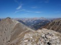
A route away from the crowds, leading to one of the most beautiful larch forests and a ridge offering a stunning panoramic view stretching from the Écrins and the Briançonnais region all the way to the Aiguilles d’Arves.
Navigation here is made easier by the Visorando app.
Lac du Plan Vallon
4.04 mi
+1,467 ft
-1,467 ft
3h 10
Moderate
Departure from Villar-Saint-Pancrace (Hautes-Alpes)
A pleasant walk through the larch forest overlooking the mountain pasture hamlet of Mélézin, ending in the Plan Vallon cirque where, normally, the lake acts as a mirror for the surrounding peaks. Unfortunately, this lake dries up by mid-July, which is a bit of a shame.
Lake Orceyrette, starting from the Cité Vauban in Briançon
 13.25 mi
+2,644 ft
-2,631 ft
8h 25
Difficult
Departure from Briançon (Hautes-Alpes)
13.25 mi
+2,644 ft
-2,631 ft
8h 25
Difficult
Departure from Briançon (Hautes-Alpes)
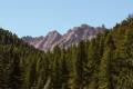
A walk that starts at the Cité Vauban, crosses through Briançon, then climbs up to Lac de l’Orceyrette via Les Ayes, offering breathtaking views. Whilst demanding in terms of duration, it is not technically challenging and requires no special equipment, just a good supply of water.
Tour of Pont Baldy Lake
 7.98 mi
+1,732 ft
-1,736 ft
5h 10
Moderate
Departure from Briançon (Hautes-Alpes)
7.98 mi
+1,732 ft
-1,736 ft
5h 10
Moderate
Departure from Briançon (Hautes-Alpes)
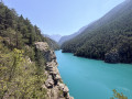
An easy hike between Vauban fortifications and the turquoise waters of Lake Pont Baldy.
Crête des Pénitents via the Col and Crête de l'Alpavin
 8.26 mi
+3,793 ft
-3,763 ft
7h 05
Difficult
Departure from Saint-Martin-de-Queyrières (Hautes-Alpes)
8.26 mi
+3,793 ft
-3,763 ft
7h 05
Difficult
Departure from Saint-Martin-de-Queyrières (Hautes-Alpes)
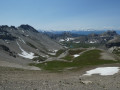
A hike away from the crowds to one of the most beautiful ridges in the Hautes-Alpes, offering a sweeping 360° panorama of the Écrins and the Queyras, with a bird’s-eye view of the magnificent Lacs d’Escur and de l’Ascension. You’ll be captivated by the timeless beauty of the rocks of the Aiguille des Pénitents massif.
A high-clearance crossover-type vehicle is essential to reach the starting point.
Gaillard Canal from Briançon to Cité Vauban in Saint-Chaffrey
 5.89 mi
+75 ft
-75 ft
2h 45
Easy
Departure from Briançon (Hautes-Alpes)
5.89 mi
+75 ft
-75 ft
2h 45
Easy
Departure from Briançon (Hautes-Alpes)
A pleasant path along the canal with little change in elevation. The canal is for pedestrians only and mountain bikes are prohibited. Wooden barriers are currently being installed.
The canal path isn’t always well-maintained or easy to follow – it’s a bit of a treasure hunt.
Vauban city - Pont d'Asfeld - Fort des Trois Têtes - Parc de la Schappe
 3.67 mi
+1,020 ft
-1,043 ft
2h 35
Moderate
Departure from Briançon (Hautes-Alpes)
3.67 mi
+1,020 ft
-1,043 ft
2h 35
Moderate
Departure from Briançon (Hautes-Alpes)
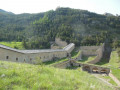
An easy family hike. Caution in the mountains: children must be supervised at all times due to the presence of ravines. Round trip route in the Vauban city of Briançon. Numerous viewpoints and historical sites of great interest.
Serre des Aigles via the Croix de Toulouse
 7.69 mi
+4,019 ft
-4,019 ft
7h 00
Difficult
Departure from Briançon (Hautes-Alpes)
7.69 mi
+4,019 ft
-4,019 ft
7h 00
Difficult
Departure from Briançon (Hautes-Alpes)
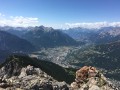
A beautiful hike starting from the centre of Briançon, offering magnificent views of the town, the valley and the famous glaciers of the Écrins massif.
Briançon - La Chalp
14.64 mi
+4,544 ft
-3,389 ft
10h 40
Difficult
Departure from Briançon (Hautes-Alpes)
Étape de la Grande Traversée des Alpes de Briançon à La Chalp par le Col des Ayes.
The Cross of Toulouse
 3.60 mi
+2,018 ft
-1,998 ft
3h 25
Moderate
Departure from Briançon (Hautes-Alpes)
3.60 mi
+2,018 ft
-1,998 ft
3h 25
Moderate
Departure from Briançon (Hautes-Alpes)
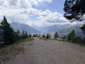
For those who love aerial views, the Croix de Toulouse offers a spectacular view of Briançon.
From the Chemin des Fontaines to the Pierre aux Œufs
 6.52 mi
+1,289 ft
-1,289 ft
4h 05
Moderate
Departure from Briançon (Hautes-Alpes)
6.52 mi
+1,289 ft
-1,289 ft
4h 05
Moderate
Departure from Briançon (Hautes-Alpes)
From the Vauban citadel to the Pierre aux Œufs site, a megalithic site featuring cup marks.
Fort de l'Infernet
 8.38 mi
+3,176 ft
-3,159 ft
6h 35
Difficult
Departure from Briançon (Hautes-Alpes)
8.38 mi
+3,176 ft
-3,159 ft
6h 35
Difficult
Departure from Briançon (Hautes-Alpes)
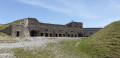
Visit a sentry fort overlooking the five Briançon valleys.
Croix de la Salcette
 5.42 mi
+2,552 ft
-2,552 ft
4h 45
Difficult
Departure from Saint-Martin-de-Queyrières (Hautes-Alpes)
5.42 mi
+2,552 ft
-2,552 ft
4h 45
Difficult
Departure from Saint-Martin-de-Queyrières (Hautes-Alpes)
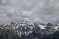
A hike through the impressive and magnificent rocky massif of Montbrison, passing beneath Les Tenailles, a legendary spot for climbers. The cross offers a magnificent viewpoint.The route includes a few short off-trail sections, made easier by using the Visorando app.Moderator’s note: following some difficulties encountered by a hiker, you can watch this video to get a better idea of any potential problems this route might present.
From the banks of the Guisane to the heights of Saint-Chaffrey
 Association / Club / Walk leader
 6.30 mi
+758 ft
-755 ft
3h 35
Moderate
Departure from Saint-Chaffrey (Hautes-Alpes)
6.30 mi
+758 ft
-755 ft
3h 35
Moderate
Departure from Saint-Chaffrey (Hautes-Alpes)
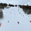
This lovely walk showcases two remarkable features of Saint-Chaffrey: a cool path along the Torrent de la Guisane and its canal, followed by a tour of the hamlets of Chantemerle, Villard Laté and La Villette. Beautiful views of the valley and surrounding mountains complete this walk.
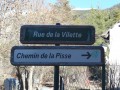
Cascade de la Pisse - Bois des Rousses - Bois de l'Ours in Saint-Chaffrey
 4.92 mi
+1,798 ft
-1,801 ft
3h 50
Moderate
Departure from Saint-Chaffrey (Hautes-Alpes)
4.92 mi
+1,798 ft
-1,801 ft
3h 50
Moderate
Departure from Saint-Chaffrey (Hautes-Alpes)
A very pleasant route through a pine forest. Panoramic views of the Serre Chevalier valley, the village of Saint-Chaffrey and the Écrins mountain range.